

WARNING for Maui and Hawaii Counties, Rainfall Projected at 6-10 Inches

Flossie 5-day Track issued at 11 p.m. 7/27/13. Courtesy NOAA, NWS, CPHC.
By Wendy Osher
The National Weather Service issued a Tropical Storm Warning for Maui and Hawaiʻi Counties with the onset of conditions from Flossie starting as early as tonight after midnight. The island of Oʻahu is now under a Tropical Storm Watch. A Flash Flood Watch is also in effect for all of the Hawaiian Islands from Monday morning until late Tuesday night.
As of 2 a.m., on Sunday, July 28, 2013, Flossie was located about 600 miles east of Hilo, Hawaiʻi, and 690 miles E of Kahului, Maui (between latitude 19.7 N and longitude 145.8 W). The system was moving west at 20 mph, and had maximum sustained winds near 65 mph. Minimum central pressure was 996 mb or 29.41 inches.
According to NWS forecasters, rainfall of over 6 to 10 inches is expected on Hawaiʻi Island and Maui Counties, and up to 15 inches on the windward slopes. On Oʻahu, forecasters say rainfall is expected to be slightly less with 4 to 8 inches across the island and 12 inches on the windward slopes.
Forecasters say winds are expected to be in the 30 to 40 mph range on Monday morning, with gusts of up to 50 mph. The strongest gusts are projected over mountainous terrain, through downslope passes, and at the upper level o high rise buildings.
Forecasters say the chance of tropical storm conditions has increases since the last forecast to 42%.
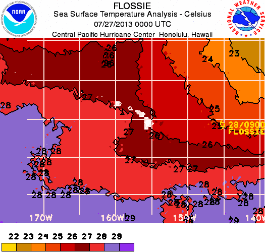
Flossie, sea surface temperature imagery. Courtesy NWS, NOAA, CPHC.
The NWS is forecasting possible coastal flooding as wind blown water pushes onshore. Officials say pounding surf can result in road closures even before the storm arrives. “Initial impacts are expected to arrive as early as Monday morning for Hawaiʻi Island, and then spread westward Monday and Tuesday. At this time it is still too early to determine which island is at most risk from Flossie,” said NWS officials in a statement.
As a precautionary measure, those under a warning should make preparations to protect life and property. Authorities say conditions can change quickly and advise the public to evacuate if directed to do so by local officials or if a residence is vulnerable to high winds and flooding.
On the water, authorities say boats should be moved to safe mooring and remain in port and well secured. The NWS forecasts warning level surf to arrive on the east facing shores beginning on Monday morning through Tuesday.
Authorities say seas will be up to 21 feet with storm surge possible. The most susceptible areas to coastal flooding, NWS officials say is shallow beach slopes and coastal areas near stream mouths.

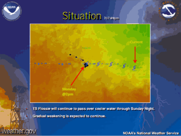
Flossie Wind Speeds issued at 1:20 a.m. 7/28/13. Courtesy NOAA, NWS, CPHC.
Preparedness Tips from the Central Pacific Hurricane Center:
When a hurricane or tropical storm watch is issued some tips that could be useful include:
- Fuel and service family vehicles
- Prepare to cover all windows and door openings with boards, shutters or other shielding materials
- Store and secure outdoor lawn furniture and other loose, lightweight objects, such as garbage cans and garden tools
- Check and replenish disaster supply kits
- Have an extra supply of cash on hand
Watches/Warnings/Advisories Currently in effect include:
- Flash flood watch from Monday morning through late Tuesday night for all Hawaiian islands.
- Tropical storm watch for Oʻahu.
- Tropical storm warning for Molokaʻi, Lānaʻi, Kahoʻolawe, Maui, and Hawaiʻi Island.
- Tropical storm watch for Kauaʻi channel, Oʻahu windward waters, Oʻahu leeward waters.
- Tropical storm warning for Kaiwi Channel (separating Oʻahu from Molokaʻi); Maui county windward and leeward waters; Māʻalaea Bay; Pailolo Channel (between Maui and Molokaʻi); ʻAlenuihāhā Channel (between Hawaiʻi and Maui); Hawaiʻi Island windward, leeward, and southeast waters.
- Small craft advisory until 6 a.m. HST Monday for Māʻalaea Bay; Pailolo Channel; ʻAlenuihāhā Channel; Hawaiʻi Island leeward and southeast waters.
***Supporting information courtesy: National Weather Service, Central Pacific Hurrican Center, and the National Oceanic and Atmospheric Administration.
Flossie projections 8 p.m. 7//27/13/
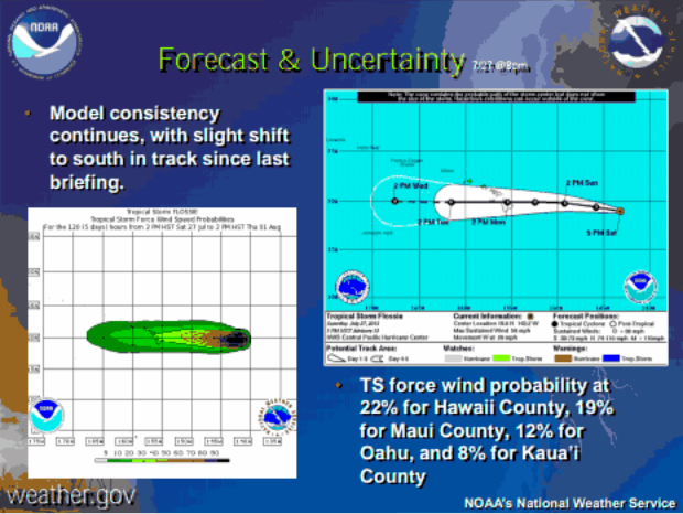
Flossie projections 8 p.m. 7//27/13/
Sponsored Content


