Ana Gradually Intensifying, Hurricane Watch Possible Later Today
By Wendy Osher
***An 11 a.m. UPDATE is now posted at the following LINK.
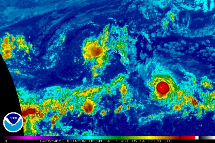
Tropical Storm Ana is forecast to gradually intensify through tomorrow night, and may become a hurricane later today (Wednesday, Oct. 15, 2014) or tonight, according to forecasters with the National Weather Service.
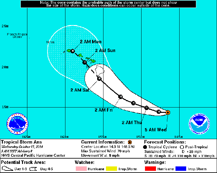
At 5 a.m., Ana was located 675 miles SE of Hilo, Hawaiʻi; 795 miles SE of Kahului, Maui; 845 miles SE of Kaunakakai, Molokaʻi; and 820 miles SE of Lānaʻi City.

5-day forecast track for Tropical Storm Ana as of 5 a.m. on Wednesday, Oct. 15, 2014. Image courtesy NOAA/NWS/Central Pacific Hurricane Center.
The Central Pacific Hurricane Center says the system was moving toward the west near 9 mph with maximum sustained winds near 70 mph.
The current forecast track brings the center of the system near the southern edge of the Big Island of Hawaiʻi early Saturday morning, and south of Maui County on Sunday.
According to a forecast discussion issued by the Central Pacific Hurricane Center, the peak intensity of the system is expected Thursday and Friday, with a gradual weakening trend forecast this weekend, however the certainty of the forecast continues to be refined as the system gets closer.
As of 8 a.m., there were no warnings or watches in effect, however forecasters say a hurricane watch may be required for portions of the Main Hawaiian Islands later today or tonight. A hurricane watch is issued when hurricane conditions are possible in the designated watch area within 36 hours.


