No Advisories After 4.5 Earthquake NW of Kailua-Kona
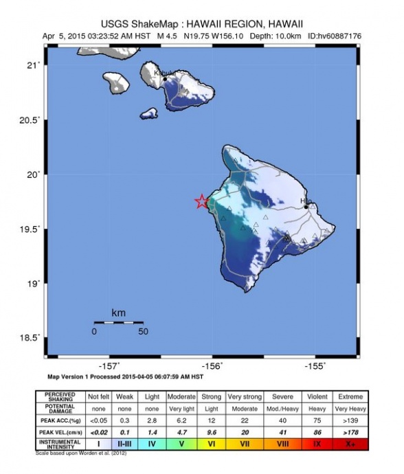
Shake map, April 5, 2015. Image courtesy USGS.
By Wendy Osher
There was no tsunami generated by a preliminary magnitude 4.5 earthquake reported at 3:23 a.m. on Sunday, April 5, NW of Kailua-Kona on the Big Island of Hawaiʻi, according to the Pacific Tsunami Warning Center.
The USGS reports that the quake occurred at a dewas located: 7 miles W of Kalaoa, Hawaiʻi; 10 miles NW of Kailua-Kona, Hawaiʻi; 66 miles W of Hilo, Hawaiʻi; 74 miles W of Hawaiian Paradise Park, Hawaiʻi; and 156 miles SE of Honolulu, Oʻahu.
The US Geological Survey’s Hawaiian Volcano Observatory reports that the earthquake caused no detectable changes on the active volcanoes on Hawaiʻi Island.
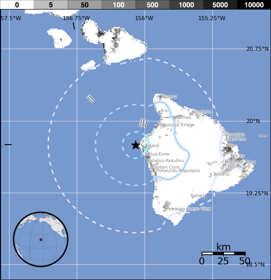
Population exposure map, April 5, 2015. Map courtesy USGS.
“Earthquakes at this depth off the west coast of the Island of Hawaiʻi are typically caused by abrupt motion on the boundary between the old ocean floor and the volcanic material of the island and are not directly tied to volcanic activity,” according to a press release issued by Wes Thelen, HVO’s Seismic Network Manager.
According to the USGS “Did you feel it?” website, more than 150 felt reports were documented in the Kailua Kona area alone.
The quake was also felt felt in Kamuela, Holualoa, and Waikoloa on Hawaiʻi Island. At least three felt reports were filed from Hickam Air Force Base located 260 miles away.
As of 7 a.m., HST, no aftershocks had been recorded.
The HVO reports that a magnitude-3.3 earthquake, that occurred near Hāwī on the Big Island of Hawaiʻi approximately three hours prior at 12:17 a.m. HST, is unrelated.
According to information released by the HVO, “During the past 30 years, there have been 23 earthquakes, including this morning’s event, in this same area offshore of Keahole Point with magnitudes greater than 3.0 and depths of 3 to 9 miles. Today’s event is the largest earthquake recorded in the area since a magnitude-4.6 earthquake in November 1969.”
Sponsored Content