

Fernanda Remnants Move East Across O‘ahu, Kaua‘i
The remnants of Fernanda, will be moving east to west across Oʻahu and Kauaʻi today, bringing with it the threat of heavy showers and thunderstorms.
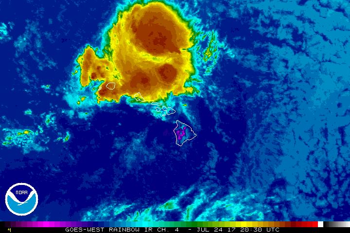
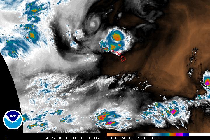
Remnants of Fernanda moving over Kauaʻi and Oʻahu. PC: Satellite Imagery, 7.24.17, 10:30 a.m. HST.
Marine Weather Statement:
Unsettled Conditions over Windward Maui, Kauaʻi and Oʻahu Waters
Earlier this morning at around 8:23 a.m., the National Weather Service was monitoring a strong thunderstorm capable of producing waterspouts that was located North of Turtle Bay on Oʻahu. The special marine statement related to the area was cancelled by 9:30 a.m.
The NWS says that thunderstorms are still possible over coastal waters of Kauaʻi, Oʻahu and windward Maui County today. The unsettled weather is associated with the remnants of Fernanda and could include lighting, rain and localized wind gusts of over 40 knots, according to a Marine Weather Statement issued shortly before 9 a.m.
Remnants of Fernanda moving over Kauaʻi and Oʻahu. PC: Satellite Imagery, 7.24.17, 11 a.m. HST.; TS Greg is also making its advance towards the islands. PC: NOAA/NHC/NWS
Flood Watch for Kauaʻi Until 6 p.m. 7/24/17:
The islands of Kauaʻi and Niʻihau are also under a Flash Flood Watch until 6 p.m. on Monday, July 24, 2017. The NWS advises that the area could experience showers and thunderstorms that could lead to rising levels of streams and rivers.
Forecasters with the National Weather Service say the current trough will interrupt trade winds statewide with muggy conditions and the possibility of inclement, wet weather.
More “settled conditions” are forecast to begin their return tonight.
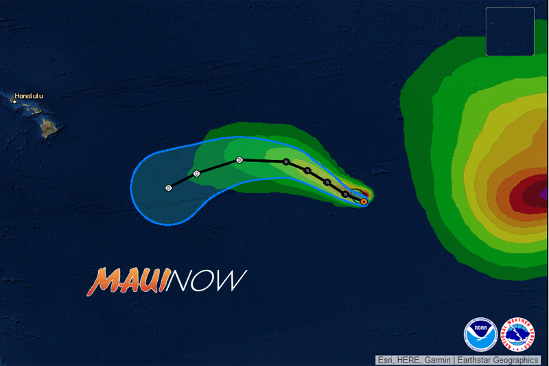
Tropical Storm Greg. 2 p.m. PDT Mon Jul 24 2017. PC: NOAA/NWS/NHC
TS Greg to Cross Into Central Pacific on Wednesday:
Meantime, the National Hurricane Center is tracking Tropical Storm Greg, centered about 1485 miles ESE of Hilo, Hawaiʻi. At 5 a.m. on Monday, July 24, 2017, the system was last located: 1555 miles ESE of Hāna; 1590 miles ESE of Kahului; 1625 miles ESE of Kaunakakai; and 1625 miles ESE of Lānaʻi City.
Greg is expected to move into the Central Pacific on Wednesday afternoon as a depression or post-tropical remnant low.
Sponsored Content


