Number of Residents Seeking Shelter Rises, New Fissure Emerges
East Rift Zone Eruption Update (Monday, May 14, 7:25 a.m.)
An new fissure opened up this morning in Lanipuna Gardens Subdivision between fissure 15 and 16, bringing the total to 19 at the East Rift Zone eruption.
As of 6 a.m., the Hawaiian Volcano Observatory reports that fissure 17 also continues to be active. A narrow lava flow has been generated and is slowly moving toward the ocean, which is about two miles away. There are no homes or roads threatened at this time.
As of midnight, there were about 484 residents at the Pāhoa shelter and 25 residents at the Keaʻau shelter.
Officials with the Hawaii County Civil Defense Agency say continued earthquake activity and additional outbreaks in the area are likely. In addition, HVO has cautioned about the possibility of an explosive eruption at Halema’uma’u Crater due to the withdrawal of lava from Kīlauea summit lake. This could generate dangerous debris very near the crater and ashfalls up to 12 miles downwind.
Due to the volcanic activity, the following are issued:
On schools, Keonepoko Elementary, Pāhoa High, Intermediate and Elementary Schools are open. Normal school bus routes are operating today.
On road closures, Highway 132 is closed at Pohoiki Road intersection and a checkpoint is located on Highway 130 by Pāhoa High School.
Only local traffic allowed beyond all roadblocks.
The residents of Puna are going through a very difficult time. We ask for your help and understanding.
County, State, Federal and private partners continue to monitor the situation.
At 8 a.m. HST on Sunday, May 13, 2018. A slow sticky a’a flow emerges from a new fissure just over a half mile northeast of the end of Hinalo Street. The new fissure – fissure 17 – is about one half mile south of Hwy 132. Some reports have referred to this fissure as number 18 but that is not correct. Fissure 18 had not erupted by this time. PC: US Geological Survey
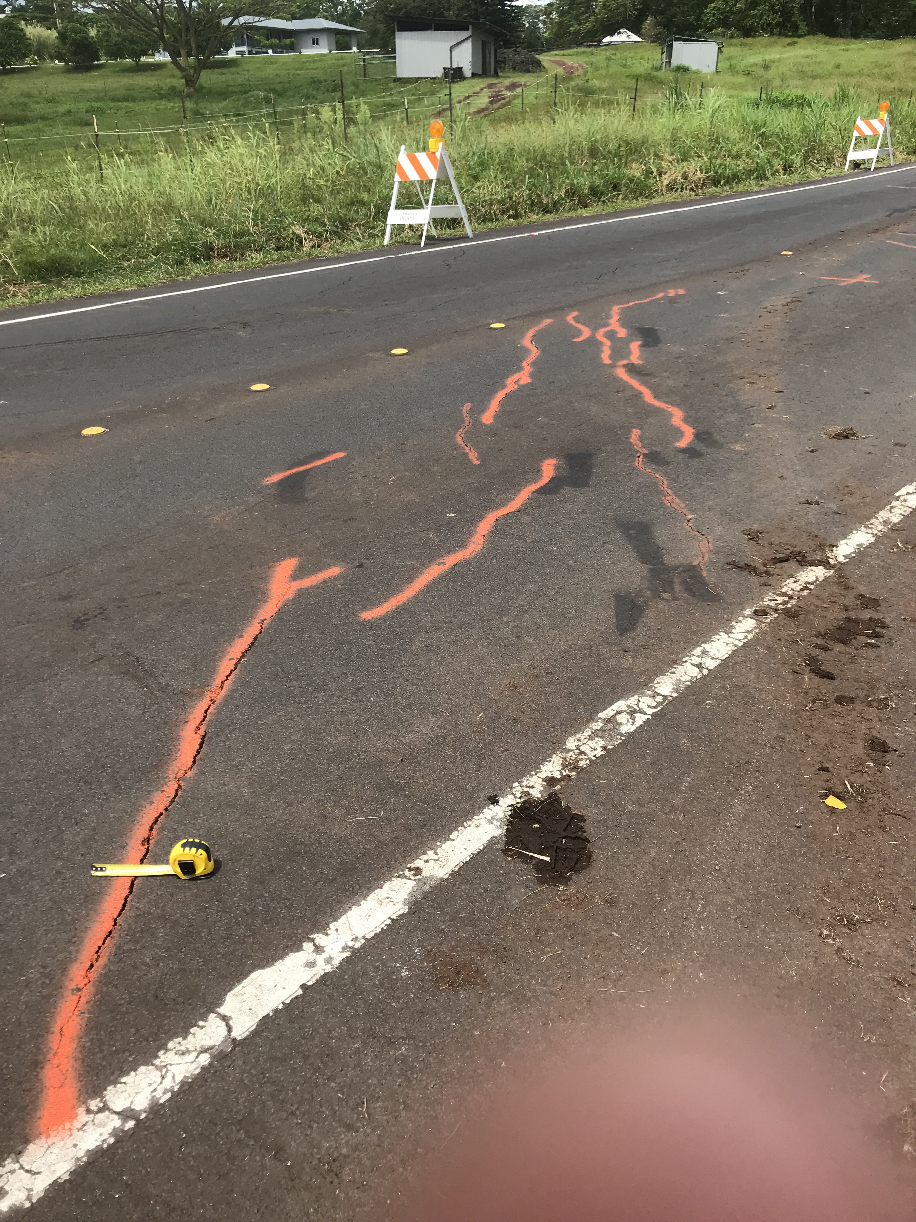
At 10:31 a.m. HST on Sunday, May 13, 2018. Cracks on Hwy 132 marked with orange spray paint to track changes through time. PC: US Geological Survey
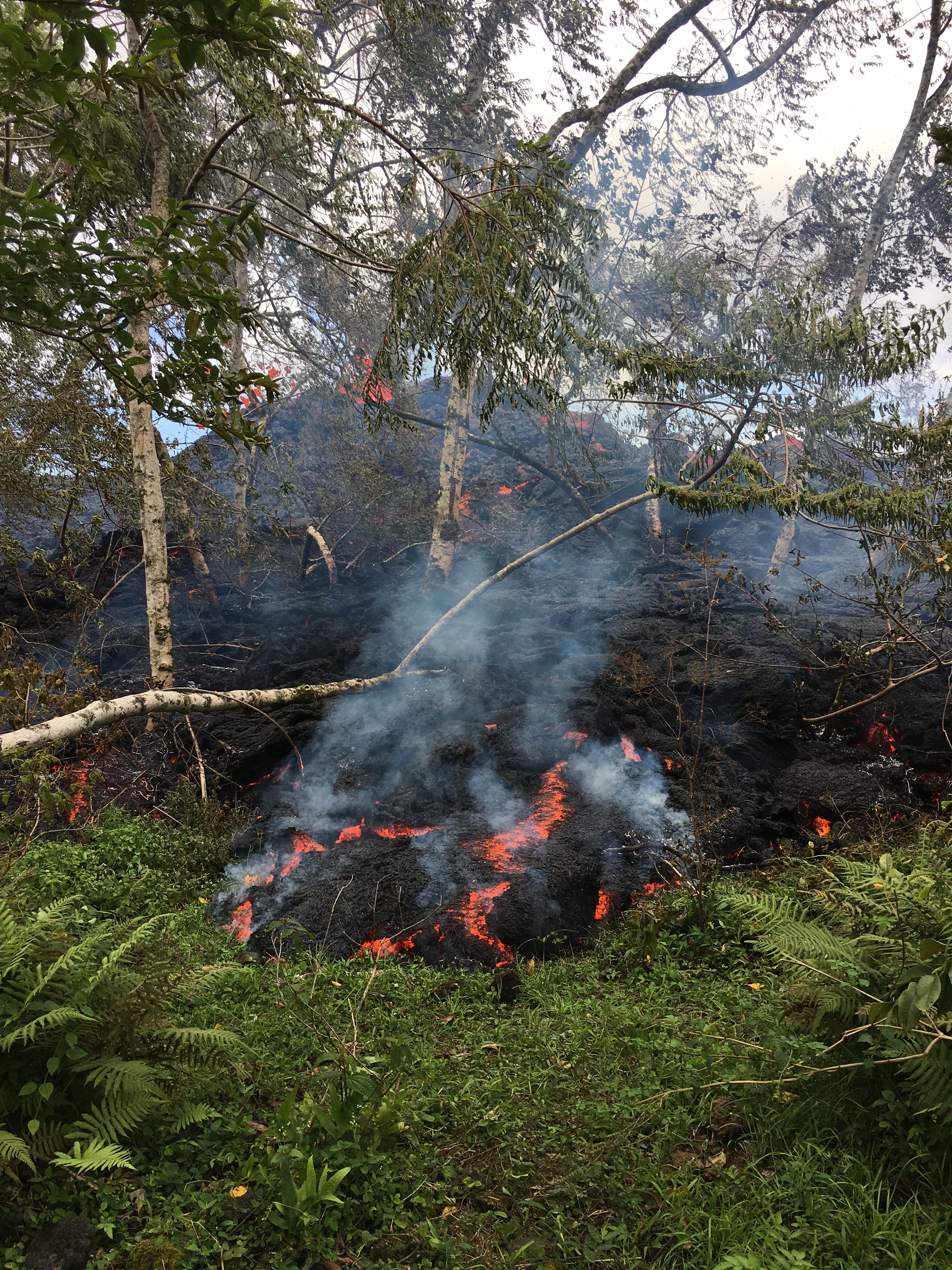
At 2 p.m. HST on Sunday, May 13, 2018. View of Fissure 17 looking makai (southward) from Hwy 132. PC: US Geological Survey
At 2 p.m. HST on Sunday, May 13, 2018. This photo reveals a small pad of lava between Fissures 16 and 17 which did not appear in photos of the same scene taken this morning. (Red arrow points to the lava pad.) From the photo it appears that this fissure had stagnated. The small outbreak has been designated as Fissure 18. PC: US Geological Survey.
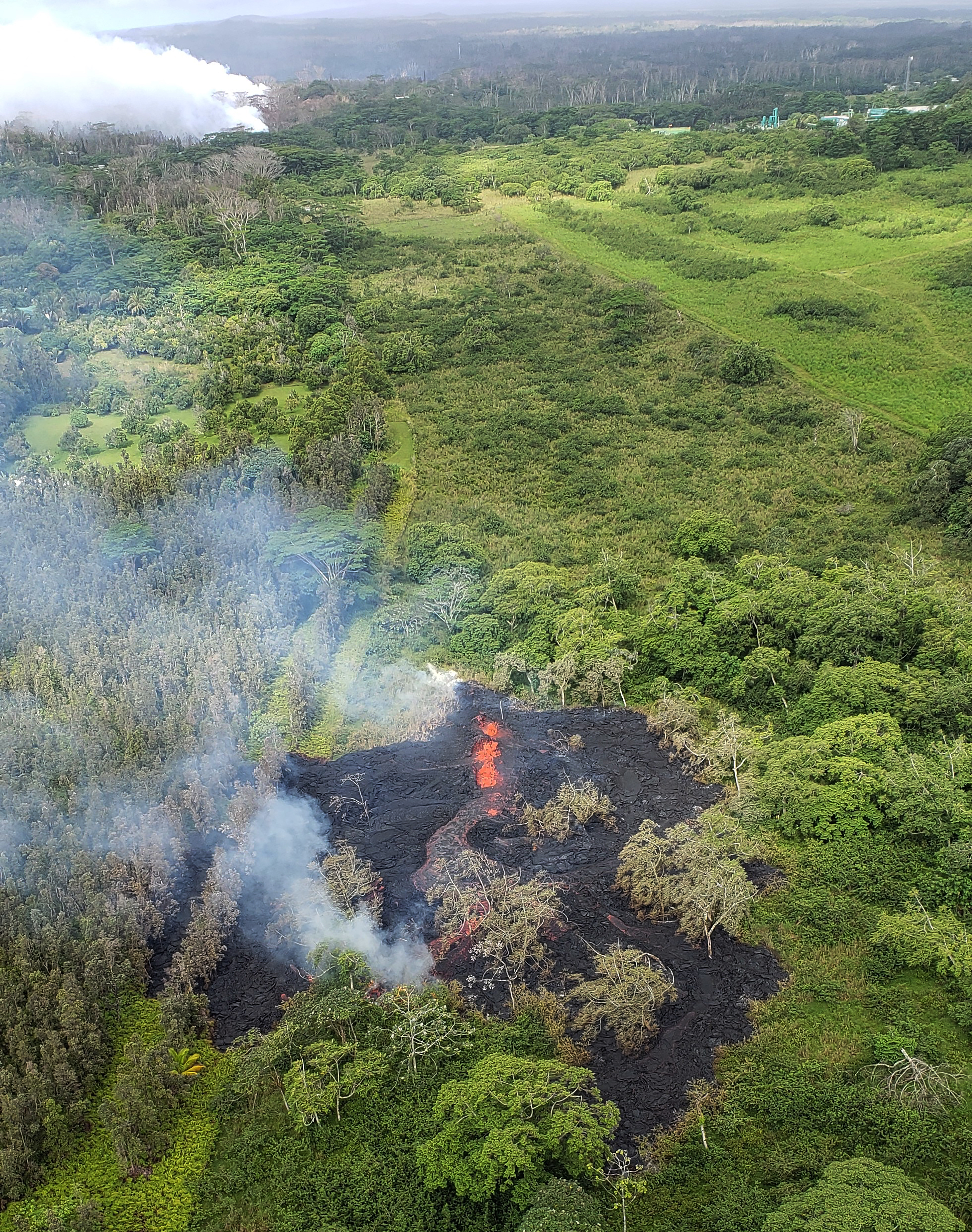
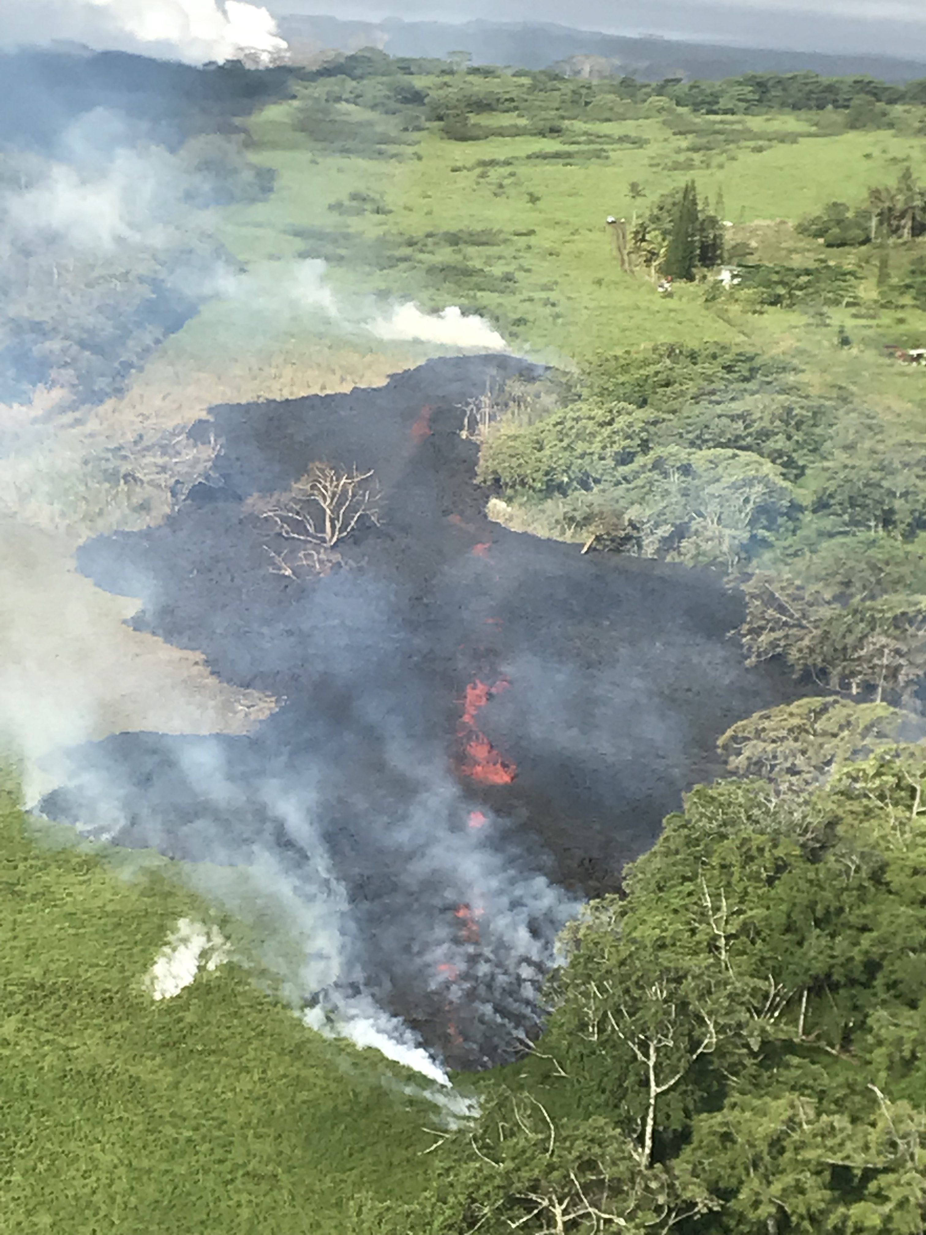
At 08:27 a.m. HST on Saturday, May 12, 2018, aerial view of fissure 16, located about 1.3 km (0.8 miles) northeast of fissure 15 (top left). The fissure is located 500 m northeast of the Puna Geothermal Venture site (top right). Photograph courtesy of Hawai`i County Fire Department. PC: US Geological Survey.
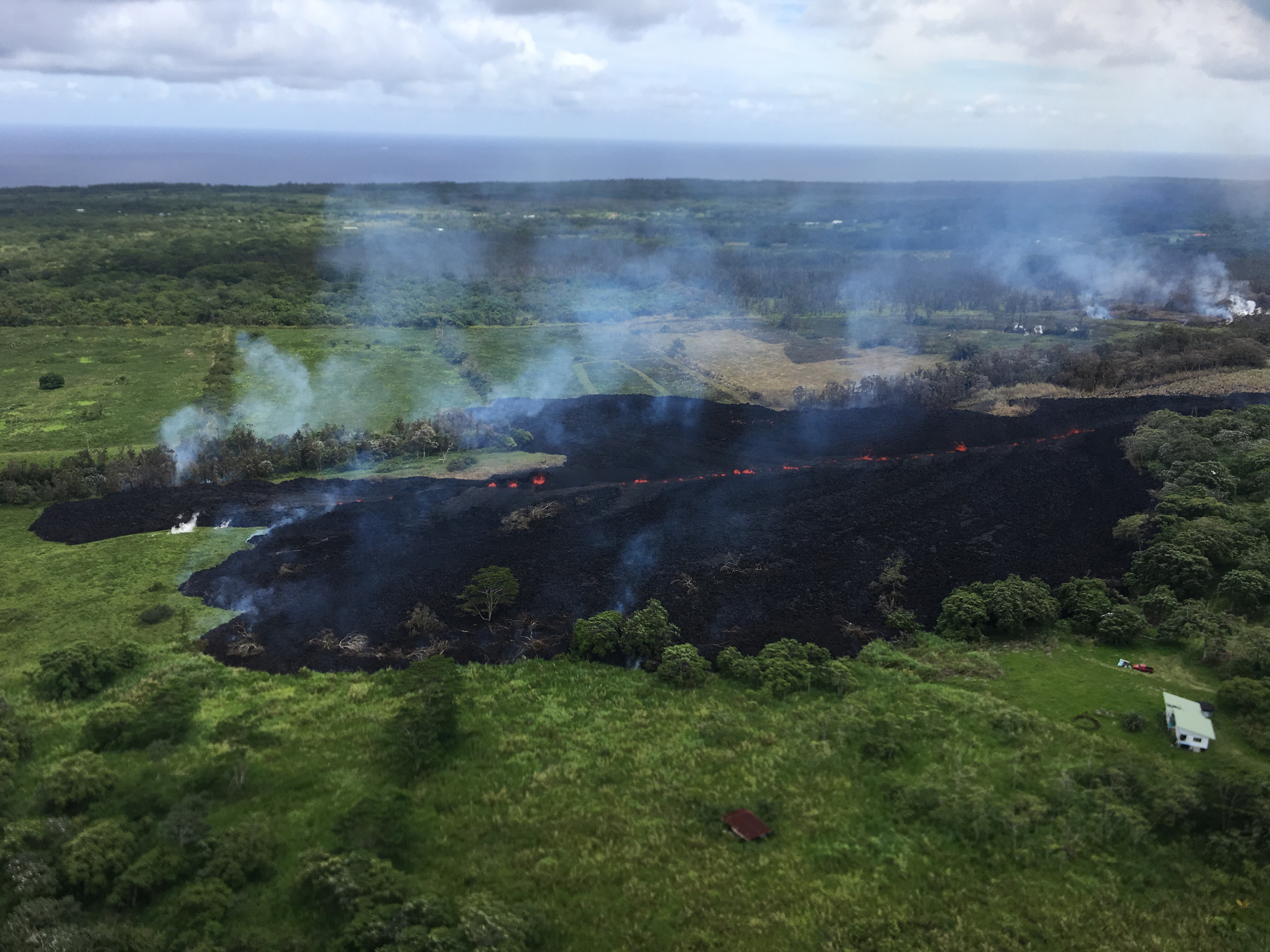
At 12:57 p.m. HST on Saturday, May 12, 2018, lava was slowly advancing from fissure 16. PC: US Geological Survey.
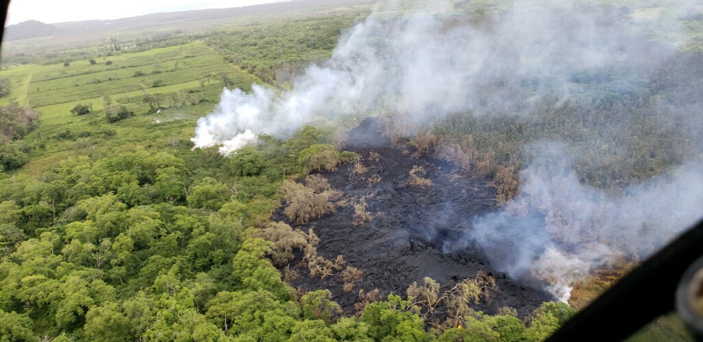
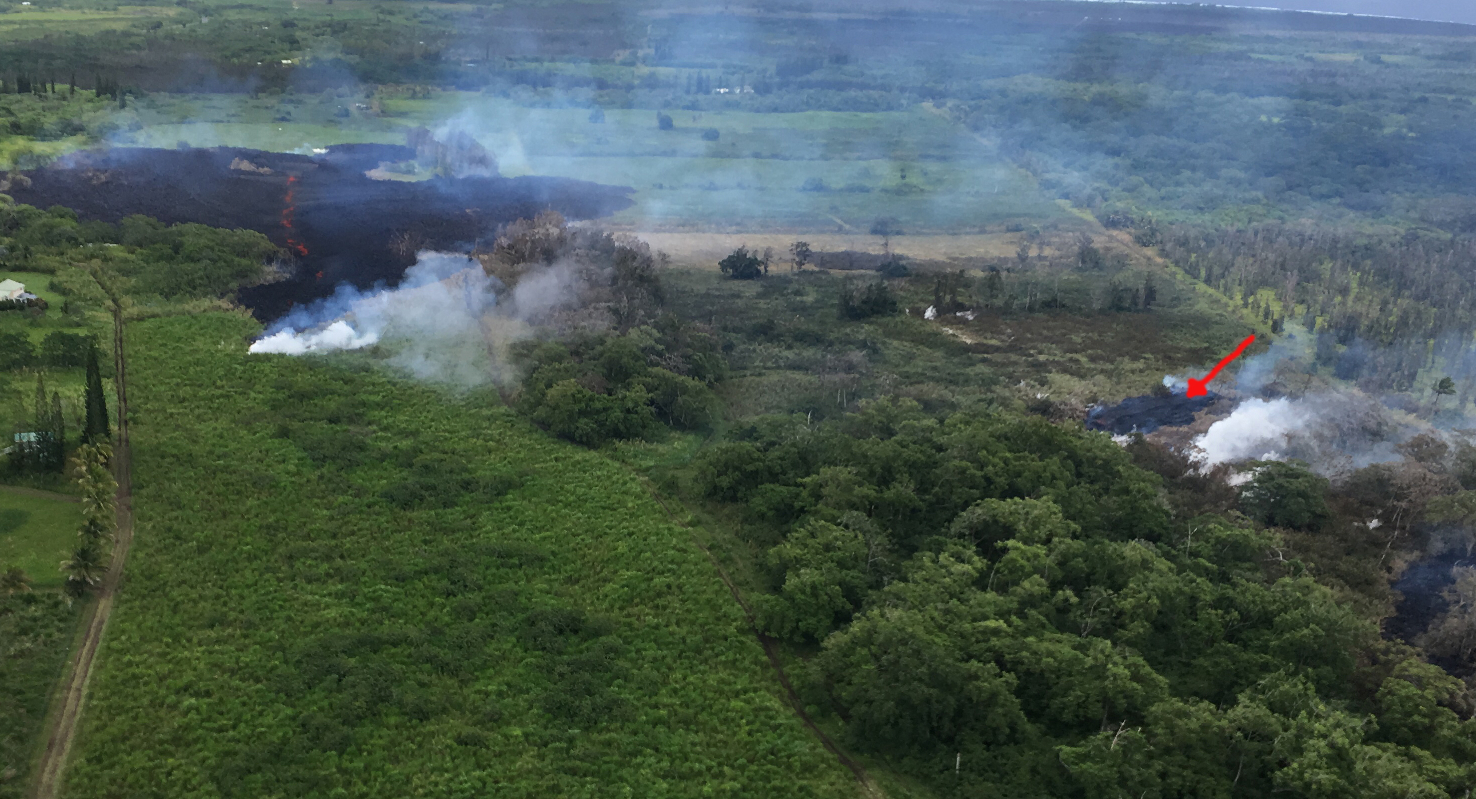
At 18:14 HST on Saturday, May 12, 2018, HVO received this photo from a Hawaii County Fire Department overflight, showing steaming areas downrift from fissure 16, which developed into fissure 17. PC: US Geological Survey
Sponsored Content