

Cold Front Approaching State Results in Flood Watch Through Monday
Flood Watch Through Monday for All Islands
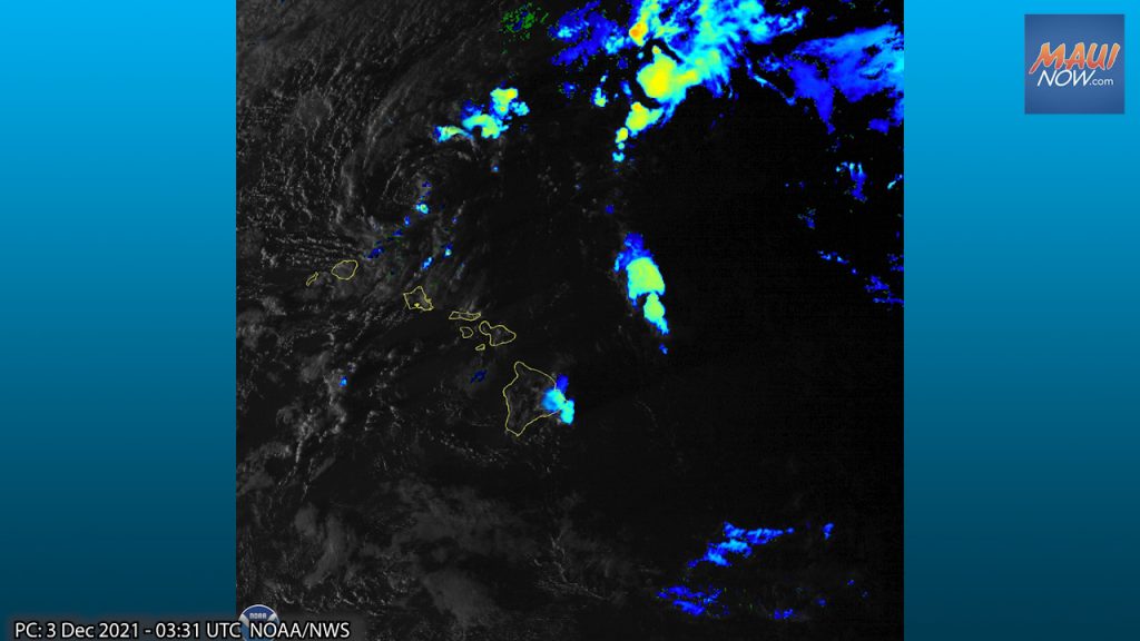
Flash flooding caused by excessive rainfall is possible across the Hawaiian Islands through Monday afternoon, prompting a Flood Watch from the National Weather Service.
The wet weather is from a cold front that will move over the islands from the northwest tonight and Friday, initially bringing a relatively short period of heavy rainfall to Kauaʻi and Oʻahu. “The front is expected to stall near Maui County and the Big Island late Friday, bringing the potential for an extended period of heavy rainfall as a slow-moving Kona low forms west of Kauaʻi on Saturday,” according to the NWS.
The NWS advises that significant flooding may occur due to the overflow of streams and drainages. “Isolated highways, such as the Belt Highway in the Big Island’s Kaʻū District, and Piʻilani Highway on Maui, may be closed in one or more locations, resulting in long detours or even the isolation of communities. Landslides may also occur in areas with steep terrain,” according to the NWS forecast.
The NWS says that as the low develops, moisture associated with the front will spread back toward the west, bringing the threat of heavy rainfall to all islands, with this threat likely persisting well into next week.
The public is advised to be prepared to take action if a Flash Flood Warning is issued.
“If you experience heavy rain or rising waters, head to higher ground immediately. A Flood Watch means that conditions are favorable for flash flooding. Flash Flooding is life threatening,” forecasters said. The NWS reminds the public, “Do not cross fast flowing water in your vehicle or on foot.”
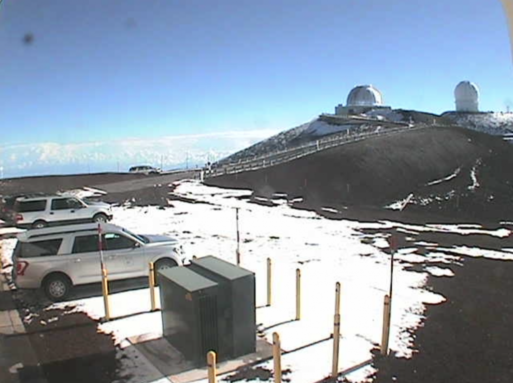
Blizzard Warning for Big Island Summits: 12 Inches or More of Snow Forecast
The National Weather Service also issued a Blizzard Warning for the Big Island Summits, in effect from 6 p.m. Friday to 6 a.m. Sunday.
The NWS says total snow accumulations of up to 12 inches or more are in the forecast, with winds gusting at over 100 mph.
“Travel could be very difficult to impossible. Blowing snow will significantly reduce visibility at times, with periods of zero visibility. The strong winds will likely cause significant drifting of snow,” according to the NWS forecast.
“Travel should be restricted to emergencies only. If you must travel, have a winter survival kit with you. If you get stranded, stay with your vehicle,” the NWS advises.
Sponsored Content


