

High Surf Advisory Posted, Series of N Swells on Horizon
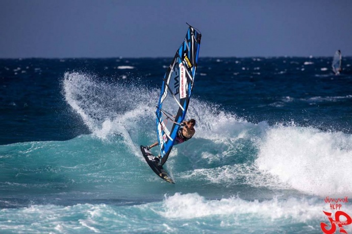
Ho’okipa Wind Surfing / Image: Jimmie Hepp
By Meteorologist Malika Dudley / Email: [email protected]
Alerts
A High Surf Advisory is posted for the north facing shores of Maui and Molokaʻi for a large north-northwest swell. The west side of Molokaʻi is also included in the advisory. Surf along north facing shores could reach heights of 10 to 15 feet through Tuesday. Surf along west facing shores could reach heights of 8 to 12 feet. The advisory is set to expire at 6 p.m. on Tuesday.
Expect strong breaking waves, shore break and dangerous currents that make getting into the water hazardous and swimming difficult.
A Small Craft Advisory is posted for all Maui County windward waters until 6 p.m. Tuesday. Winds of 25 knots or higher are expected out of the northeast and rough seas of 8 to 15 feet. Conditions are expected to continue through Wednesday at 6 p.m. for all Maui County channels with winds of 25 knots and seas of 7 – 15 feet. Inexperienced mariners should avoid navigating in these conditions.
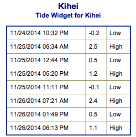
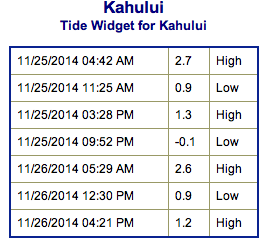
**Click directly on the images below to make them larger. Charts include: Maui County projected winds, forecasted swell direction, height & period, tides, a surface map and expected wave heights.**
 Maui County Surf Forecast, Tuesday November 25, 2014
North: Surf is expected overhead to double overhead for the best spots on Molokaʻi and Maui’s northern exposures. Shorter period north swell also expected to get in the mix.
West: Spots that are open to the northwest swell will get some wrap with waves expected shoulder to head high. Breaks that don’t catch the swell are forecasted to get smaller surf at ankle high or flat.
South: Many areas will remain flat today.
Our current northwest swell (305-330°) is expected to keep wave heights in the well overhead to double overhead range. Biggest surf will be seen early on in the day as a slow fading trend begins.
 Another swell out of the northeast is expected to bring another round of overhead waves late this week. There’s also the possibility of a new northwest swell for the weekend.
Super small trace amounts of swell expected out of the SPAC. A tiny southerly swell could bring wave heights up to thigh high tomorrow. There isn’t much on the horizon to get excited about.
**Click here for your detailed Maui County weather report.**
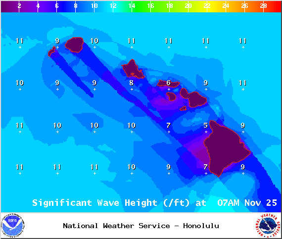
Image: NOAA / NWS
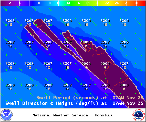
Image: NOAA / NWS
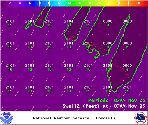
Image: NOAA / NWS
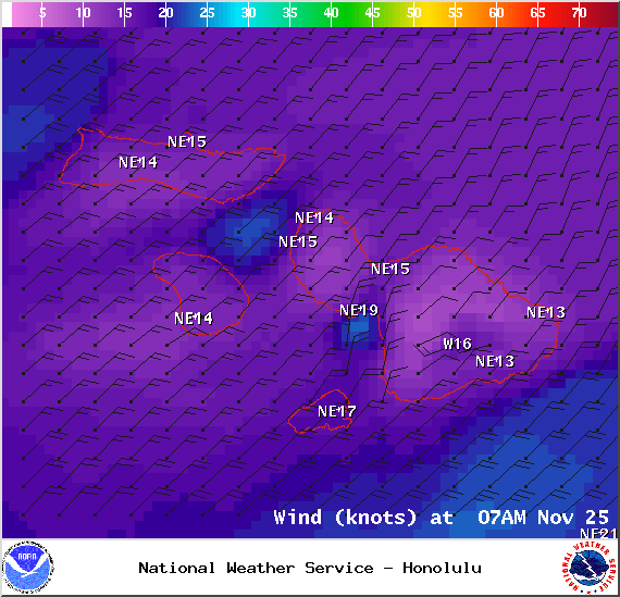
Image: NOAA / NWS
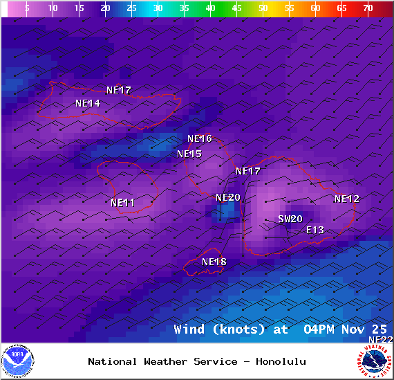
Image: NOAA / NWS
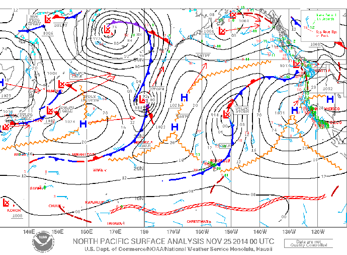
Image: NOAA / NWS
Sponsored Content


