New NW Peaks This Morning, Larger Swell Ahead
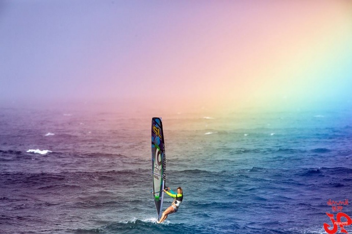
Shawna Cropas wind surfing Ho’okipa yesterday / Image: Jimmie Hepp
By Meteorologist Malika Dudley / Email: [email protected]
Alerts
A High Surf Advisory has been issued by the National Weather Service for a building northwest swell. The advisory is in effect from 4:00 p.m. today through 6:00 p.m. Friday for the north facing shores of Maui and Moloka’i. Wave heights of 12 to 16 foot faces are expected.
A Small Craft Advisory is posted through 6 p.m. Friday for all Maui County waters. Rough seas up to 14 feet and east winds of 15 to 25 knots with higher gusts are forecasted. Inexperienced mariners should avoid navigating in these conditions.
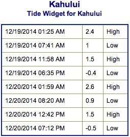
**Click directly on the images below to make them larger. Charts include: Maui County projected winds, forecasted swell direction, height & period, tides, a surface map and expected wave heights.**
 Maui County Surf Forecast, Friday, December 19
North: Surf heights are expected overhead to double overhead across the best exposed breaks. In the morning best exposures may even see triple overhead surf of 10 to 15 feet.
West: Spots open to the swells that are wrapping are expected to get waves up to maybe shoulder high or more. Otherwise, breaks that don’t catch the swell, and / or are shadowed from it, are forecasted to get smaller surf at ankle high or flat.
South: Fading out of season south swell brings ankle to knee high waves for southern shores open to the swell. Best breaks could see a waist high set from time to time.
Our current small heavily shadowed northwest swell will continue to fade Thursday.
 A new northwest is expected to peak on Friday morning overhead to double overhead on the sets at the best breaks. Outer reef breaks that can handle larger waves could see even bigger waves on the sets. By Friday evening the swell will be dropping. Saturday will see waves half as big.
Another, bigger, west-northwest swell is expected to build and peak on Sunday. Pe’ahi “Jaws” might see 20 to 25 foot faces or more late Sunday. Mid-week another shot of energy out of the northwest is forecasted to build in as well.
An out of season south swell that brought a fun little boost the last couple of days continues to slowly fade. Another small boost is due in Saturday bringing waist to chest high waves in the afternoon. Otherwise, nothing significant is expected out of the SPAC.
Keep in mind, surf heights are measured on the face of the wave from trough to crest. Heights vary from beach to beach, and at the same beach, from break to break.
**Click here for your detailed Maui County weather report.**
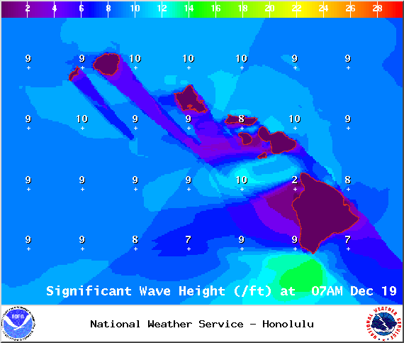
Image: NOAA / NWS
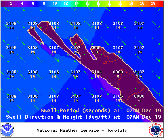
Image: NOAA / NWS
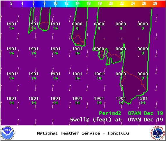
Image: NOAA / NWS

Image: NOAA / NWS
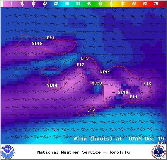
Image: NOAA / NWS
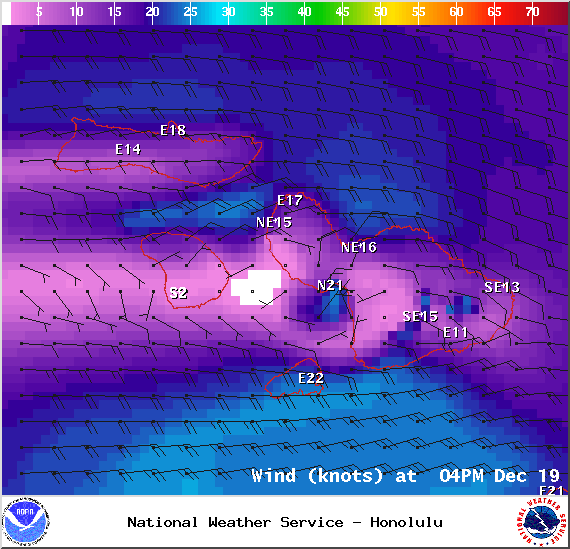
Image: NOAA / NWS
Sponsored Content