Trade Swell up to Chest High in Some Spots Today
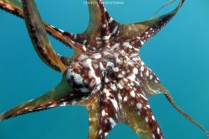
Image: Aaron Lynton
Alerts (as of 1:00 a.m.)
Small Craft Advisory: East to northeast winds up to 25 knots through 6:00 p.m. Tuesday.
**Click directly on the images below to make them larger. Charts include: Maui County projected winds, tides, swell direction & period and expected wave heights.**
Maui Surf Forecast
North: Surf heights are expected to be waist high today. The best breaks could get up to chest high.
West: Surf heights are expected to be ankle/thigh high today. Spots blocked from the swell will be flat.
South: Surf heights are expected to be ankle/thigh high today. Spots blocked from the swell will be flat.
No significant swells are expected this week. A series of small south swells is expected to keep background swell going along southern exposures through the middle of the week. We could see a slightly bigger run of swell starting around the 19th of this month.
Trade wind swells will continue to produce short period choppy surf along east facing shores.
Tropical system Fernanda will produce swell for us. Current models show swell filling in as early as Monday night increasing through Thursday, possibly up to advisory levels. Will keep an eye on it as the size of the swell is highly dependent on the eventual track and intensity of the tropical system.
Keep in mind, surf heights are measured on the face of the wave from trough to crest. Heights vary from beach to beach, and at the same beach, from break to break.
**Click here for your detailed Maui County weather report.**
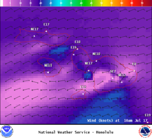
Image: NOAA

Image: NOAA
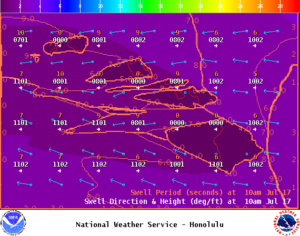
Image: NOAA
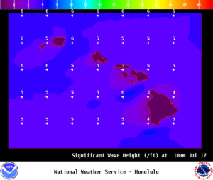
Image: NOAA
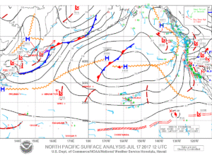
Image: NOAA
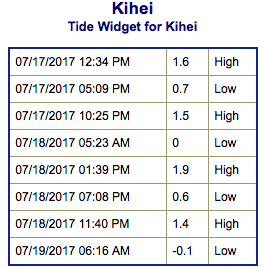
Image: NOAA
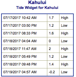
Image: NOAA
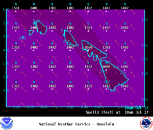
Image: NOAA
Sponsored Content