Imi Ikena Affordable Housing Proposed in Wailuku
By Wendy Osher
Imi Ikena Housing Partners has filed a Draft Environmental Assessment for a new project in Wailuku.
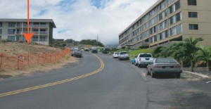
The applicant proposes to develop a 28-unit, four-story affordable apartment complex on a vacant urban lot near Pio and Imi Place.
Units will be targeted at households earning 30 to 60% of the area median income, as established by HUD, with rents restricted in perpetuity.
The Imi Ikena Affordable Housing Project is intended to provide workforce housing, in character with the existing urban development in the Sand Hills area.
The subject property is located in the Sand Hills area, north of Keopualani Park and off Liholiho Street in Central Maui. Plans call for access to the property via three driveways–two off of Pio Place, and one off of Imi Place.
Units include two and three bedroom options that range in size from 981 square feet to 1,133 square feet.
Short-term impacts include construction related activities such as noise and air impacts from construction vehicles.
An archaeological assessment was conducted at the site in April of 2005. The assessment found no cultural remains; however, sand deposits greater than two meters deep are an indicator that cultural deposits may be found on the subject site in the future.
According to the Draft Environmental Assessment, the sand deposits indicate a high probability that human burials and/or associated historic properties (e.g. trash deposits, hearths) would be encountered.
Archaeological monitoring is recommended by the project archaeologist during initial construction activities. The archaeological inventory survey and its recommendations have been reviewed and approved by the State Historic Preservation Division.
Imi Ikena is located in the ‘ili of ‘Owā, which is in the ahupua’a of Wailuku.
Based on historical maps and the archaeological finding of no cultural materials, it seems likely that there was little human activity atop the sand dune on which the subject property lies, according to a cultural impact assessment prepared in September 2011 by Jill Engledow.
Pihana, across the ‘Īao Stream on the sandstone ridge to the northwest of the property was the site of two important heiau, Haleki’i and Pihana, remnants of which still exist.
According to the Draft Environmental Assessment, the ridge where Haleki’i and Pihana are located, and possibly the ridge where the subject property is located, could have allowed surveillance of the whole northeast coast, as well as a view south to detect invaders coming from the Kīhei‐Mā’alaea area.
The document further notes that records from the Mahele and the land grants and royal patents show that portions of ‘Owa were given to several different individuals in the second half of the 19th century.
The Monsarrat map shows that the section appears to have been given to Kuihelani, later becoming part of the land grant to sugar baron Claus Spreckels.
Based on the lack of any identified cultural or traditional practices or resources on the property, no cultural impacts are anticipated to result from the proposed project, according to the Draft Environmental Assessment.
Public comment on the document is open through December 7, 2011.


