BREAKING: Explosive Eruption at Kīlauea, 30,000 ft Ash Plume Expected
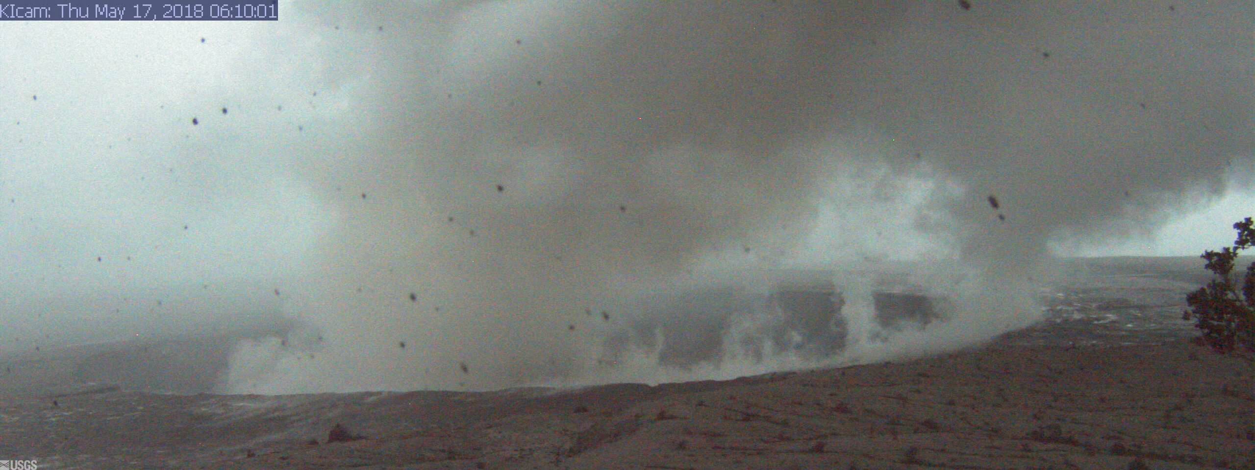
Panorama of Kīlauea Caldera from HVO Observation Tower [KIcam]
Last Updated 2018-05-17 06:10:06 (HST). This image is from a research camera mounted in the observation tower at the Hawaiian Volcano Observatory. The camera is looking SSE towards the active vent in Halemaʻumaʻu, 1.9 km (1.2 miles) from the webcam. For scale, Halemaʻumaʻu is approximately 1 km (0.6 mi) across and about 85 m (~280 ft) deep. PC: US Geological Survey.
The wind will carry the plume toward the southeast. The Hawaiʻi County Civil Defense Agency is advising those in the area to shelter in place if they are in the path of the ash plume. Driving conditions may also be dangerous and motorists driving in the area were being advised to pull off the road and wait until visibility improves.
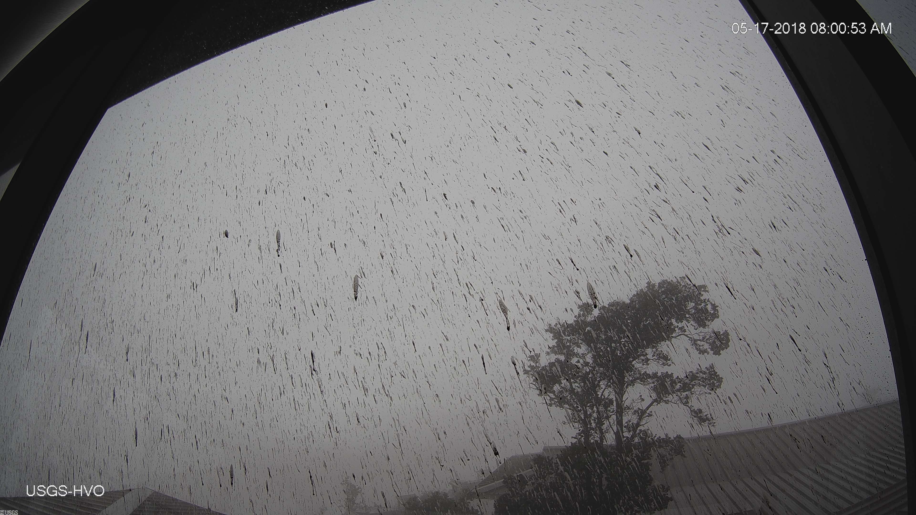
Halemaʻumaʻu Overlook Vent Wide Angle
From HVO Observation Tower
2018-05-17 08:01:10 (HST). PC: US Geological Survey
The National Weather Service has issued an Ashfall Advisory, which is in effect until 6 p.m. HST today.
The NWS says volcanic ash is expected to reach immediate vicinity of the Kīlauea Volcano Summit (Halemaʻumaʻu Crater), including Volcano and Glenwood. The Civil Defense agency says the resulting ash plume may affect the surrounding areas with wind carrying the ash plume north toward Kaʻū, Volcano, Mt. View, Keaʻau and as far as Hilo.
The advisory may need to be extended if volcanic ashfall emissions persist.
Due to elevated sulfur dioxide (S0 2 ) levels, Pāhoa High, Intermediate, and Elementary School Complex, Keonepoko Elementary, Hawaiʻi Academy of Arts and Science, Volcano School of Arts and Science will be closed.
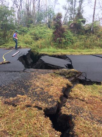
HVO geologist next to cracks on Nohea Street in Leilani Estates this morning. These cracks expanded significantly in the past day. Note the vertical offset across the cracks. PC: US Geological Survey.
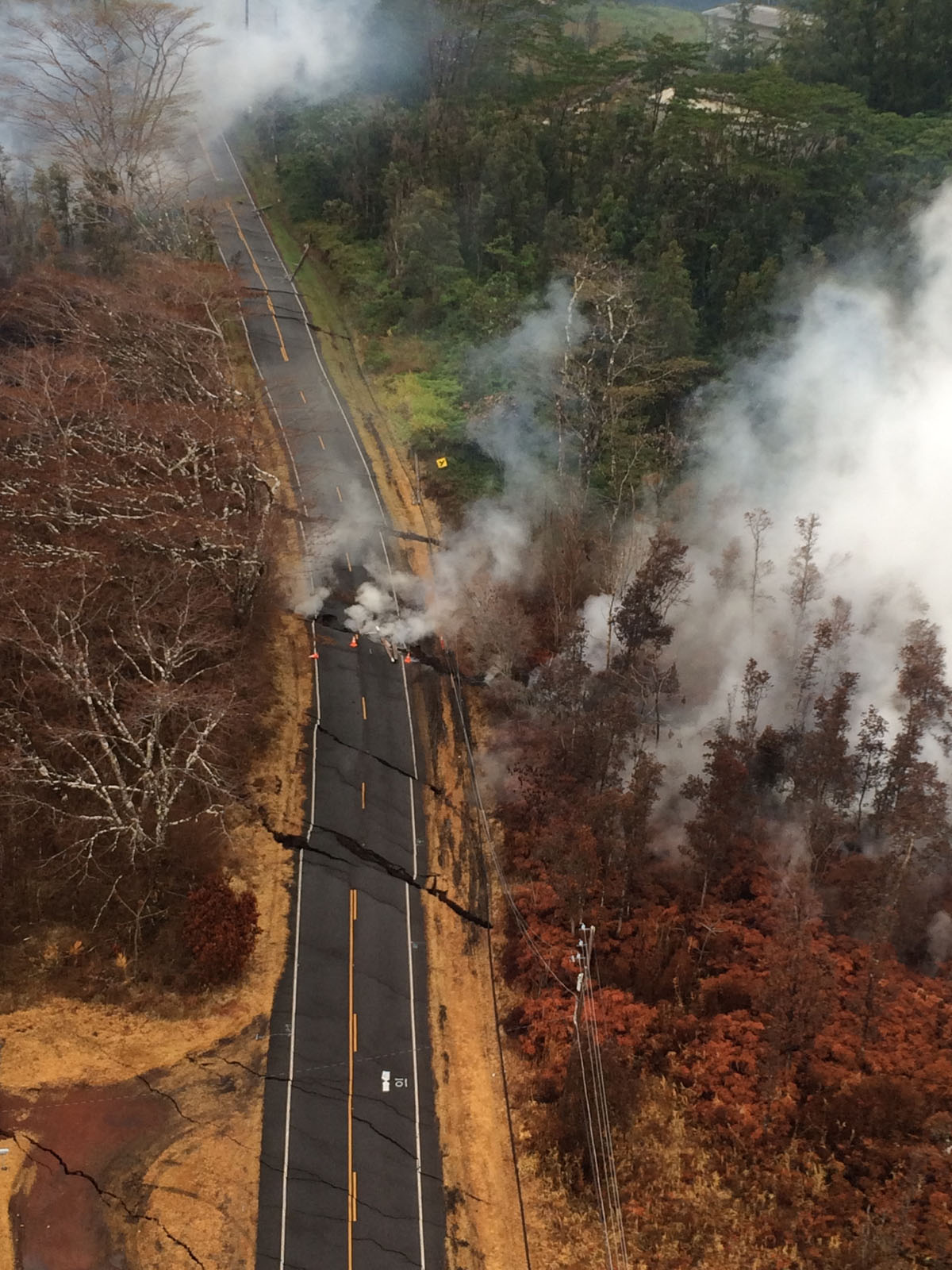
Aerial view of ground cracks on Pohoiki Road during an overflight of the eruptive fissure area at about 7 a.m. HST. Cracks continued to open and widen, some with horizontal and vertical offsets, in the area during the past 24 hours. These cracks are caused by the underlying intrusion of magma into the lower East Rift Zone. PC: US Geological Survey.
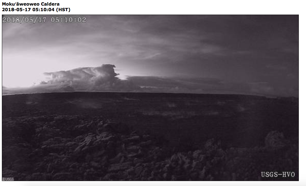
View of this morning’s eruption plume from the Overlook crater nearly an hour after the event started. This image is from the webcam located on the north rim of Moku‘āweoweo Caldera near the summit of Mauna Loa Volcano. This image was recorded at 5:10 a.m. HST. At about 04:15 a.m. HST, an explosion from the Overlook crater at Kīlauea Volcano’s summit produced an eruption column that reached at least 30,000 ft. above sea level. The plume was blown by wind toward the northeast. This resulted in ash fall at the Hawaiian Volcano Observatory, and nearby Volcano Village and the Volcano Golf and Country Club Subdivsion. PC: US Geological Survey.
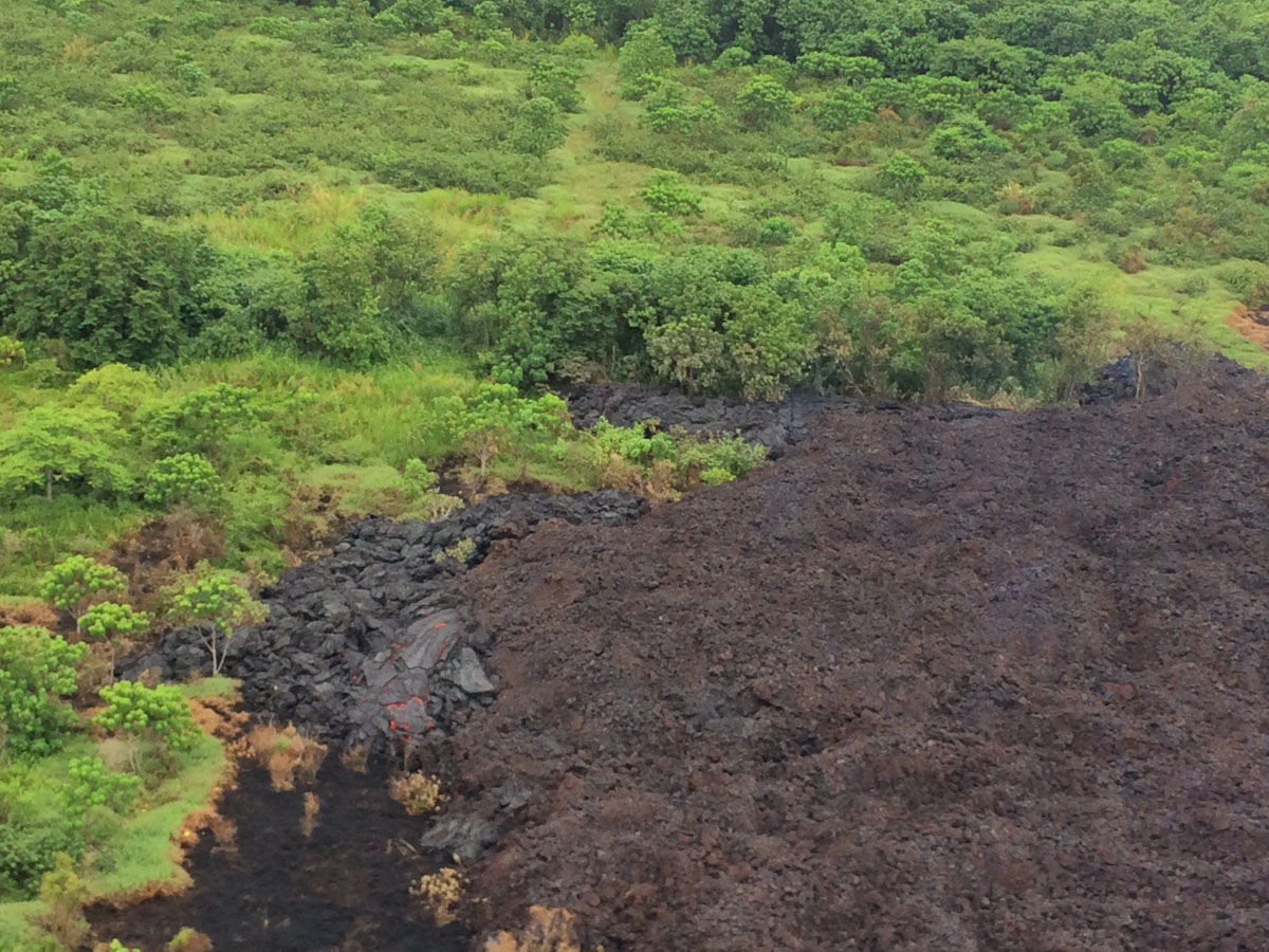
The Fissure 17 flow front has slowed substantially with only small amounts of pasty “toothpaste” lava oozing out from the flow front. However lava continues to be erupted from the active fissure. This lava appears to be accumulating within the flow and has widened the flow margins slightly. PC: US Geological Survey

At about 07:00 a.m. HST, Fissure 17 as shown from the air. The HVO field crew reported that the spattering height and intensity at Fissure 17 seemed to have intensified slightly from yesterday, but the length of active spattering in the fissure is shorter. The overall vigor of Fissure 17 appears to have dropped over the past two days, accompanying a stalling of the Fissure 17 flow front. PC: US Geological Survey
Sponsored Content