


Category 3 Dora has likely peaked in intensity; current forecast path is “well south” of Hawaiʻi
 Dora satellite imagery (8.3.23, 6 a.m. HST)PC: NOAA/NHC
- Dora satellite imagery (8.3.23, 6 a.m. HST)PC: NOAA/NHC
- Dora five day forecast cone (8.3.23, 6 a.m. HST)PC: NOAA/NHC
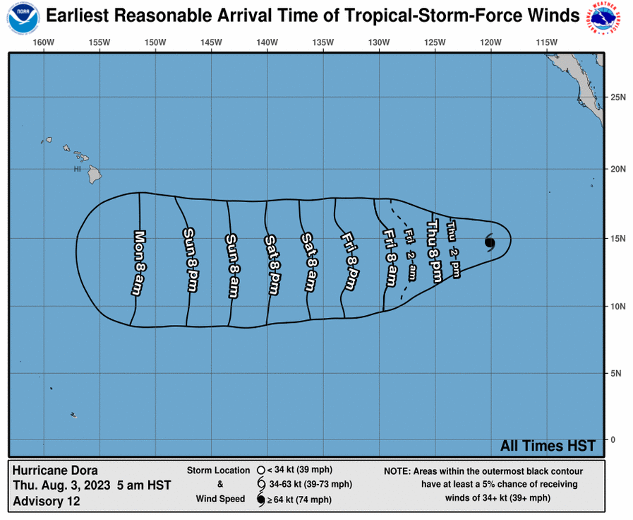
- Dora earliest reasonable arrival time of tropical storm force winds (8.3.23, 6 a.m. HST)PC: NOAA/NHC
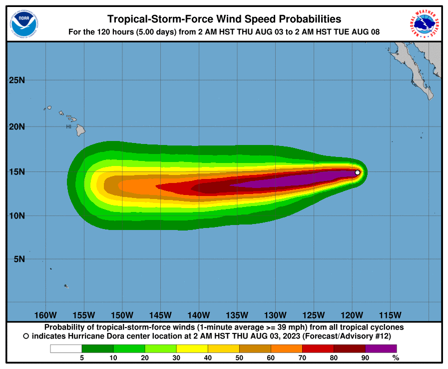
- Dora wind speed probabilities (8.3.23, 6 a.m. HST)PC: NOAA/NHC


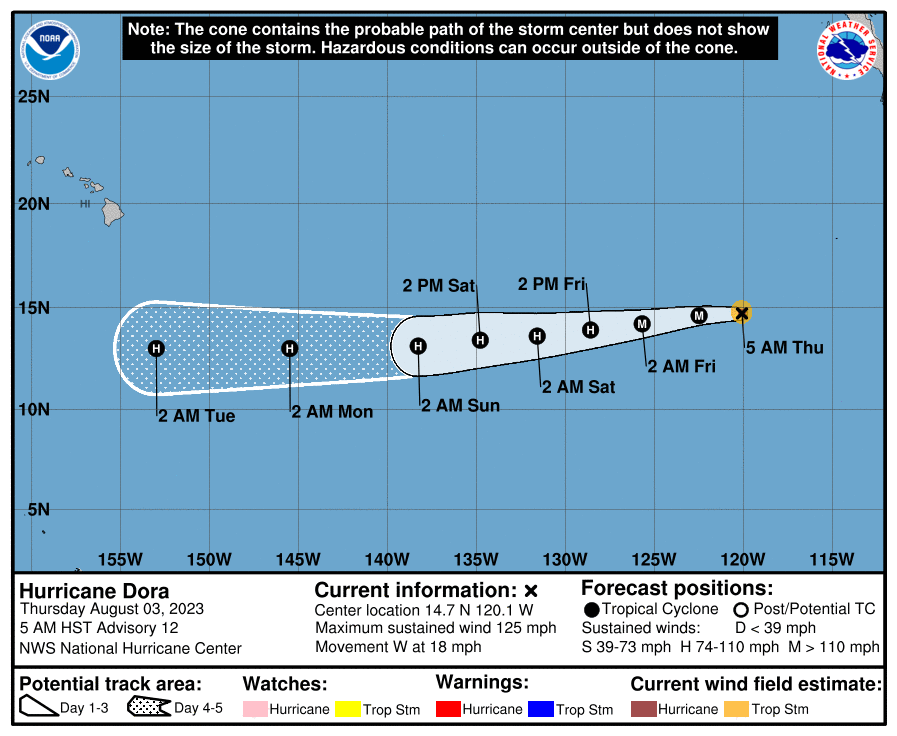


Hurricane Dora continues on a path westward across the open Eastern Pacific, according to forecasters with the National Hurricane Center.
The Category 3 hurricane has maximum sustained winds of 125 mph with higher gusts. Forecasters with the National Hurricane Center say Dora has likely peaked in intensity.
The system was last located about 875 miles SW of the southern tip of Baja California, and was moving west at 18 mph. In relation to Hawaiʻi, Dora is 2325 miles ESE of Hilo; 2395 miles ESE of Hāna, Maui; 2430 miles ESE of Kahului, Maui; and 2520 miles ESE of Honolulu.
Forecasters with the National Weather Service in Hawaiʻi say a “transition period” is anticipated Sunday through early next week, “as a ridge strengthens to the north” and Hurricane Dora enters the Central Pacific.
“Some moisture is forecast to pool northward into the area as an upper disturbance settles southward over the region Sunday night into Monday. This moisture combined with trades potentially becoming strong as the gradient tightens will support a brief period with higher rainfall chances. Thereafter, very dry and windy conditions are expected across the state as upper heights rise and Dora passes well to the south,” according to a Forecast Discussion issued by the NWS.
On the water, there is potential for a near- advisory east swell generated by Hurricane Dora that could impact east facing shores early next week, according to the NWS.
According to the NWS: “This east swell remains highly reliant on Dora’s track, intensity, and the size of the fetch. This swell will gradually shift out of the southeast then south with a lowering period as Dora tracks close to, then south of the islands during the first half of next week.”
The National Hurricane Center reports that some gradual weakening is forecast during the next couple of days.
The compact system has hurricane-force winds extending outward up to 15 miles from the center and tropical-storm-force winds extending outward up to 45 miles, according to the NHC.
Sponsored Content


