

Trade Wind Weather Today, Front Ahead

Stars above Mākena / Image: Chris Archer
By Meteorologist Malika Dudley / Email: [email protected]
Alerts
A High Surf Advisory has been issued by the National Weather Service for a building northwest swell. The advisory is in effect from 4:00 p.m. today through 6:00 p.m. Friday for the north facing shores of Maui and Moloka’i. Wave heights of 12 to 16 foot faces are expected.
Expect strong breaking waves, shore break and strong longshore and rip currents making swimming difficult and dangerous.
A Small Craft Advisory is posted through 6 p.m. Friday for all Maui County waters. Rough seas up to 14 feet and east winds of 15 to 25 knots with higher gusts are forecasted. Inexperienced mariners should avoid navigating in these conditions.
**Click directly on the images below to make them larger. Charts include: Maui County high/low forecasted temperatures, projected winds, chance of cloud cover, projected localized weather conditions and expected wave heights.**
Today, Friday, December 19, 2014
Today we expect partly cloudy skies with scattered showers in windward and mauka areas. Some leeward areas may experience a few isolated showers blown over to those sides on our breezy winds. Winds have shifted a bit and are now out of the east from 15 to 20 mph. High temperatures should fall in the range of 79° to 85° and around 71° at 5000 feet.
Sunrise: 6:57 a.m.
Sunset: 5:49 p.m.
UV index at 6 (“high” exposure level)
Tonight
Partly to mostly cloudy skies are expected tonight in Maui County with scattered overnight showers in windward and mauka spots and isolated showers for lee areas. Winds are expected out of the east from 15 to 20 mph. Low temperatures from 66° to 71° degrees are expected with a low of about 50° at 5000 feet.
Moonset: 4:08 p.m.
Moonrise: 5:35 a.m. on Dec 20
Next New Moon: Dec. 21 at 3:36 p.m.
Next Full Moon: Jan. 4 at 6:54 p.m.
The peak nights for the Geminid Meteor Shower have passed but the shower is still active until December 19. Details on timing and viewing tips can be found HERE.
Looking Ahead
Trade winds will push showers into our usual windward and mauka areas and some of that moisture may pass leeward from time to time. Over the weekend, winds are expected to shift and become light as our “natural air conditioner” – high pressure – moves away from the islands and a cold front approaches. The cold front is expected to spread rain, cold air and strong northerly winds across the state from Kauai down to the Big Island starting Sunday night. There is a chance of thunderstorms for Moloka’i on Monday. The rainy conditions are expected to linger into Tuesday. Conditions will gradually return to typical trade wind weather.
Almanac for Kahului Airport
Maximum Temperature for today:
Normal 81°
Record 87° / Set in 1980 and tied in 1995
Minimum Temperature for today:
Normal 65°
Record 54° / Set in 1950
**Click here for your detailed Maui County surf report.**
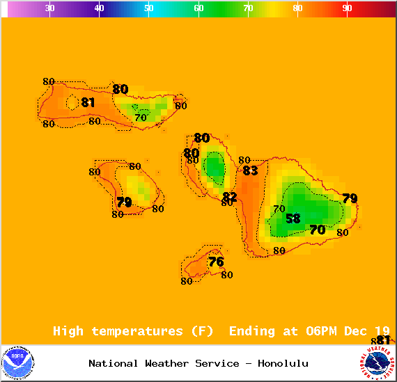
Image: NOAA / NWS
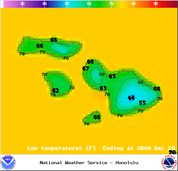
Image: NOAA / NWS
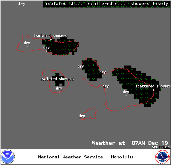
Image: NOAA / NWS
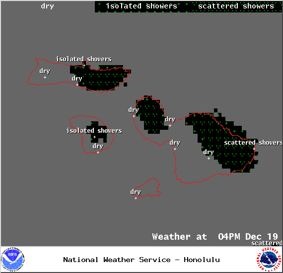
Image: NOAA / NWS
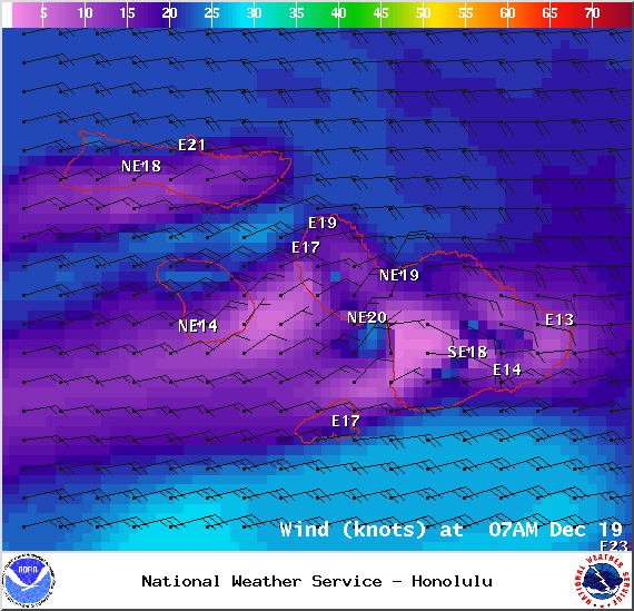
Image: NOAA / NWS
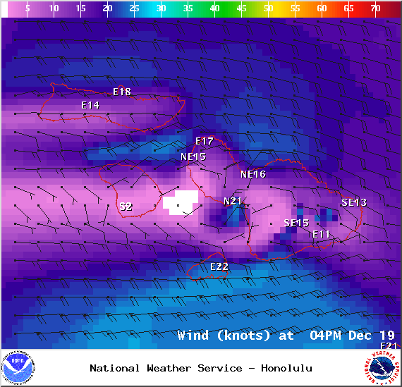
Image: NOAA / NWS
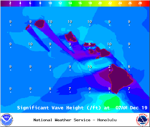
Image: NOAA / NWS

Image: NOAA / NWS
Sponsored Content


