Trade Swell Increases, South Fading Today
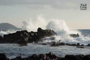
Image; Tad Craig
Alerts (as of 1:00 a.m.)
A Gale Warning is posted for all island waters starting Friday at 6 a.m. in the morning. Winds out of the east from 25 to 35 knots and seas of 8 to 12 feet are expected.
A Wind Advisory is posted from 6 a.m. Friday to 6 p.m. Saturday. Northeast to east winds from 15 to 30 mph are forecast with gusts getting up to 50 mph or more. Winds will be strongest over mauka areas and ridges and downslope of the mountains. Over the summit of Haleakalā winds could gust up to 60 mph.
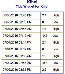
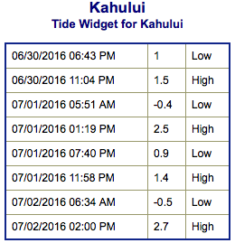
**Click directly on the images below to make them larger. Charts include: Maui County projected winds, tides, swell direction & period and expected wave heights.**
 Maui Surf Forecast
North: Wave heights are expected to be around waist/chest/head high for spots catching the trade swell.
West: Surf is waist high or less today out of the southwest. Spots from Kihei to around Olowalu/Lahaina will be smaller or even flat due to shadowing from the other islands.
South: Surf is waist high or less today.
 Old south energy is fading through the weekend. New swells will fill in over the weekend and into early next week. Not really notable though with wave heights not expected to get higher than waist high. Looking farther out, we may see another round of swell starting around July 7th.
Trade swell will bring surf to northeast exposures but onshore breeze will pick up quickly during the day to chop it up. Trade swell is expected to pick up this weekend.
Quiet in the North Pacific at this time. A possible swell may be generated in the Eastern Pacific later this weekend or early next week. We will keep an eye on it.
Keep in mind, surf heights are measured on the face of the wave from trough to crest. Heights vary from beach to beach, and at the same beach, from break to break.
**Click here for your detailed Maui County weather report.**
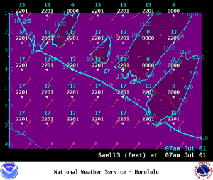
Image: NOAA / NWS
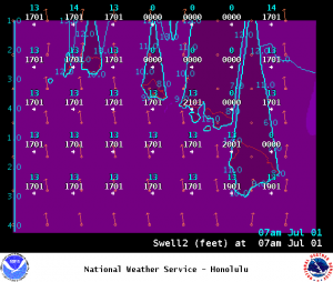
Image: NOAA / NWS
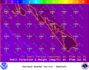
Image: NOAA / NWS
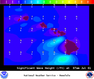
Image: NOAA / NWS
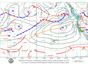
Image: NOAA / NWS
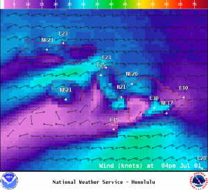
Image: NOAA / NWS
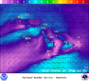
Image: NOAA / NWS
Sponsored Content