

Flood Risk Remains Due to High Moisture, Instability

Image: Chris Archer
Alerts (as of 1:00 a.m.)
A Flash Flood Watch is posted for the island of Maui through this afternoon.
**Click directly on the images below to make them larger. Charts include: Maui County high/low forecasted temperatures, projected winds, projected localized weather conditions and expected wave heights.**
Looking Ahead
Flood advisories have been posted for the Hana side of the island through the night and into early this morning. High moisture and unstable conditions mean the unsettled weather pattern will continue today, with the potential for locally heavy rainfall on Maui and the Big Island. A drier and more stable trade wind weather regime is expected to gradually become established across the Aloha State by late Thursday, and will continue into early next week. A disturbance forecast to pass south of the islands early next week could boost trade wind speeds.
Today
Partly cloudy with scattered windward showers . Mostly clear for lee areas with isolated morning showers and building clouds in the afternoon and scattered showers during that time. Locally heavy rainfall is possible. High temperatures from 85° to 90°. East-southeast winds around 10 to 15 mph.
UV index at 9 (“very high” exposure level)
Tonight
East-southeast winds around 15 mph. Partly to mostly cloudy skies with scattered windward showers and gradual clearing for leeward areas through the night. Locally heavy rainfall is possible to start. Low temperatures from 72° to 77°.
Our Maui Now Weather homepage always includes daily: Sunrise | Sunset | Moonrise | Moonset | Moon Phase | Live Weather Cams | 5-day Forecast | Current Temperature & Conditions
***Click here for your marine outlook and surf report.***
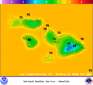
Image: NOAA
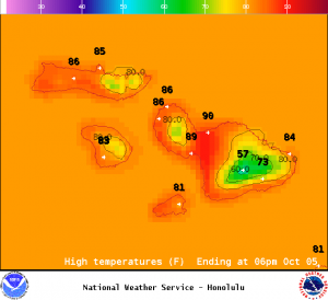
Image: NOAA
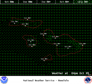
Image: NOAA

Image: NOAA
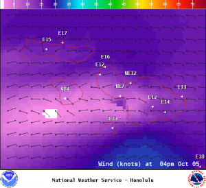
Image: NOAA
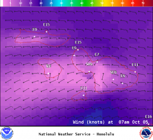
Image: NOAA
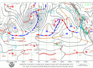
Image: NOAA
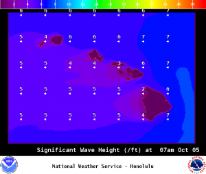
Image: NOAA
Sponsored Content


