Strong Thunderstorm Moves NE from Hāna to Maliko
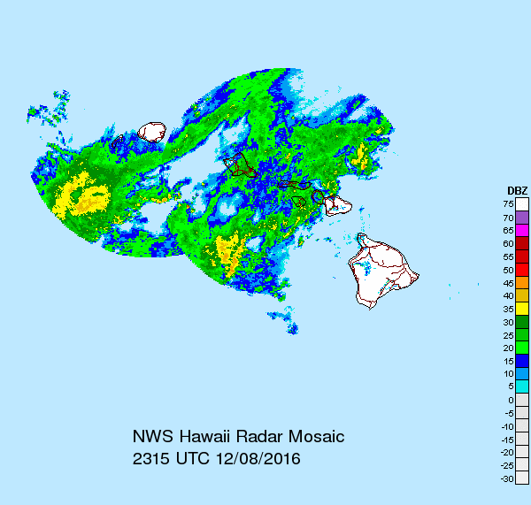
Radar image 1:15 p.m. HST, 12.08.16. PC: NWS/NOAA
Update: (12:40 p.m. HST 12.08.16)
The National Weather Service has extended a Special Marine Warning for Maui County Windward Waters, in effect until 1:30 p.m.
At 12:39 p.m., HST, Doppler radar indicated a strong thunderstorm capable of producing waterspouts and winds of 34 knots or greater. The storm was located 28 NM northeast of Maliko Boat Ramp and was moving north at 20 knots.
Update: (11:41 a.m. HST 12.08.16)
The National Weather Service has issued a Special Marine Warning for Maui County Windward Waters, that remains in effect until 12:45 p.m. HST on Thursday, Dec. 8, 2016.
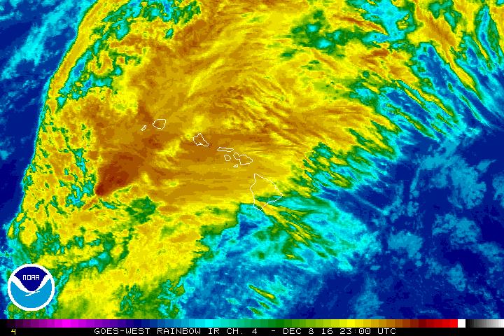
Satellite imagery 1 p.m. HST, 12.08.16. PC: NWS/NOAA
At 11:40 a.m. HST, Doppler radar indicated a strong thunderstorm capable of producing waterspouts and winds of 34 knots or greater. This storm was located just north of Hāna and was moving north at 20 knots.
The NWS says mariners can expect gusty winds, high waves, dangerous lightning and heavy rains. Boaters should seek safe harbor until the storm passes.
Thunderstorms can produce sudden waterspouts that are capable of overturning boats and creating locally hazardous conditions.
The NWS states that frequent lightning is occurring with this storm.
If caught on the open water, mariners are advised to stay below deck if possible and keep away from ungrounded metal objects.
Previous Post: (11:31 a.m. HST 12.08.16)
A special weather statement was issued by the National Weather Service indicating there is a strong thunderstorm affecting the Hāna area of East Maui.
At 11:30 a.m. HST, a strong thunderstorm was located near Hāna, or 29 miles east of Kahului, and was moving north at 15 mph.
Wind gusts in excess of 40 mph are possible with this storm.
Locations impacted include Nāhiku, Hāna and Hāmoa.
Sponsored Content