

Today’s Forecast: Wet Trade Wind Weather Continues

Image: Mark Petri
Alerts (as of 1:00 a.m.)
Flash Flood Watch: Maui and the Big Island through Thursday afternoon. The highest chance of flooding will be over windward and interior areas. Grounds are already saturated from earlier rains.
High Surf Advisory: North and east facing shores of Maui & Molokai and the west side of Molokai through 6 a.m. Friday.
Small Craft Advisory: Through 6 a.m. Friday for east winds up to 25 knots and seas from 9 to 14 feet.
**Click directly on the images below to make them larger. Charts include: Maui County high/low forecasted temperatures, projected winds, projected localized weather conditions and expected wave heights.**
Looking Ahead
Trade winds are expected through the weekend. A disturbance high in the atmosphere is lingering near the state through about Saturday before drifting south on Sunday. This means wet trade conditions are forecast with improving conditions on Sunday. The trade winds are expected to weaken early next week.
Today
We expect east winds around 15 to 25 mph. Mostly cloudy skies are forecast with windward showers likely and scattered showers for leeward spots. Temperatures up to 79° to 84°.
UV index at 6 (“high” exposure level)
Tonight
Mostly cloudy skies with showers likely in windward spots and scattered leeward showers. Low temperatures from 70° to 75°. Winds are expected to be east around 15 to 25 mph.
Our Maui Now Weather homepage always includes daily: Sunrise | Sunset | Moonrise | Moonset | Moon Phase | Live Weather Cams | 5-day Forecast | Current Temperature & Conditions
***Click here for your marine outlook and surf report.***

Image: NOAA

Image: NOAA

Image: NOAA

Image: NOAA
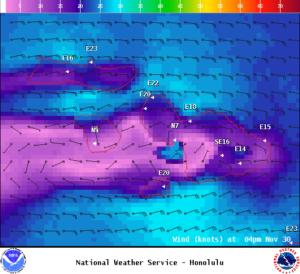
Image: NOAA
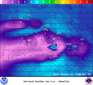
Image: NOAA
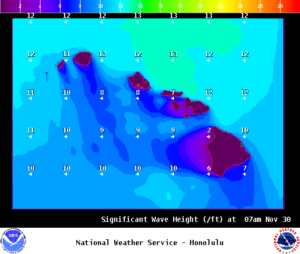
Image: NOAA
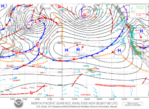
Image: NOAA
Sponsored Content


