


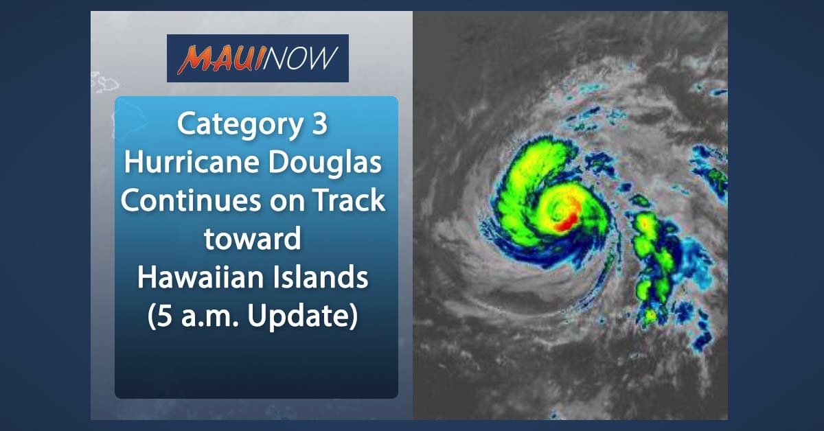
Major Hurricane Douglas Continues Track Toward Hawaiian Islands (5 a.m. Update)
• 2020 Hurricane Season in Hawaiʻi: https://bit.ly/30MBtUn
• Storm Prep and Kits: https://bit.ly/3eXGy1p
• Ige Issues Emergency Proclamation Ahead of Douglas: https://bit.ly/3hxIu2d
• Mayor Victorino urges Maui to Prep for Potential Impacts: https://bit.ly/32QRPhz
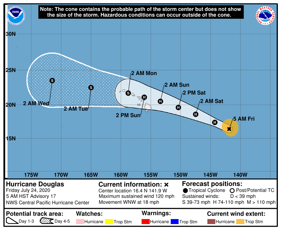
At 5 a.m. HST on Friday, July 24, 2020, the center of Hurricane Douglas was located 895 miles ESE of Hilo, Hawaiʻi (near latitude 16.4 North, longitude 141.9 West).
Douglas experienced slight weakening overnight, but remains a major hurricane with maximum sustained winds are near 120 mph with higher gusts.
The Category 3 system will continue to experience gradual weakening today through the weekend; however, the Central Pacific Hurricane Center says Douglas is still forecast to be near hurricane strength as it approaches the eastern end of the Hawaiian Island chain late Saturday night or Sunday.
Douglas is moving toward the WNW near 18 mph, and the CPHC says this motion is expected to continue for the next few days with a gradual decrease in forward speed and a slight turn toward the west.
Forecasters with the CPHC says on the current track, Douglas will approach the eastern Hawaiian Islands late Saturday night or Sunday.
Hurricane-force winds extend outward up to 25 miles from the center and tropical-storm-force winds extend outward up to 115 miles, according to the latest report.
John Bravender, Warning Coordination Meteorologist with the Central Pacific Hurricane Center advised that although Douglas is on a track to be near Maui as a potential hurricane on Sunday afternoon, he said:
“You don’t want to go too deterministic with our track forecast. Understand that the cone still covers all islands this point. So whether or not Douglas comes closest to the Big Island or Maui or Oʻahu, we’re still going to see fairly significant and rather widespread impacts in the main Hawaiian Islands as Douglas makes its closest approach or moves through. So we don’t want folks to dial in to the exact forecast track, but understand that additional changes could still happen–shifts to the north or shifts to the south. Remain prepared. As we always say, prepare for the worst and hope for the best as Douglas approaches.”
The following hazards are forecast:
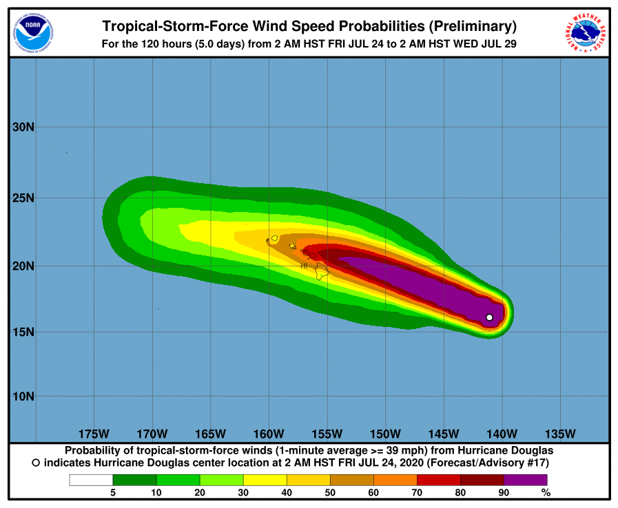
WIND: Strong winds associated with Douglas are expected to affect portions of the Hawaiian Islands as early as late Saturday night or Sunday, through the day Monday. Tropical Storm or Hurricane Watches will likely be required for portions of the state later today.
SURF: Large swells generated by Douglas are expected to begin affecting portions of the Hawaiian Islands on Saturday. These swells are likely to cause life-threatening surf and rip current conditions. Forecasters say this will likely affect E and SE facing shores.
RAINFALL: Heavy rainfall associated with Douglas is expected to affect portions of the Hawaiian Islands from late Saturday night through Monday. Total rain accumulations of 6 to 10 inches with isolated maximum totals of 15 inches will be possible, especially across elevated terrain. This rain may result in life-threatening flash flooding and land slides, as well as rapid water level rises in small streams.
*Supporting information courtesy Central Pacific Hurricane Center.
Douglas 5 a.m. (7.24.20) PC: NOAA/NWS/CPHC

Douglas 5 a.m. (7.24.20) PC: NOAA/NWS/CPHC

Douglas 5 a.m. (7.24.20) PC: NOAA/NWS/CPHC
Douglas 5 a.m. (7.24.20) PC: NOAA/NWS/CPHC
Douglas 5 a.m. (7.24.20) PC: NOAA/NWS/CPHC
Sponsored Content


