

NNW Slowly Fading, Advisory Level Swell Expected

Ho’okipa / Image: Jimmie Hepp
By Meteorologist Malika Dudley / Email: malika@mauinow.com
Alerts
There are no ocean alerts posted at this time.
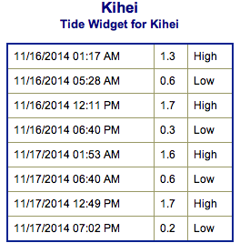
**Click directly on the images below to make them larger. Charts include: Maui County projected winds, forecasted swell direction, height & period, tides, a surface map and expected wave heights.**
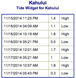 Maui County Surf Forecast, Sunday November 16, 2014
North: Surf is expected head high to possibly slightly overhead at the best breaks. We could see waves up to 2 feet overhead at the best spots on Molokaʻi and Maui.
West: Breaks that don’t catch the swell are forecasted to get smaller surf at ankle high or flat. Spots that are open to the fading north-northwest swell will get some wrap with waves expected about waist high at the best breaks.
South: Ankle-slappers to flat surf conditions are expected.
Our current north-northwest swell (325-350°) continues to fade through the weekend and remain below advisory level. The swell is still showing best on the Hilo side and along the Hamakua coast up to Kohala.
 A larger north northwest swell (330-350°) is expected to fill in Sunday night, build Monday to advisory level heights and peak Tuesday morning before gradually fading through Wednesday. We expect to see another round of overhead to double overhead surf for the best breaks exposed to the swell.
Another, but slightly smaller northwest swell is expected to slowly build Wednesday afternoon and peak just below advisory levels through the day on Thursday, then gradually fade on Friday.
Super small trace amounts of swell expected out of the SPAC. There isn’t much on the horizon out of the South Pacific. Possibly a small bump building on Tuesday but not expected to be over waist high at the best breaks.
Keep in mind, surf heights are measured on the face of the wave from trough to crest. Heights vary from beach to beach, and at the same beach, from break to break.
**Click here for your detailed Maui County weather report.**
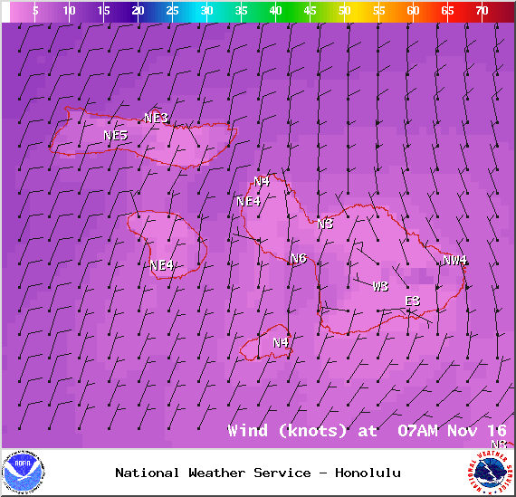
Image: NOAA / NWS
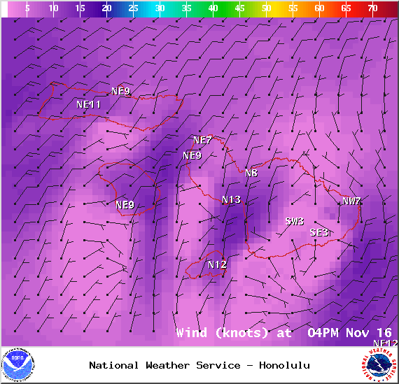
Image: NOAA / NWS
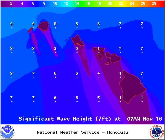
Image: NOAA / NWS

Image: NOAA / NWS
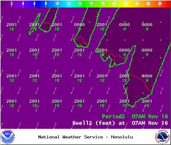
Image: NOAA / NWS
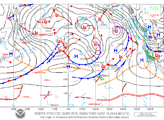
Image: NOAA / NWS
Sponsored Content


