

Overhead Waves Expected Today
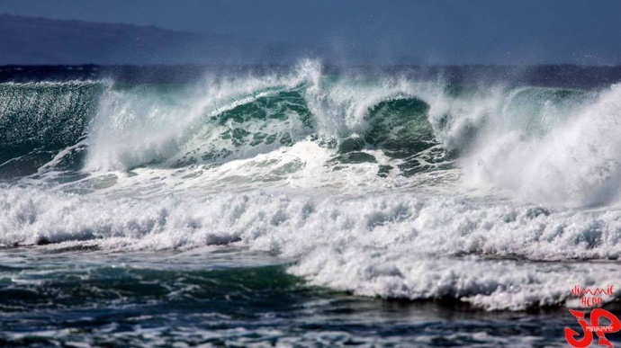
Ho’okipa File Photo / Image: Jimmie Hepp
By Meteorologist Malika Dudley / Email: [email protected]
Alerts
The High Surf Advisory has been extended for the east facing shores of Maui and Molokaʻi until 6 p.m. Thursday. Surf along east facing shores could reach heights of 5 to 8 feet, reaching heights up to 15 feet Tuesday night.
A High Surf Advisory has been issued for the north facing shores of Maui and Molokaʻi until 6 p.m. Tuesday. Surf along north facing shores could reach heights of 10 to 15 foot faces.
Expect strong breaking waves, shore break and dangerous currents that make getting into the water hazardous and swimming difficult.
The Small Craft Advisory has been extended for all Maui County waters until Wednesday at 6 p.m. Winds of 25 knots are expected and rough seas up to 14 feet. Inexperienced mariners should avoid navigating in these conditions.
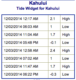
**Click directly on the images below to make them larger. Charts include: Maui County projected winds, forecasted swell direction, height & period, tides, a surface map and expected wave heights.**
 Maui County Surf Forecast, Tuesday December 2
North: Surf is expected up to be head high to overhead out of the NE for the best breaks. Northwest exposures can expect overhead to well overhead + wave heights at the best exposures.
West: Spots open to the swells are expected to get head high waves to overhead wave heights on the sets. Breaks that don’t catch the swell are forecasted to get smaller surf at ankle high or flat.
South: Many areas will remain flat today.
A west-northwest swell is expected to peak today at about 5 to 10 foot faces for exposed shores (mainly east of Ho’okipa). Swell is expected to shift tomorrow into Thursday and will swing some it’s energy away from the west sides and toward northwest exposures of Maui County.
 A north-northeast swell is expected to maintain wave heights a couple feet overhead the next couple of days, peaking Wednesday with double overhead + sets at the best exposures.
A new north-northwest swell is expected to build Friday into Saturday.
Super small trace amounts of swell expected out of the SPAC. Not much to get excited about.
**Click here for your detailed Maui County weather report.**
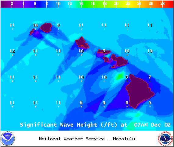
Image: NOAA / NWS

Image: NOAA / NWS

Image: NOAA / NWS
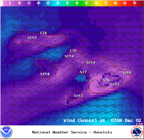
Image: NOAA / NWS
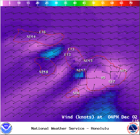
Image: NOAA / NWS

Image: NOAA / NWS
Sponsored Content


