

SSW Swell Continues to Fade

Image: Jimmie Hepp
By Meteorologist Malika Dudley / Email: malika@mauinow.com
Alerts
A High Surf Advisory is posted for the south facing shores of all islands in Maui County through 6:00 a.m. Tuesday. Expect strong breaking waves, shore break and strong longshore and rip currents making swimming difficult and dangerous.
**Click directly on the images below to make them larger. Charts include: Maui County projected winds, tides, swell direction & period and expected wave heights.**
 Maui Surf Forecast
North: Wave heights of about knee/waist high are expected today. Easterly breaks could be bigger on the sets.
West: Wave heights chest/head high are expected in the morning with a slow easing trend through the day. The best breaks exposed to the south could be slightly overhead early in the day on the sets. Many spots will be blocked by other islands.
South: Wave heights chest/head high are expected in the morning with a slow easing trend through the day. The best breaks exposed to the south could be slightly overhead early in the day on the sets.
 Our current south-southwest swell is expected to continue to slowly fade through the week, dropping out around Thursday. Small rideable pulses out of the south are expected but nothing super notable. August 4-6th we expect a new knee/thigh high swell with a better angled swell expected the 7-9th with waves possibly up to waist high or more.
Small trade swell will push into northeasterly exposures. Otherwise, the north Pacific is looking very quiet.
Keep in mind, surf heights are measured on the face of the wave from trough to crest. Heights vary from beach to beach, and at the same beach, from break to break.
**Click here for your detailed Maui County weather report.**
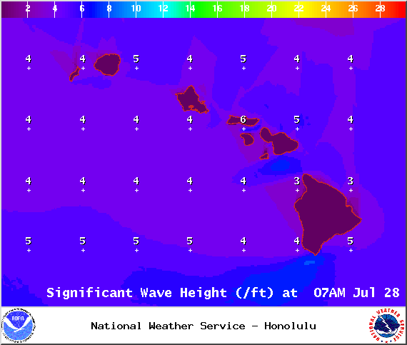
Image: NOAA / NWS

Image: NOAA / NWS

Image: NOAA / NWS
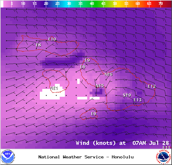
Image: NOAA / NWS
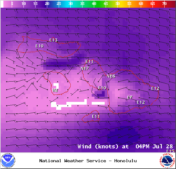
Image: NOAA / NWS
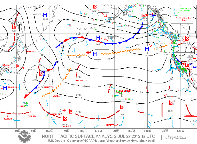
Image: NOAA / NWS
Sponsored Content


