

Warning Level Surf Expected Today
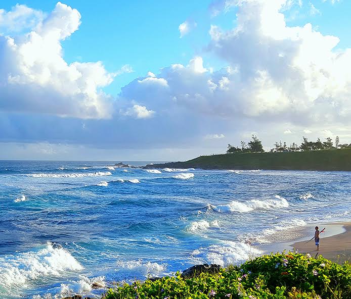
Image: John Varney
Alerts
A High Surf Warning is posted for north and west facing shores of Maui and Molokai through 6 p.m. Wednesday. Wave heights are expected to gradually rise to 20 to 15 foot faces along north shores and 15 to 20 feet for west shores.
A Small Craft Advisory is posted for all Maui County channels and windward waters through 6 p.m. Wednesday.
Check our breaking news section for any urgent weather alerts.
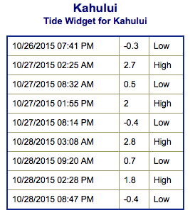
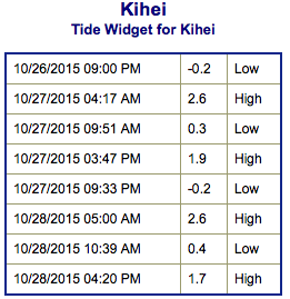
**Click directly on the images below to make them larger. Charts include: Maui County projected winds, tides, swell direction & period and expected wave heights.**
 Maui Surf Forecast
North: Wave heights are expected head high to well overhead to start today. By the afternoon surf heights should be double to triple overhead at the best breaks.
West: Wave heights waist/head high are expected today. The best exposures could get up to overhead on the sets from time to time. Spots shadowed by other islands will be smaller.
South: The south-southwest is expected to bring waist/head high waves today. The best breaks could be overhead on the sets from time to time. Spots catching wrap from Olaf could reach waist high.
 Solid north-northwest swell is expected to rapidly build Tuesday to warning levels for most islands. Swell is expected to really pick up around 3 p.m. and peak overnight into early Wednesday morning.
Another, more westerly, swell is expected on the heels of this one for the end of the work week. This energy should build Thursday, peak Friday and ease through the weekend.
Our current south-southwest is expected to peak Tuesday and begin to gradually ease on Wednesday.
Next week another pulse of south-southwest is expected. Will keep an eye on it.
Keep in mind, surf heights are measured on the face of the wave from trough to crest. Heights vary from beach to beach, and at the same beach, from break to break.
**Click here for your detailed Maui County weather report.**
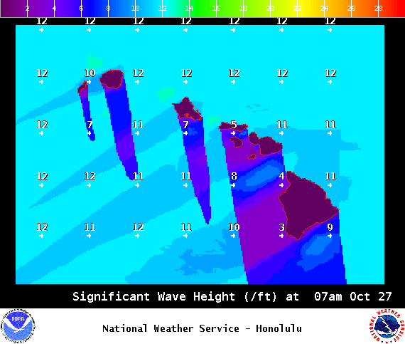
Image: NOAA / NWS
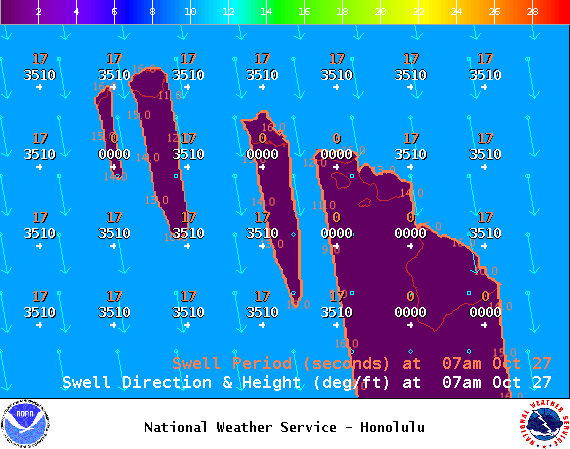
Image: NOAA / NWS
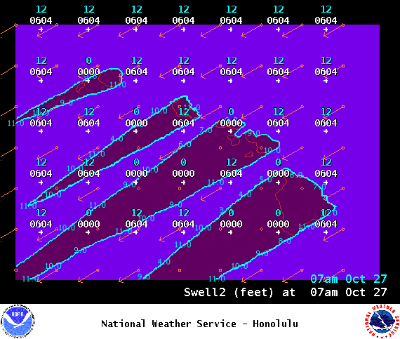
Image: NOAA / NWS

Image: NOAA / NWS
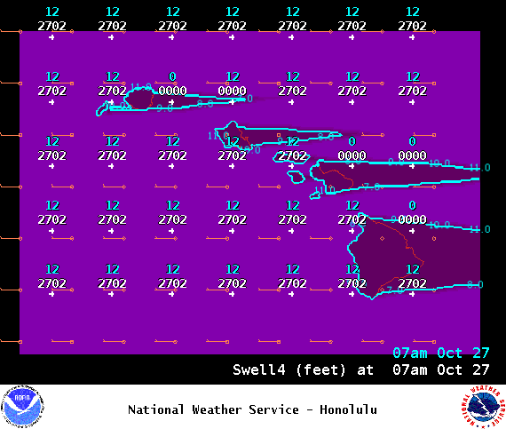
Image: NOAA / NWS
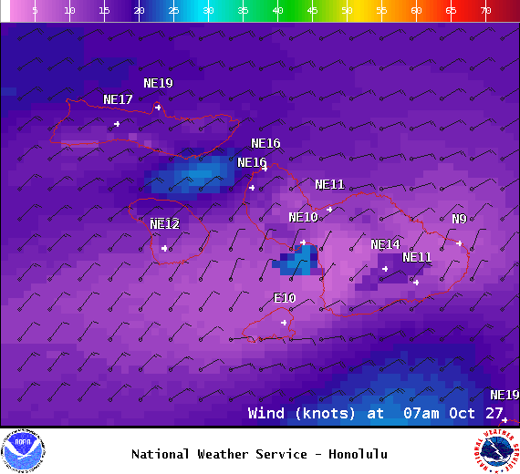
Image: NOAA / NWS

Image: NOAA / NWS
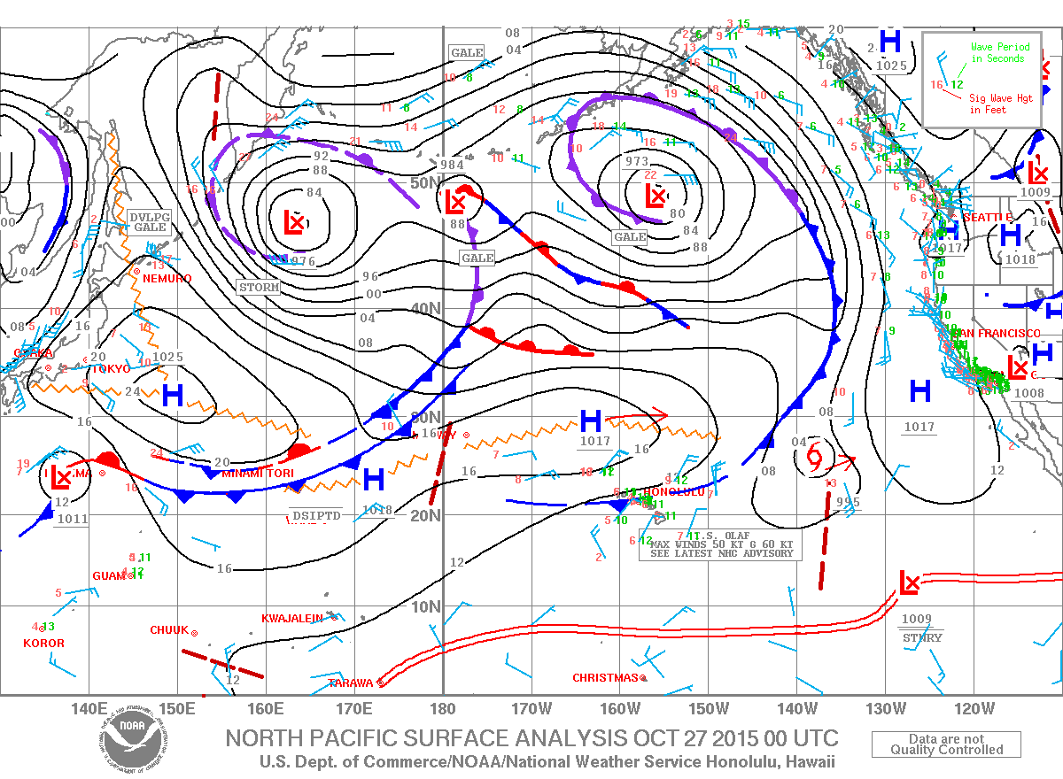
Image: NOAA / NWS
Sponsored Content


