

Surf Report, King Tides Expected for Memorial Day Weekend
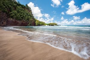
Image: Chris Archer
Alerts (as of 1:00 a.m.)
Special Weather Statement: Coastal flooding is anticipated over the next several days along all shores of the Hawaiian Islands due to record level spring (king) tides. Impacts include beach flooding, standing water on roadways and low-lying areas near the coast. A large summer south swell is also filling in Friday and will exacerbate the problem leading to additional beach run up, flooding and erosion.
Small Craft Advisory: ʻAlenuihāhā and Pailolo channels, as well as Māʻalaea Bay through 6 a.m. Thursday.
**Click directly on the images below to make them larger. Charts include: Maui County projected winds, tides, swell direction & period and expected wave heights.**
Maui Surf Forecast
North: Surf heights are expected to be waist/shoulder high today and fading.
West: Surf heights are expected to be knee/waist high today with some new swell filling in around sunset.
South: Surf heights are expected to be knee/waist high today with some new swell filling in around sunset.
Our current south swell continues to fade. A larger shot of good south-southwest is forecast for late Thursday and Friday, peaking late Friday into early Saturday. The swell could slightly exceed model guidance.
Choppy east trade wind swell continues but will drop off as our winds die down.
Our current north-northwest continues to fade. A fun northwest is forecast for the middle of next week. Will keep an eye on the models.
Keep in mind, surf heights are measured on the face of the wave from trough to crest. Heights vary from beach to beach, and at the same beach, from break to break.
**Click here for your detailed Maui County weather report.**
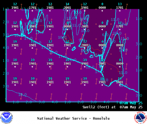
Image: NOAA
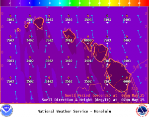
Image: NOAA
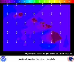
Image: NOAA
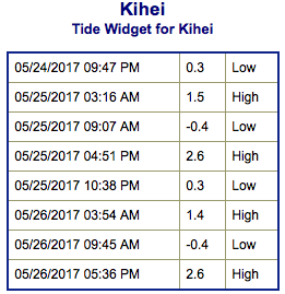
Image: NOAA
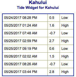
Image: NOAA
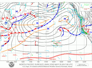
Image: NOAA
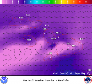
Image: NOAA
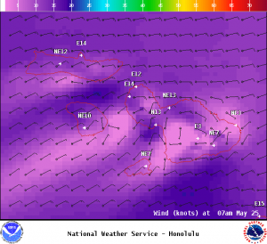
Image: NOAA
Sponsored Content


