Near Double Overhead as Northerly Swell Fades

10-year-old Levi Young surfing on Maui / Image: Dooma Photos
By Meteorologist Malika Dudley / Email: malika@mauinow.com
Alerts
There are no marine weather alerts posted at this time.
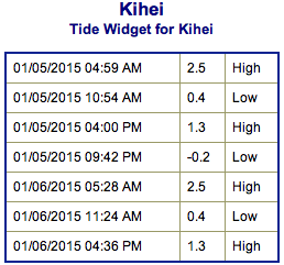
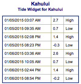
**Click directly on the images below to make them larger. Charts include: Maui County projected winds, forecasted swell direction, height & period, tides, a surface map and expected wave heights.**
 Maui County Surf Forecast, Monday, January 5, 2015
North: Surf heights are expected overhead to near double overhead early in the day at the best breaks, especially for spots east of Ho’okipa.
West: Spots open to the swells are expected to get waves waist to chest high on the sets at the best northerly breaks. The best spots may hit head high early in the day from time to time. Smaller surf expected Sunday at ankle to knee high. Otherwise, breaks that don’t catch the swells, and / or are shadowed from them, are forecasted to get smaller surf at ankle high or flat.
South: Ankle to knee high surf is expected.
 North-northwest swell is expected to linger through the next couple of days, holding through Monday morning then slowly fading.
Our current west-northwest swell is expected to ease Monday. New west-northwest is expected to peak early Tuesday morning.
More swells are on tap for the middle of next week and the end of this week.
Nothing of note out of the SPAC to get excited about.
Keep in mind, surf heights are measured on the face of the wave from trough to crest. Heights vary from beach to beach, and at the same beach, from break to break.
**Click here for your detailed Maui County weather report.**
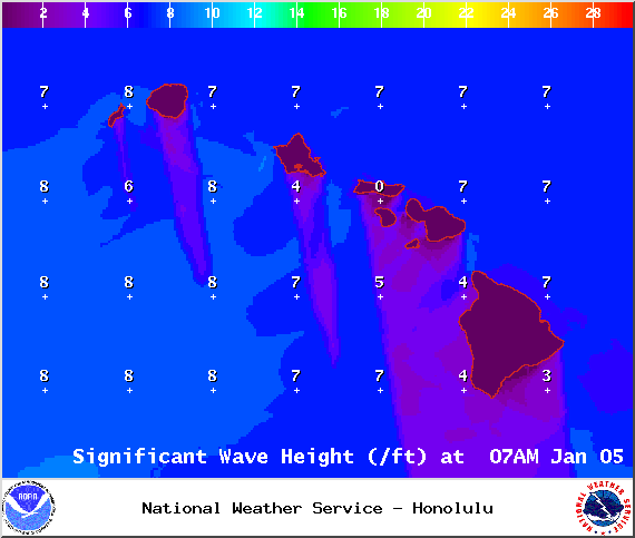
Image: NOAA / NWS

Image: NOAA / NWS
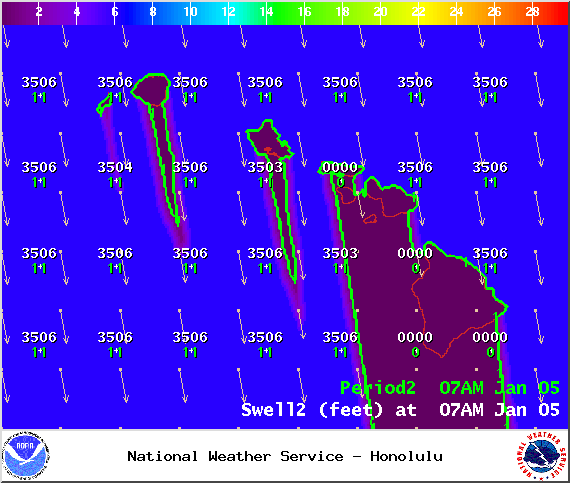
Image: NOAA / NWS

Image: NOAA / NWS

Image: NOAA / NWS
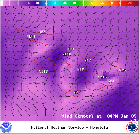
Image: NOAA / NWS
Image: NOAA / NWS
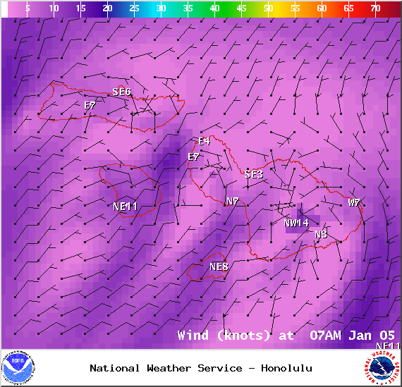
Image: NOAA / NWS
Sponsored Content