

Overlapping SSW Swells Today
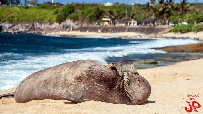
Ho’okipa Monk Seal / Image: Jimmie Hepp
By Meteorologist Malika Dudley / Email: malika@mauinow.com
Alerts
A Small Craft Advisory is posted for Pailolo and ʻAlenuihāhā channels as well as Māʻalaea Bay through 6:00 p.m. Sunday. East winds up to 25 knots are forecasted along with rough seas of 7 to 11 feet. Inexperienced mariners should avoid navigating in these conditions.
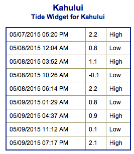
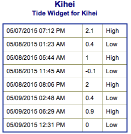
**Click directly on the images below to make them larger. Charts include: Maui County projected winds, forecasted swell direction, height & period, tides, a surface map and expected wave heights.**
 Maui County Surf Forecast
North: Wave heights are expected around chest/head high today. Best breaks go overhead on the sets.
West: Spots catching the south-southwest could get up to waist/chest high waves today, bigger on the sets at the best spots. Spots not catching the swell are expected to be in the ankle to knee high range.
South: Waist/chest/shoulder high waves are expected today. The best breaks could see head high waves on the sets.
 Our current south-southwest is expected to ease into Friday. Friday an incoming swell will overlap with the current one. That second pulse is expected to peak over the weekend and ease early next week. Smaller surf is expected for spots shadowed by other islands.
A new northwest swell will continue to build early Friday, peaking late Friday up to head high or so at the best spots. This swell will fade early next week. A small swell is expected for the second half of the week out of the southwest.
Keep in mind, surf heights are measured on the face of the wave from trough to crest. Heights vary from beach to beach, and at the same beach, from break to break.
**Click here for your detailed Maui County weather report.**
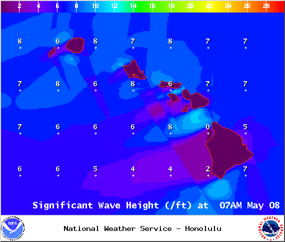
Image: NOAA / NWS

Image: NOAA / NWS
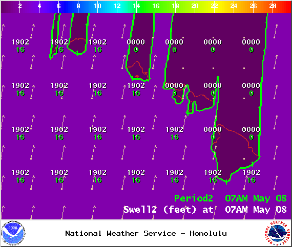
Image: NOAA / NWS
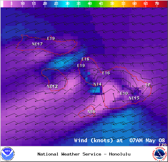
Image: NOAA / NWS
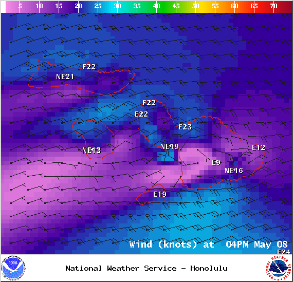
Image: NOAA / NWS

Image: NOAA / NWS
Sponsored Content


