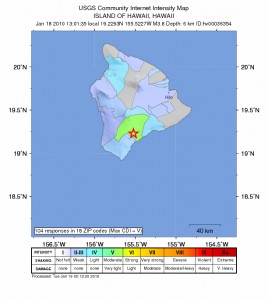
3.8 Big Island Quake Shakes Mauna Loa
The USGS recorded a 3.8 magnitude earthquake at 1:01 p.m. on Monday, January 18, 2010 on the Southeastern Flank of Mauna Loa on the Big Island of Hawaii.
The epicenter of the quake was 3 miles WNW of Pahala, 12 miles NNE of Naaleahu, 18 miles ENE of Hawaiian Ocean View, 44 miles SW from Hilo and 207 miles SE of Honolulu. The depth of the quake was 4.1 miles below the surface.
The Pacific Tsunami Warning Center in Ewa Beach quickly dismissed the threat of a tsunami saying no tsunami is expected from the event and no action was required.
The exact coordinates of the quake were:Â 19.2 North and 155.5 West.
(Posted by Wendy Osher; Information and mapping courtesy: U.S. Geological Survey, Hawaiian Volcano Observatory, Hawaii National Park, Hawaii)


