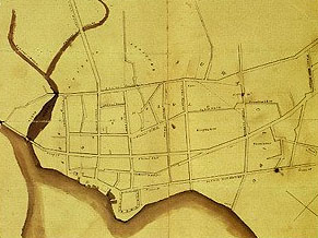
The Mapping of Maui from 1778 to 1929
By Wendy Osher
A unique history of the Hawaiian Islands through historic maps comes to Maui in October.
The traveling exhibit, entitled The Mapping of Hawai’i, will be available for viewing October 1-15, 2011 at the Bailey House Museum in Wailuku.
The exhibit traces the history of the Hawaiian Islands through its maps.
There is a $7 admission charge to the museum, except on Friday, October 7, between 5:30 and 8 p.m., when the public is invited to view the exhibit for free, in conjunction with the Wailuku First Friday event.
During the October 7 viewing, exhibit curators Bryant Neal and Buck will act as docent for the event, joined by Richard Mickelsen. In addition to the maps and prints, there will also be a special exhibit with illustrations on the history of Polynesian voyaging canoes.
The Maui Historical Society also presents an illustrated talk entitled, The Mapping of Maui from 1778 to 1929.
Riley Moffat, a noted authority on Hawaiian maps, will be the guest speaker. Moffat is a Senior Librarian at BYU-Hawai’i in La’ie, where he has also taught geography and surfing.
Moffat is the co-author of three books in the award-winning Palapala’aina series including: The Early Mapping of Hawaii (1986), Surveying the Mahele (1995) and Mapping the Lands and Waters of Hawaii (2004).
The talk will take place at 4 p.m. on Saturday, October 8, at the Bailey House Museum. There is no charge for members of the Maui Historical Society. Non-members will be charged $10 for admission to the talk, which includes admission on that day to the museum and the traveling exhibition.
The Bailey House Museum is located at 2375-A Main St. in Wailuku. Museum hours are Monday to Saturday, 10 a.m. to 4 p.m.


_1768613517521.webp)

