Kermadec Islands 7+ Quake, No Tsunami Threat to Hawaii
By Wendy Osher

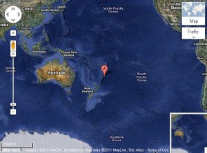
Map of Kermadec Island region where a 7+ magnitude earthquake was reported at 7:57 a.m. HST on Oct. 21, 2011. Image courtesy Google Maps.
There is NO tsunami threat to Hawai’i after 7.4 (preliminary magnitude) earthquake in the Kermadec Islands reported at 7:57 a.m. HST 10/21/11.
The quake was later listed as a 7.6 magnitude by the USGS about an hour after the initial posting.
The Pacific Tsunami Warning Center/NOAA/NWS evaluation says no tsunami threat exists to Hawai’i based on historical data.
Tsunami waves were generated in the area near the quake, including the Boat Cove Raoul and Fishing Rock Raoul where wave measurements were .3 and .6 ft respectively, with 6-8 min periods between waves.
The epicenter was located 112 miles E of Raoul Island, Kermadec Islands; 541 miles S of Nuku’alofa, Tonga; and 1851 miles WSW of Papeete, Tahiti, French Polynesia.


