

Henriette has Peaked, Continued Weakening Forecast
Tropical Storm Henriette, a.m. 8/9/13. Image courtesy NOAA/NWS/CPHC.
By Wendy Osher
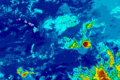
(Update: 5:35 a.m. 8/9/13)
Henriette has now weakened to a tropical storm overnight with maximum sustained winds dropping to 70 mph, according to the Central Pacific Hurricane Center.
As of 5 a.m., the system was located 870 miles ESE of Hilo, 980 miles ESE of Kahului, 1035 miles ESE of Kaunakakai, and 1010 miles ESE of Lānaʻi City.
Forecasters with the CPHC say Henriette is moving toward the WSW at 13 mph, and is expected to increase in forward speed over the next couple of days.
According to the CPHC, Henriette is expected to pass south of the main Hawaiian islands on Sunday, with continued weakening forecast during the next 48 hours.
The system is expected to weaken to a depression early Saturday, according to the CPHC.
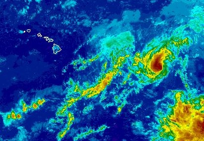
Henriette satellite imagery as of 4:30 p.m. on Thursday, Aug. 8, 2013. Image courtesy NOAA/NWS/CPHC.
(Update: 4:40 p.m. 8/8/13)
Hurricane Henriette appears to have peaked in intensity with gradual weakening forecast as the system moves over cooler waters over the next couple of days.
At 5 p.m., the system was located 975 miles E/SE of Hilo; 1040 miles E/SE of Kailua-Kona; 1015 miles E of South Point, 1080 miles E/SE of Kahului; 1130 miles E/SE of Kaunakakai; 1110 miles E/SE of Lānaʻi City, 1175 miles E/SE of Honolulu, 1275 miles ESE of Līhuʻe, and 1325 miles E/SE of Niʻihau, according to the Central Pacific Hurricane Center.
Authorities say the system had maximum sustained winds near 100 mph, with additional weakening forecast during the next 48 hours. The system is expected to move over cooler waters, encounter an increase in southwesterly shear, and approach a drier and more stable air mass over the next couple of days, according to CPHC reports.
Officials with the National Hurricane Center say Henriette is expected to become a tropical storm by Friday night or early Saturday.
The system was classified as a ‘category 2’ hurricane on the Saffir-Simpson scale from 1 to 5 with 5 being the most severe and destructive.
Hurricanes identified as ‘category 2’ carry extremely dangerous winds that can cause extensive damage to roofs, uproot trees, and cause extensive power outages if they pass over land. Storms of this magnitude are classified as those carrying winds of 96 to 110 mph.
Earlier today, officials with the CPHC said Henriette is expected to gradually begin weakening later today, with the forecast track passing the storm south of Hawaiʻi possibly this weekend. Forecasters reminded the public to be aware that these tracks can change.
“We do expect a rise in east facing shore surf, particularly for Big Island this weekend due to swell generated by Henriette,” agency officials said in an online update earlier today.
The system continued on a path to the west at 12 mph, with a turn toward the W/SW and an increase in forward speed expected tonight, CPHC officials said.
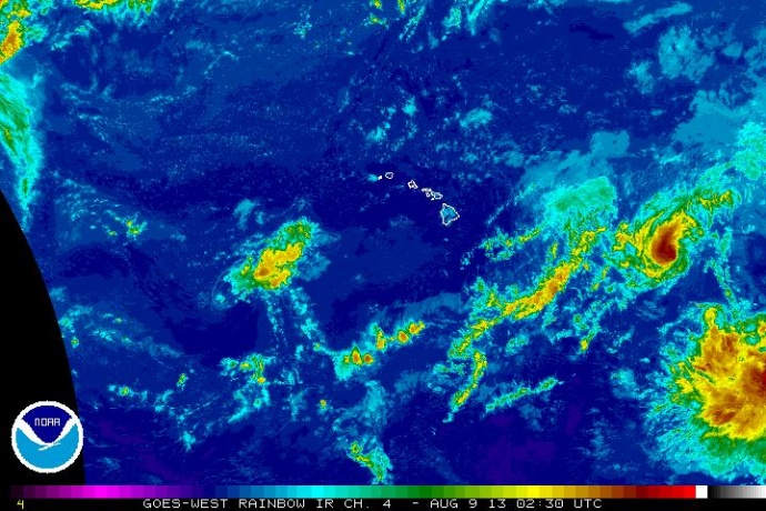
Henriette satellite imagery as of 4:30 p.m. on Thursday, Aug. 8, 2013. Image courtesy NOAA/NWS/CPHC.
Sponsored Content


