

2.6 Quake Recorded Near Kīlauea Summit
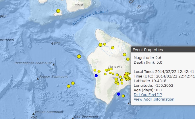
Image courtesy Hawaiian Volcano Observatory. Kīlauea quake, 2/22/14.
By Wendy Osher
There were no immediate advisories issued following a 2.6 earthquake reported at 12:42 p.m. on Saturday, Feb. 22, 2014, NW of the Kīlauea Summit on Hawaiʻi Island.
The quake was initially recorded as a preliminary magnitude 3.0, but was later downgraded to a 2.6, according to the Hawaiian Volcano Observatory.
According to the USGS, the quake was centered 4 miles W of Volcano, Hawaiʻi; 24 miles WSW of Hawaiian Paradise Park, Hawaiʻi; 25 miles SW of Hilo, Hawaiʻi; 47 miles ESE of Kailua-Kona, Hawaiʻi; and 209 miles SE of Honolulu, Hawaiʻi.
The agency reports that the quake occurred at a depth of 5 km or 3.1 miles, with the following coordinates: 19.432°N 155.306°W.
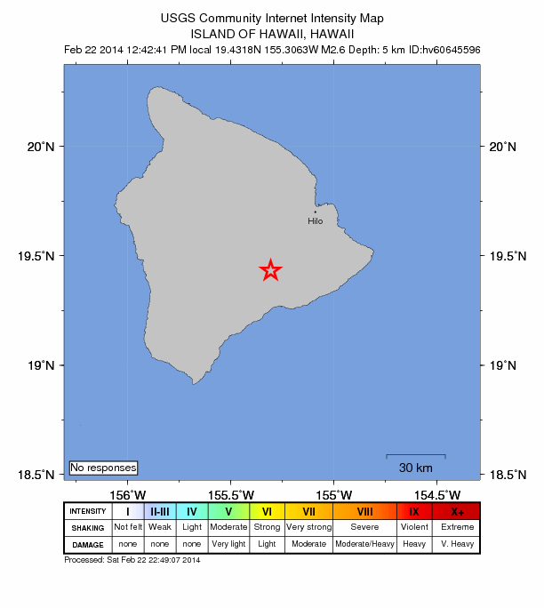
Image courtesy USGS/ Hawaiian Volcano Observatory. Kīlauea Summit earthquake, 2/22/14, 12:42 p.m.
Sponsored Content


