

Possible Peʻahi Swell Early Next Week
By Meteorologist Malika Dudley / Email: malika@mauinow.com
 North: Surf is expected in the chest to head high range at the best breaks, especially early in the day.
West: Breaks that don’t catch the swells are forecasted to get smaller surf at ankle high or less. Spots that are open to the north-northwest swell should see waist to chest high waves at the best breaks, especially early in the day.
South: Ankle-slappers to possibly thigh high surf is expected.
Our current north-northwest swell (325-355°) is fading today. An even bigger swell (320-345°) is expected to build tomorrow and peak overnight into Sunday morning. Waves could peak at double to triple overhead on the sets at the best breaks.
Typhoon Nuri is expected to bring us a solid swell starting late Monday and peaking mid day on Veteran’s Day with 15 to 25 foot faces possible at the best big wave spots on Maui like Peʻahi.
 Small swells generated in the South Pacific are expected to bring us waves in the thigh high or less range. You might see possible plusses at the best tides and exposures but they will be inconsistent at best and most west side spots will remain flat since they lie in the shadow of other islands.
There isn’t much on the horizon out of the South Pacific.
Keep in mind, surf heights are measured on the face of the wave from trough to crest. Heights vary from beach to beach, and at the same beach, from break to break.
**Click here for Malika’s full weather forecast.**
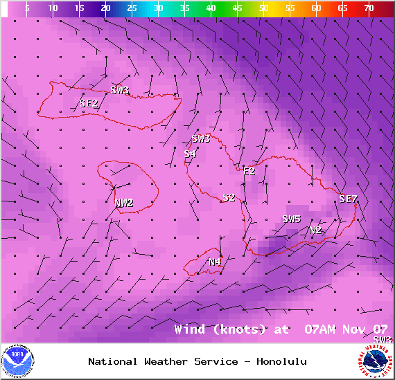
Winds at 7am – Image: NOAA / NWS
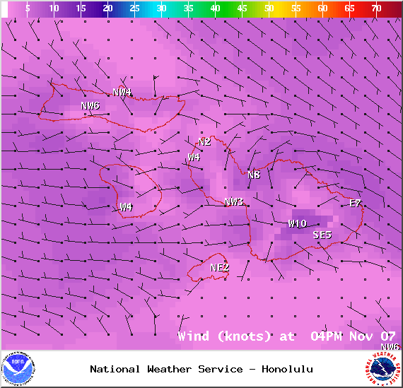
Winds at 4pm – Image: NOAA / NWS

Surf heights – Image: NOAA / NWS

Swell 1 – Image: NOAA / NWS
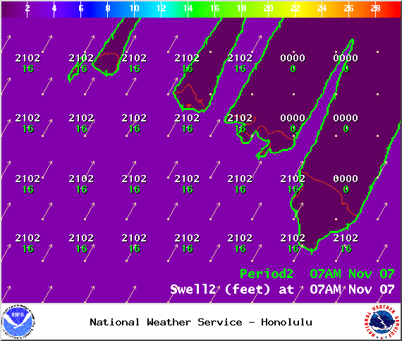
Swell 2 – Image: NOAA / NWS
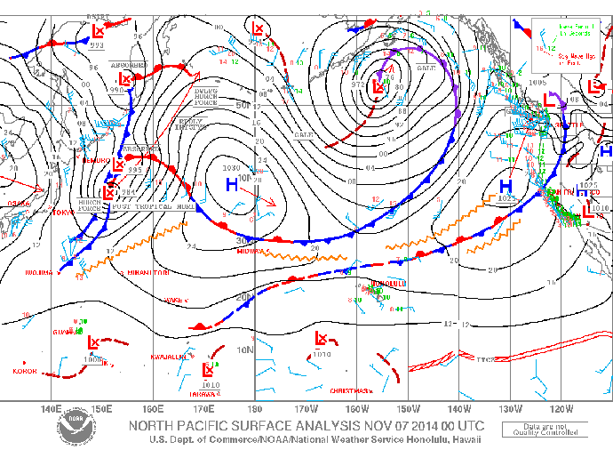
Surface map – Image: NOAA / NWS
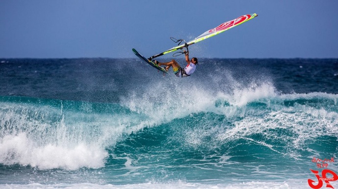
Giampaolo Cammarota wind surfing at Ho’okipa / Image: Jimmie Hepp
Sponsored Content


