

NNW Fades Over Weekend, South Flat

Peahi “Jaws” File Photo from earlier this week / Image: Sophie Louca Fish Bowl Diaries
By Meteorologist Malika Dudley / Email: malika@mauinow.com
Alerts
There are no ocean alerts posted at this time.
**Click directly on the images below to make them larger. Charts include: Maui County projected winds, forecasted swell direction, height & period, tides, a surface map and expected wave heights.**
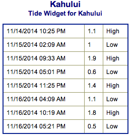 Maui County Surf Forecast, Saturday November 15, 2014
North: Surf is expected shoulder to possibly slightly overhead at the best breaks. We could see 10 foot faces at the best spots on Molokaʻi and Maui early in the day.
West: Breaks that don’t catch the swell are forecasted to get smaller surf at knee high or smaller. Spots that are open to the north-northwest swell will get some wrap with waves expected about head high at the best breaks.
South: Ankle-slappers to flat surf conditions are expected.
Our current north-northwest swell (325-350°) is fading through the weekend.
 The next swell on the horizon is expected to build through the day on Monday. A storm near the Aleutians is taking form and expected to generate the new north-northwest swell (330-350°). If so, we could see another round of overhead to double overhead surf for the best breaks along the north shores of Molokaʻi and Maui.
There’s potential for another swell out of the west-northwest for the mid to later part of next week and a series of swells through the last week of November.
Super small trace amounts of swell expected out of the SPAC. There isn’t much on the horizon out of the South Pacific.
Keep in mind, surf heights are measured on the face of the wave from trough to crest. Heights vary from beach to beach, and at the same beach, from break to break.
**Click here for your detailed Maui County weather report.**
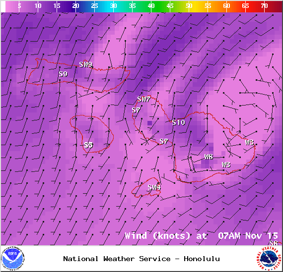
Winds at 7am – Image: NOAA / NWS
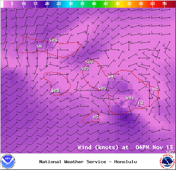
Winds at 4pm – Image: NOAA / NWS
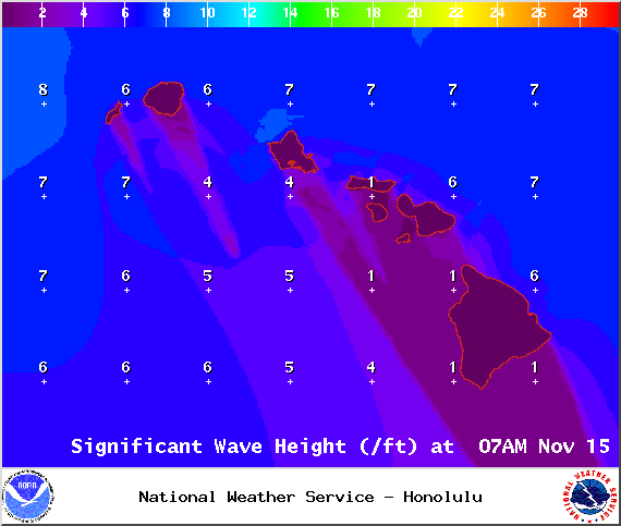
Swell height 7am – Image: NOAA / NWS
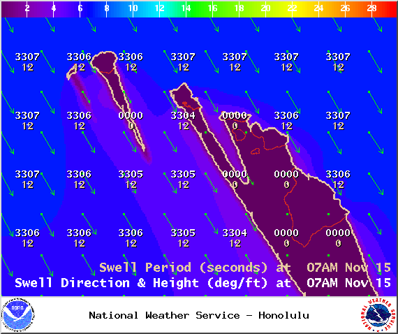
Swell 1 at 7am – Image: NOAA / NWS
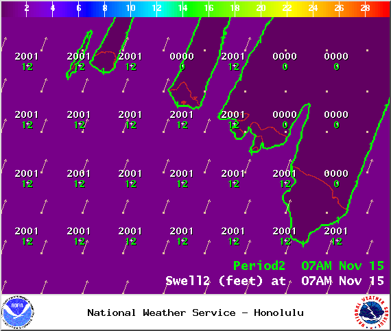
Swell 2 at 7am – Image: NOAA / NWS
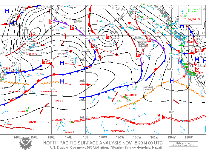
Surface Map – Image: NOAA / NWS
Sponsored Content


