

Weekend Maui County Surf Forecast
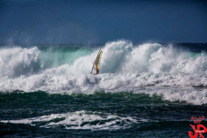
Ho’okipa / Image: Jimmie Hepp
By Meteorologist Malika Dudley / Email: malika@mauinow.com
Alerts
The High Surf Advisory has been extended for the east facing shores of Maui and Molokaʻi until 6 p.m. Sunday. Surf along east facing shores could reach heights of 6 to 8 feet. Expect strong breaking waves, shore break and dangerous currents that make getting into the water hazardous and swimming difficult.
A Small Craft Advisory is posted for all Maui County windward waters and the Kaiwi channel until 6 p.m. Saturday. The advisory will last until Sunday at 6 p.m. for the ʻAlenuihāhā and Pailolo channels. Winds of 20 to 30 knots are expected and rough seas from 10 to 15 feet. Inexperienced mariners should avoid navigating in these conditions.
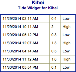
**Charts for Saturday and Sunday below. Wind conditions are shown at 7am and 4pm on each day. Click directly on the images below to make them larger. Charts include: Maui County projected winds, forecasted swell direction, height & period, tides, a surface map and expected wave heights.**
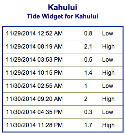 Maui County Surf Forecast, Saturday and Sunday November 29 & 30
North: Surf is expected head high to overhead. The best spots on Molokaʻi and Maui’s northern exposures could even see double overhead waves on the sets.
West: Spots that are open to the northwest-north swell will get some wrap with waves expected head high to overhead. Breaks that don’t catch the swell are forecasted to get smaller surf at ankle high or flat.
South: Many areas will remain flat today.
Another swell out of the northeast is expected to bring another round of overhead waves over the weekend starting this afternoon. New northwest swell could start building over the weekend on top of our old swell. Wave heights expected in the overhead range to double overhead at the best breaks.
 If models are right, a series of swells will affect our northerly exposures the first week of December.
Super small trace amounts of swell expected out of the SPAC. Some small SW to S swells could fill in Friday/Saturday of next week if storms in the SPAC behave as forecasted.
**Click here for your detailed Maui County weather report.**
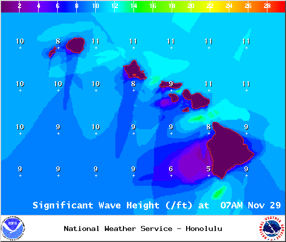
Image: NOAA / NWS
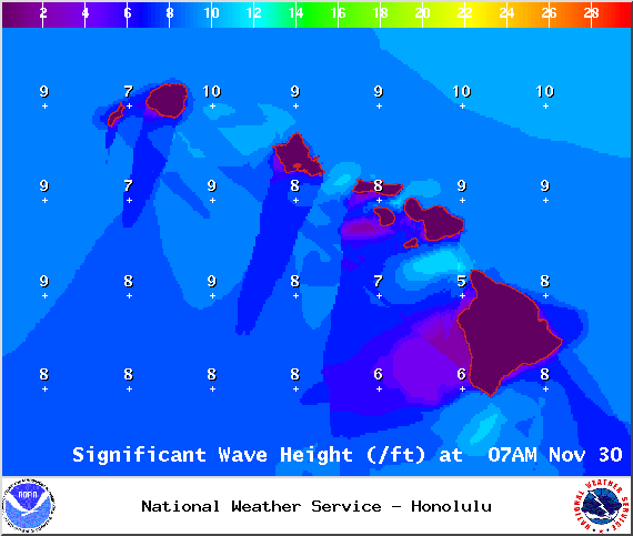
Image: NOAA / NWS
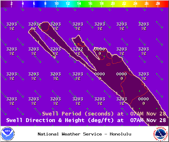
Image: NOAA / NWS

Image: NOAA / NWS
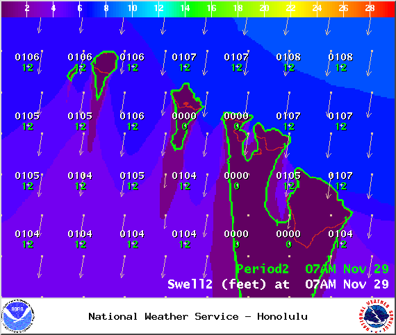
Image: NOAA / NWS

Image: NOAA / NWS
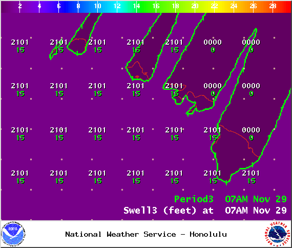
Image: NOAA / NWS

Image: NOAA / NWS
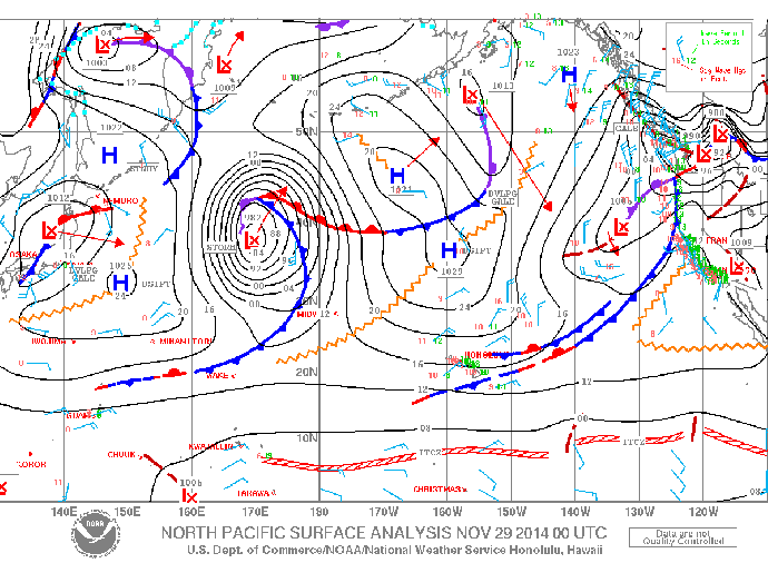
Image: NOAA / NWS
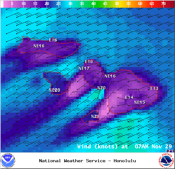
Image: NOAA / NWS
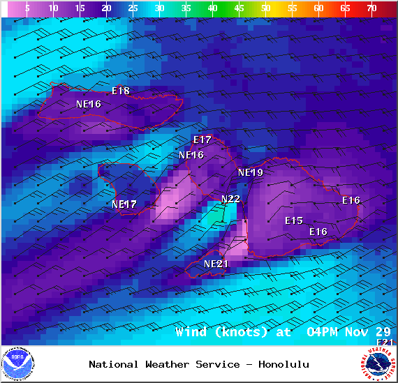
Image: NOAA / NWS
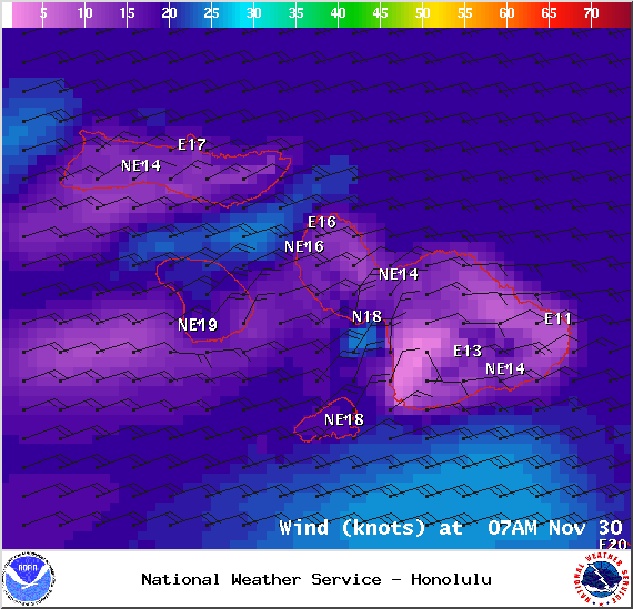
Image: NOAA / NWS
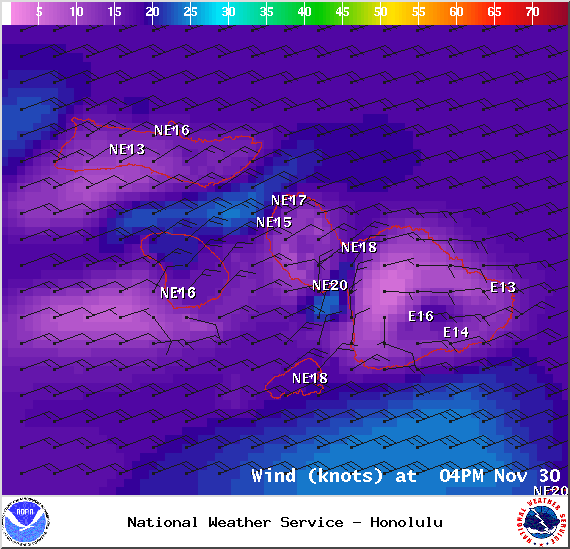
Image: NOAA / NWS
Sponsored Content


