

Swells Fade Today, Messy Windward Conditions
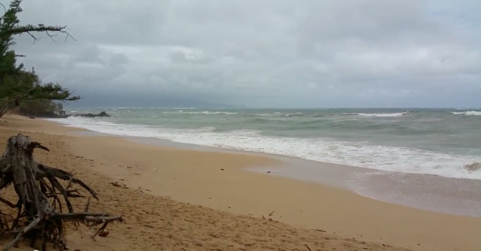
Pāʻia Bay / Image: Asa Ellison
By Meteorologist Malika Dudley / Email: malika@mauinow.com
Alerts
A High Surf Advisory is posted for north and east facing shores of Maui and Moloka’i through 6:00 p.m. Tuesday. Surf is expected at 10 to 15 foot faces along north shores. Expect strong breaking waves, shore break and strong longshore and rip currents making swimming difficult and dangerous.
A Small Craft Advisory is posted for all Maui County waters through 6:00 a.m. Thursday. East winds up to 30 knots are forecasted along with rough seas of 9 to 11 feet. Inexperienced mariners should avoid navigating in these conditions.
**Click directly on the images below to make them larger. Charts include: Maui County projected winds, forecasted swell direction, height & period, tides, a surface map and expected wave heights.**
 Maui County Surf Forecast
North: Wave heights are expected to start out around head high today with standouts still reaching well overhead on the sets early in the day. Swell drops through the day and becomes more messy as NNE mixes in.
West: Wave heights waist/shoulder high at the breaks open to the swell early in the day. Otherwise, pretty flat conditions are expected today for spots shadowed from the swells.
South: Ankle to knee high waves are expected today. Best breaks could get waist high sets.
 A pulse out of the northwest is expected to fade through the middle of the week. A little jumbled with the added energy out of the north-northeast Tuesday.
Our current south-southwest swell is expected to fade through the early part of this week. This week is looking pretty quite out of the southern hemisphere although a small boost out of the south-southwest is expected midweek. Next week we could see some activity around May 5th or 6th pending development of storms.
Keep in mind, surf heights are measured on the face of the wave from trough to crest. Heights vary from beach to beach, and at the same beach, from break to break.
**Click here for your detailed Maui County weather report.**

Image: NOAA / NWS
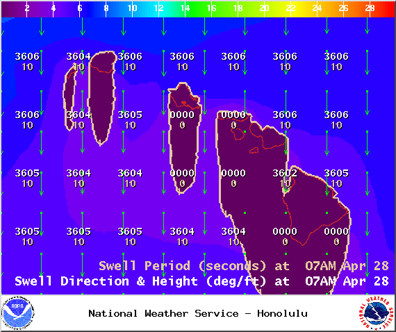
Image: NOAA / NWS
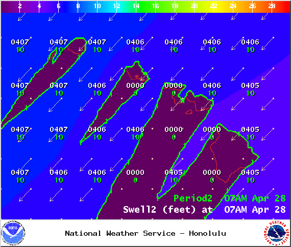
Image: NOAA / NWS

Image: NOAA / NWS
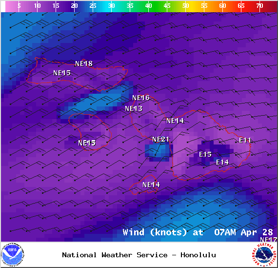
Image: NOAA / NWS

Image: NOAA / NWS
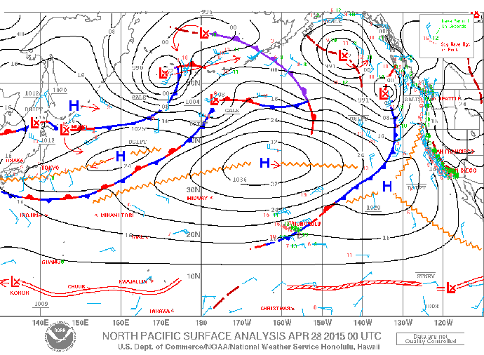
Image: NOAA / NWS
Sponsored Content


