

Trade Swell Continues Today

La Perouse / Image: Malika Dudley
By Meteorologist Malika Dudley / Email: malika@mauinow.com
Alerts
A Small Craft Advisory is posted for all Maui County waters through 6:00 a.m. Tuesday. East winds up to 40 knots are forecasted along with rough seas of 8 to 13 feet. Inexperienced mariners should avoid navigating in these conditions.
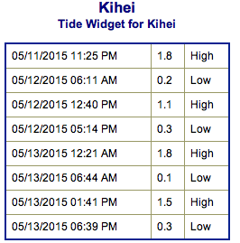
**Click directly on the images below to make them larger. Charts include: Maui County projected winds, forecasted swell direction, height & period, tides, a surface map and expected wave heights.**
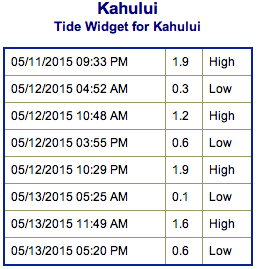 Maui County Surf Forecast
North: Wave heights are expected around ankle/knee high today. Trade swell could get up to head high or more with whitecapping, windy conditions.
West: Spots not catching the swells are expected to be in the ankle to knee high range. Possibly up to waist high for breaks that are still catching the fading south-southwest.
South: Knee/waist high waves are expected today. The best breaks could see slightly bigger waves on the sets early in the day.
 Our current south-southwest continues to drop through mid week. A small swell is expected for the second half of the week out of the southwest but really just small shots of energy out of the SPAC – waist high or less.
Flat conditions expected out of the northwest. Choppy trade swell will be the only source of waves for windward sides this week.
Keep in mind, surf heights are measured on the face of the wave from trough to crest. Heights vary from beach to beach, and at the same beach, from break to break.
**Click here for your detailed Maui County weather report.**
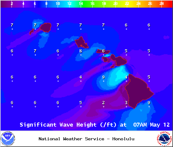
Image: NOAA / NWS

Image: NOAA / NWS
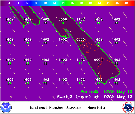
Image: NOAA / NWS
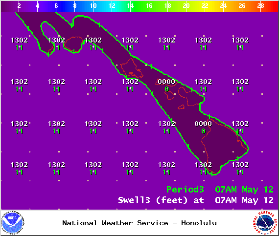
Image: NOAA / NWS

Image: NOAA / NWS
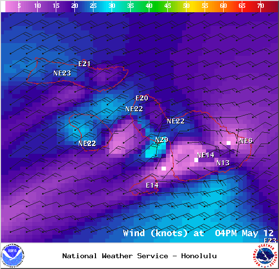
Image: NOAA / NWS
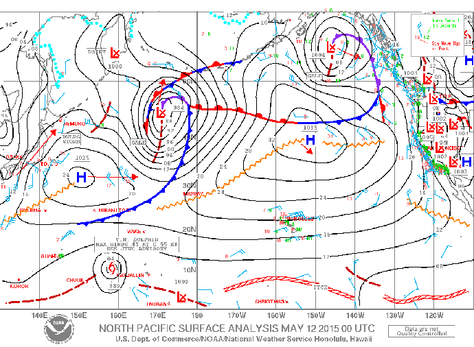
Image: NOAA / NWS
Sponsored Content


