

WNW Swell Fills in Today
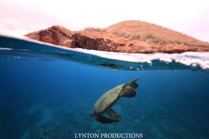
Mākena / Image: Aaron Lynton
By Meteorologist Malika Dudley / Email: malika@mauinow.com
Alerts
A Small Craft Advisory is posted for all Maui County channels (except the Kaiwi Channel) and Māʻalaea Bay through 6:00 p.m. Sunday. East winds up to 30 knots are forecasted along with rough seas of 7 to 12 feet. Inexperienced mariners should avoid navigating in these conditions.
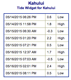
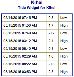
**Click directly on the images below to make them larger. Charts include: Maui County projected winds, forecasted swell direction, height & period, tides, a surface map and expected wave heights.**
 Maui County Surf Forecast
North: Wave heights of waist to head high are expected today as WNW builds. Trade swell could get up to head high with whitecapping, windy conditions (Hana area).
West: Spots not catching the swells are expected to be pretty flat. Possibly up to thigh high for breaks that are catching swell out of the south.
South: Knee/thigh high waves are expected today. The best breaks could get bigger on the sets.
 Our current mix of south and south-southwest swells brings waves of waist high or less through the end of the week. Storms firing up in the Tasman Sea could bring us swell in about a week.
A west-northwest is expected to build Friday and bring waves for the weekend peaking Saturday. A northwest pulse could fill in midweek.
Keep in mind, surf heights are measured on the face of the wave from trough to crest. Heights vary from beach to beach, and at the same beach, from break to break.
**Click here for your detailed Maui County weather report.**
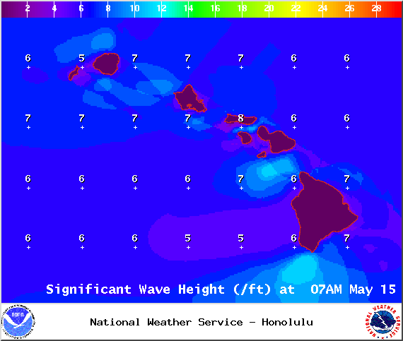
Image: NOAA / NWS
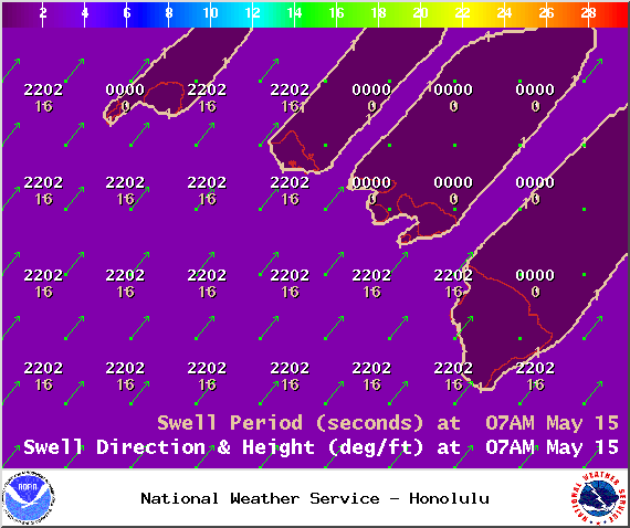
Image: NOAA / NWS
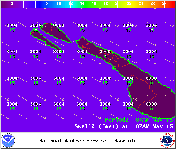
Image: NOAA / NWS
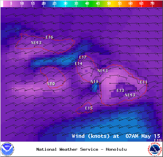
Image: NOAA / NWS

Image: NOAA / NWS
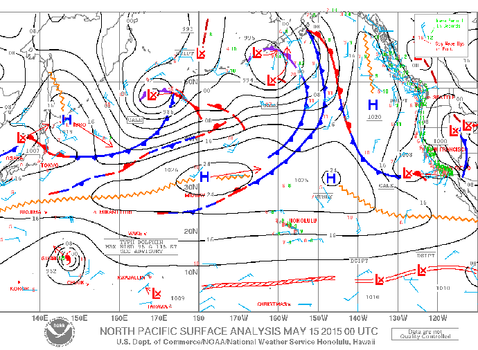
Image: NOAA / NWS
Sponsored Content


