

Wave Heights Hold Steady Today
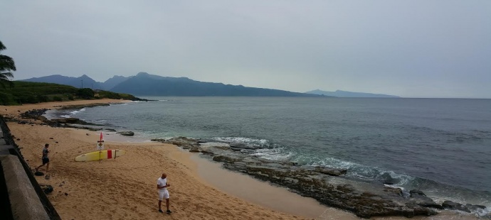
Image: Asa Ellison / Kanaha
By Meteorologist Malika Dudley / Email: malika@mauinow.com
Alerts
A Flood Watch remains in effect until 6 p.m. Tuesday for all islands. An unstable and very moist air mass on the back side of the tropical system is lingering across the state. This moisture interacting with the land is expected to produce periods of heavy rain and slow-moving downpours that could lead to flash flooding. If that occurs a more urgent Flood Advisory (flooding is imminent) or Flood Warning (flooding is occurring) will be posted by the National Weather Service.
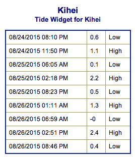
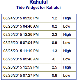
**Click directly on the images below to make them larger. Charts include: Maui County projected winds, tides, swell direction & period and expected wave heights.**
 Maui Surf Forecast
North: Wave heights of about waist/chest high are expected today for the best breaks. Spots not catching the northeast swell will be pretty flat.
West: Wave heights knee/waist high are expected at the best breaks catching the swells. Spots shadowed by other islands will be smaller or even flat.
South: Wave heights knee/waist high are expected at the best breaks. Chest high waves could be seen on the sets.
Our current blend of southerly swells will hold through Wednesday. Thursday into the weekend we expect some fun surf to build into the waist/chest high range.
 Kilo and Loke generated swell is expected to be fun size out of the west at about waist high. Atsani is sending some west energy as well which is expected to hold into Tuesday. Models are showing Atsani turning extratropical next week. We are expecting a west-northwest swell from Atsani to build Thursday and possibly peak Friday.
Keep in mind, surf heights are measured on the face of the wave from trough to crest. Heights vary from beach to beach, and at the same beach, from break to break.
**Click here for your detailed Maui County weather report.**
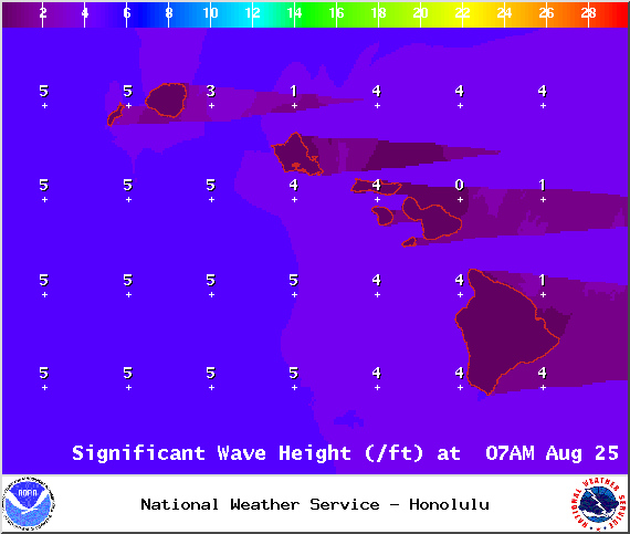
Image: NOAA / NWS

Image: NOAA / NWS

Image: NOAA / NWS
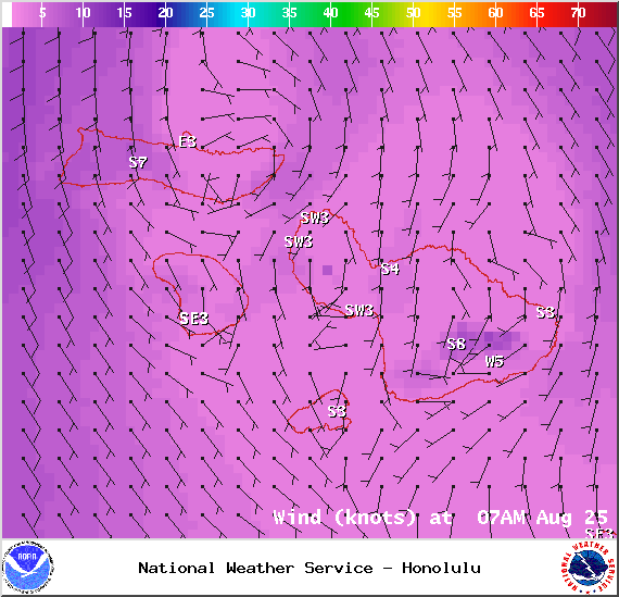
Image: NOAA / NWS
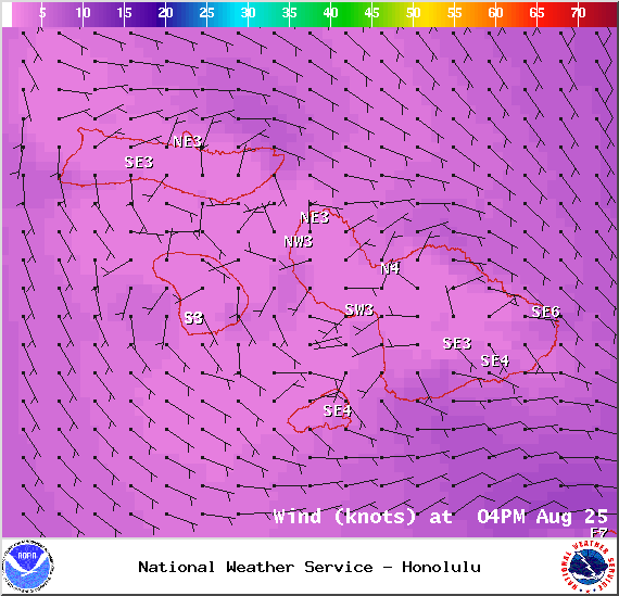
Image: NOAA / NWS
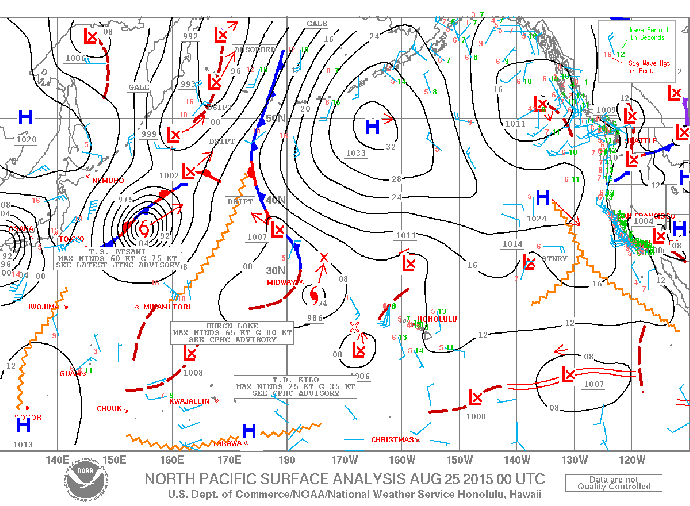
Image: NOAA / NWS
Sponsored Content


