

High Surf Advisory for South and East Shores

Image: Jimmie Hepp
By Meteorologist Malika Dudley / Email: malika@mauinow.com
Alerts
A High Surf Advisory is posted for south and east facing shores through 6:00 p.m. Tuesday. Expect strong breaking waves, shore break and strong longshore and rip currents making swimming difficult and dangerous.
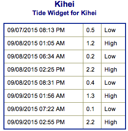
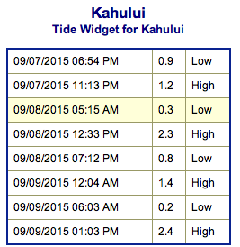
**Click directly on the images below to make them larger. Charts include: Maui County projected winds, tides, swell direction & period and expected wave heights.**
 Maui Surf Forecast
North: Spots that are pulling in the tropical swell could get up to chest to overhead surf today. The best breaks could get a couple feet overhead on the sets. This swell will show best at east-northeast breaks.
West: Wave heights chest/head high are expected. The best breaks could get up to overhead on the sets early in the day. Spots shadowed by other islands will be smaller.
South: The south-southwest is expected to bring chest/head high waves today. The best breaks could get a couple feet overhead on the sets early in the day.
 Jimena is delivering a solid shot of east swell to the islands. The high surf warning has been canceled and replaced by a high surf advisory for east-facing shores of most islands. The swell is expected to fade over Tuesday and Wednesday and drop out on Thursday.
Nothing significant is expected from Kilo or Ignacio anymore.
Our current long-period swell from the south-southwest continues to produce advisory-level surf along south-facing shores. The swell is expected to gradually fade Tuesday and the rest of the week.
Keep in mind, surf heights are measured on the face of the wave from trough to crest. Heights vary from beach to beach, and at the same beach, from break to break.
**Click here for your detailed Maui County weather report.**
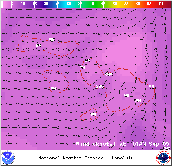
Image: NOAA / NWS
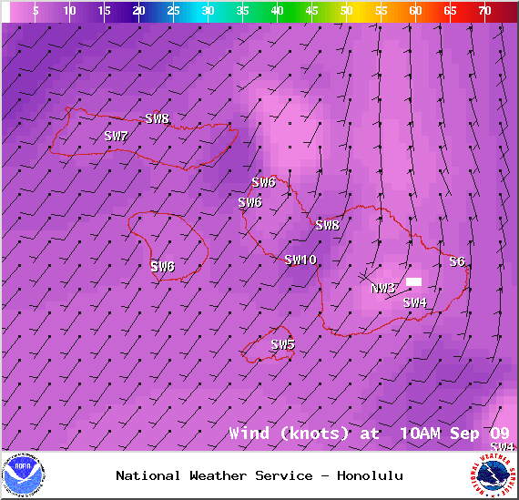
Image: NOAA / NWS

Image: NOAA / NWS
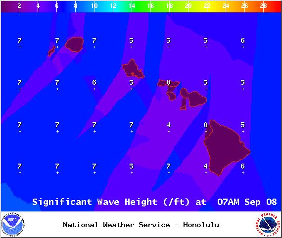
Image: NOAA / NWS
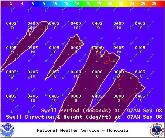
Image: NOAA / NWS
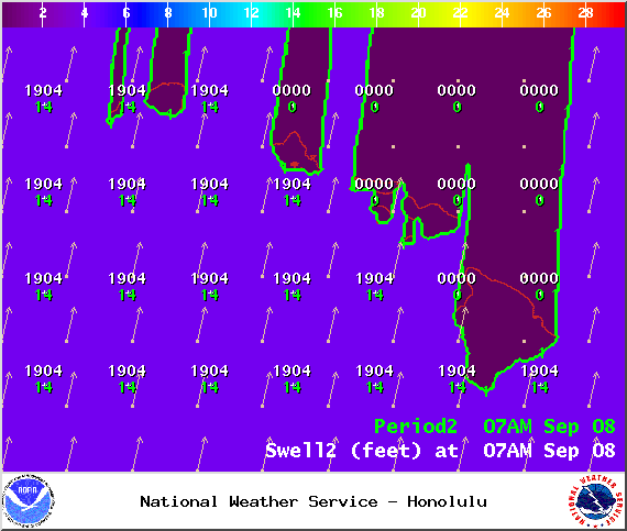
Image: NOAA / NWS
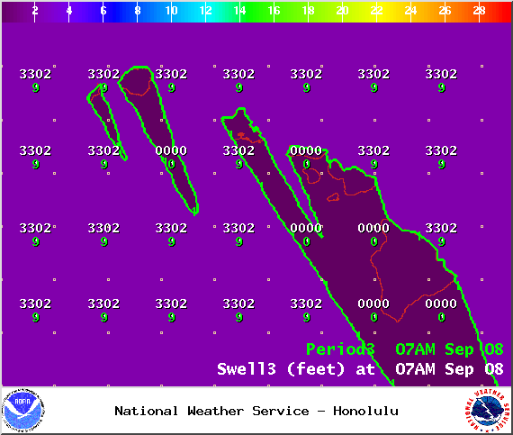
Image: NOAA / NWS

Image: NOAA / NWS
Sponsored Content


