

SSW Fills in Further, Trade Swell Continues

Image: Tad Craig
Alerts
A Small Craft Advisory is posted for the ʻAlenuihāhā channel and Maui County windward waters through 6 p.m. Wednesday for east winds up to 25 knots and seas up to 11 feet.
Check our breaking news section for any urgent weather alerts.
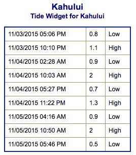
**Click directly on the images below to make them larger. Charts include: Maui County projected winds, tides, swell direction & period and expected wave heights.**
 Maui Surf Forecast
North: Wave heights are expected to be head high or more for trade swell standout spots like Hana.
West: Wave heights waist/chest high are expected today. Spots shadowed by other islands will be pretty flat.
South: The south-southwest is expected to bring waist/chest high waves today. Breaks open to the trade swell could get up to waist/head high.
A east-northeast trade swell is showing for windward coasts this week.
 A new small south-southwest builds in further Wednesday into Thursday and holds through Friday. A slightly bigger swell is expected for the weekend.
We could see a northwest swell for the weekend if a system tracking toward the Aleutians progresses as models are currently indicating. Will keep an eye on it.
Keep in mind, surf heights are measured on the face of the wave from trough to crest. Heights vary from beach to beach, and at the same beach, from break to break.
**Click here for your detailed Maui County weather report.**
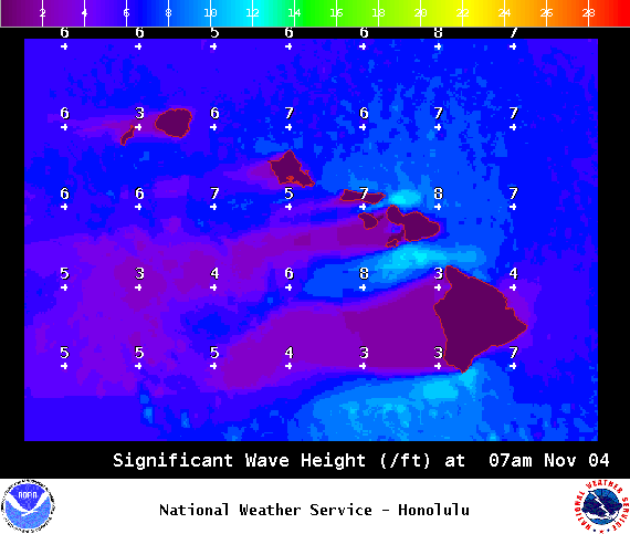
Image: NOAA / NWS
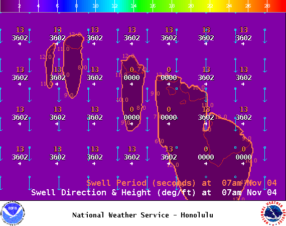
Image: NOAA / NWS
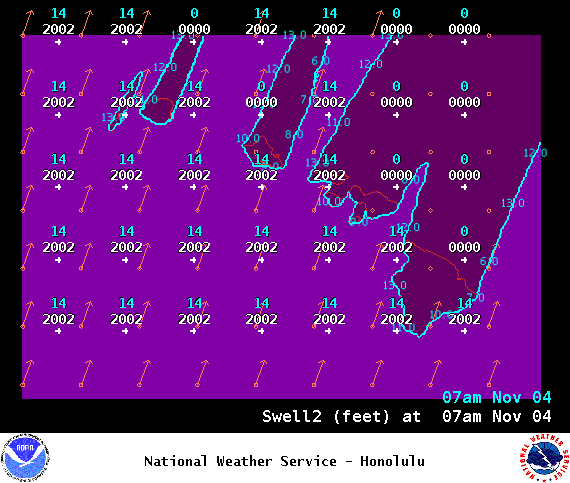
Image: NOAA / NWS
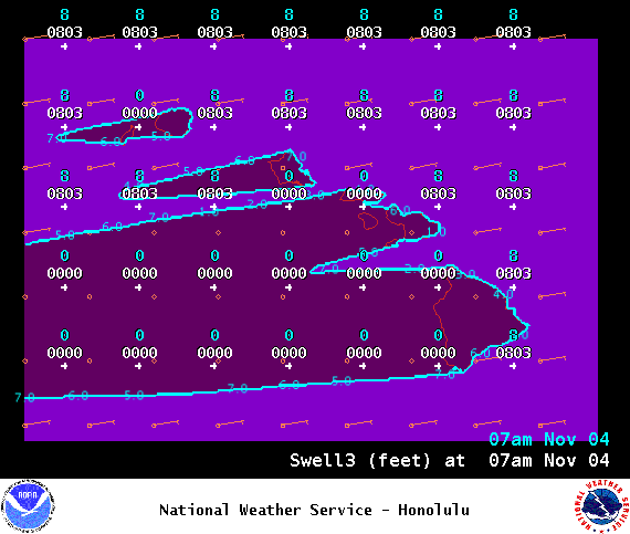
Image: NOAA / NWS
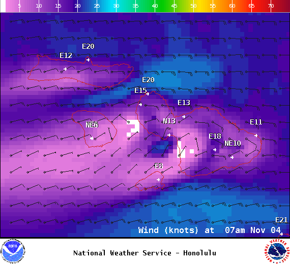
Image: NOAA / NWS
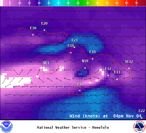
Image: NOAA / NWS
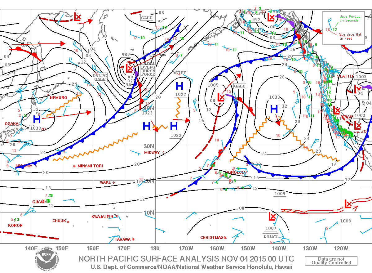
Image: NOAA / NWS
Sponsored Content


