

NW Fades Today, XL Swell Expected Tomorrow

Image: Dooma Photos
Alerts
A High Surf Warning is posted for the north & west facing shores of Molokai and the north shore of Maui through 6 a.m. Monday. Surf along north facing shores is expected to be 20 to 25 feet. West shores are expected to get up to 15 to 20 feet.
A Small Craft Advisory is posted for all island waters through 6 a.m. Monday for east winds up to 25 knots and seas up to 12 feet.
A Marine Weather Statement has been issued to warn of harbor surges in Kahului harbor. Large breaking waves are expected at the harbor entrance.
Check our breaking news section for any urgent weather alerts.
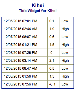
**Click directly on the images below to make them larger. Charts include: Maui County projected winds, tides, swell direction & period and expected wave heights.**
 Maui Surf Forecast
North: Wave heights are expected to be well overhead to double overhead for spots catching the fading northwest swell. The best breaks could get up to triple overhead. Swell is fading through the day.
West: Wave heights waist/chest high today. Spots farther to the south are much smaller.
South: Wave heights under waist high today. Spots shadowed by other islands will be even smaller.
 Our current northwest swell is expected to continue fading today. A new storm is brewing in the northwest Pacific and is forecast to bring another large swell building Tuesday, peaking in the evening into early Wednesday morning.
Our current south-southwest is mainly leftovers today.
Keep in mind, surf heights are measured on the face of the wave from trough to crest. Heights vary from beach to beach, and at the same beach, from break to break.
**Click here for your detailed Maui County weather report.**
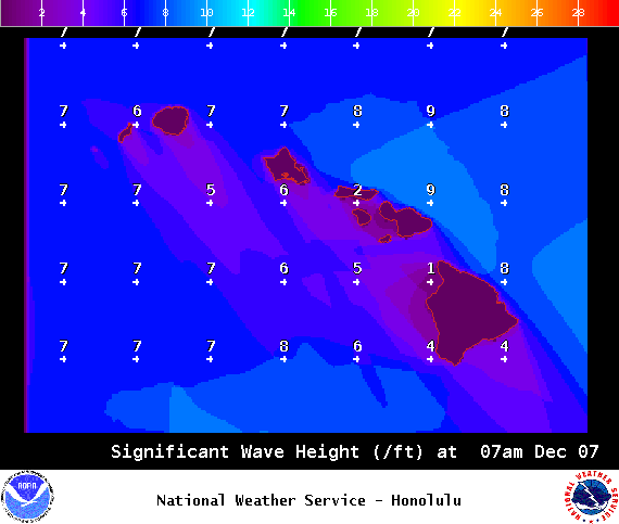
Image: NOAA / NWS
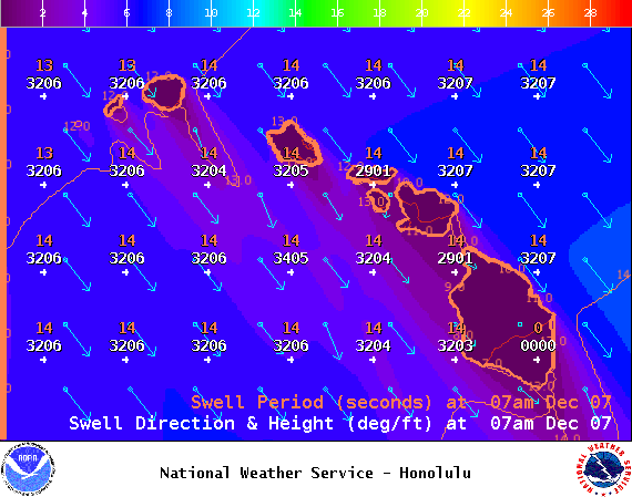
Image: NOAA / NWS

Image: NOAA / NWS

Image: NOAA / NWS
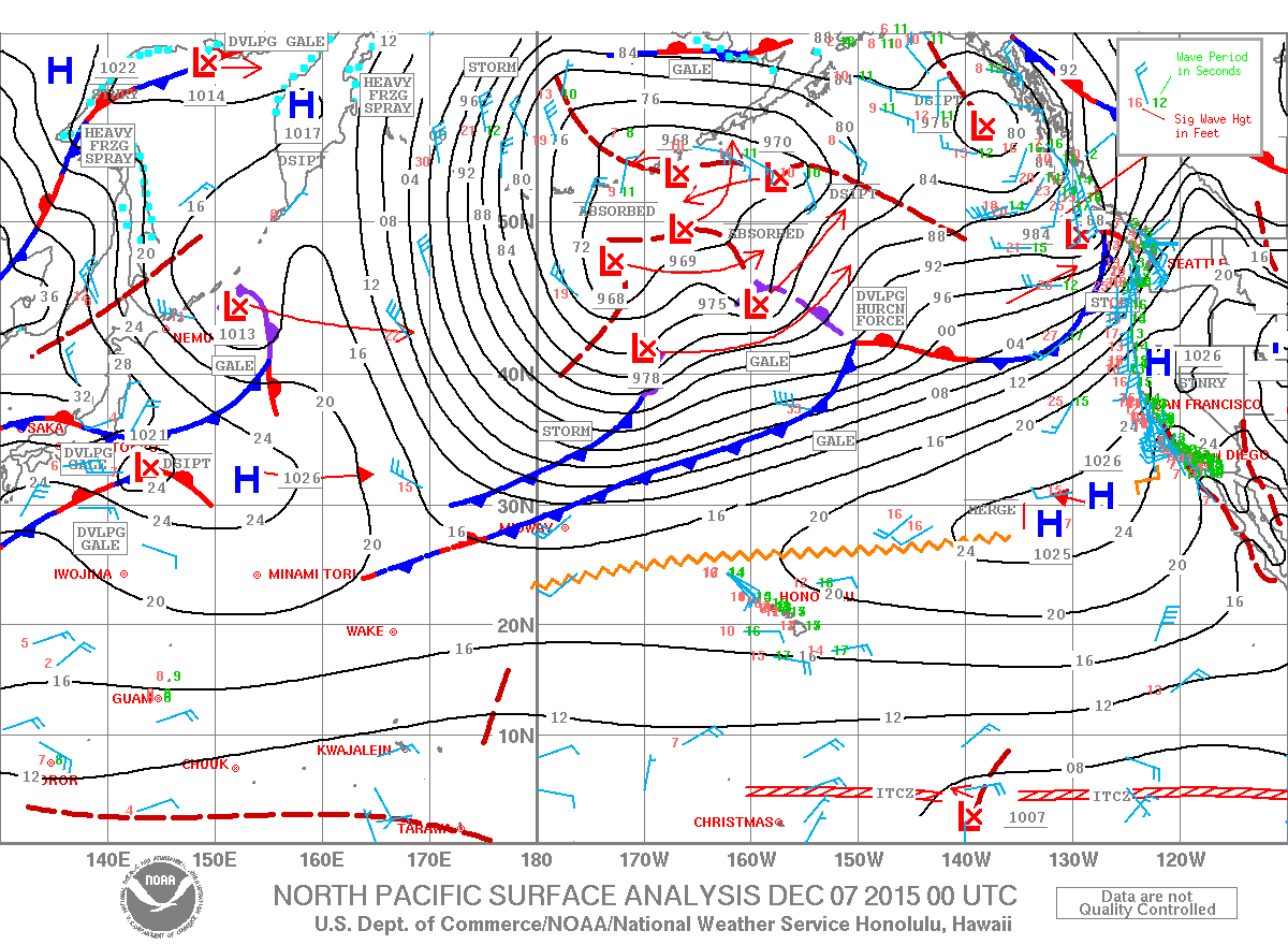
Image: NOAA / NWS
Sponsored Content


