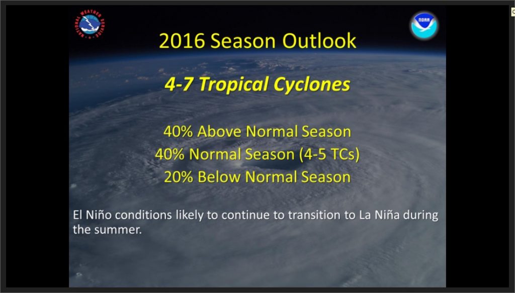
Hurricane Forecast Calls for 4-7 Tropical Cyclones in 2016
Forecasters are predicting a 40 percent chance of a normal or above-normal hurricane season this year in the Central Pacific.
The outlook this season calls for four to seven tropical cyclones according to meteorologist with the Central Pacific Hurricane Center in Honolulu. That’s more than the average season of 4 to 5 tropical cyclones in a typical year, which includes tropical depressions, tropical storms and hurricanes.
In a press conference today, officials with NOAA’s Central Pacific Hurricane Center said the outlook for 2015 calls for a, “40% chance of an above-normal season, a 40% chance of a near-normal season, and a 20% chance of a below-normal season.”
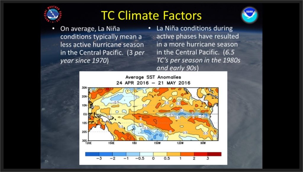
Forecasters say El Nino conditions will likely continue to transition to La Nina during the summer. On average, La Nina conditions typically mean a less active hurricane season in the Central Pacific.
“However, the central Pacific basin might be shifting toward a more active decadal cycle, in response to changing global sea surface temperatures patterns in both the Atlantic and Pacific Ocean. This combination of competing climate factors, along with model predictions for weaker vertical wind shear and warmer sea surface temperatures in the central Pacific hurricane region, suggest that the hurricane season will likely be near- or above-normal,” said Chris Brenchley, Warning Coordination Meteorologist in an agency press release.
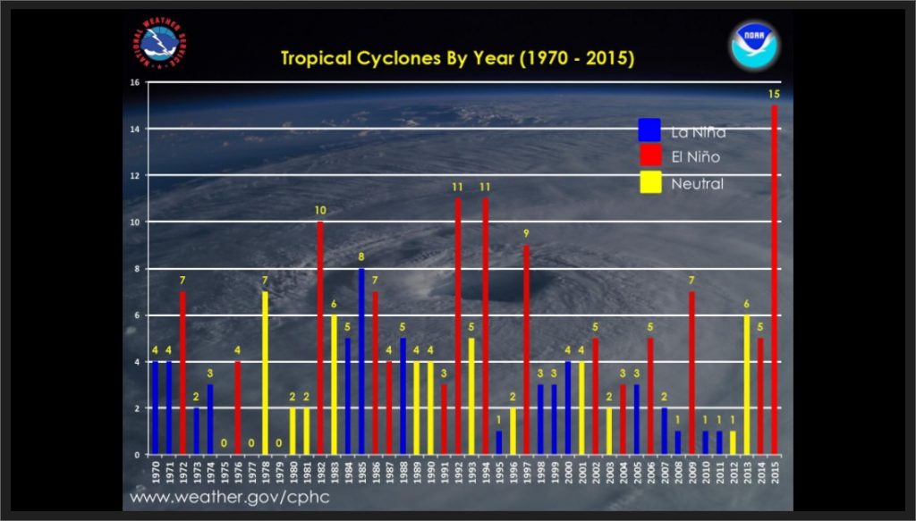
In 2015, numerous records were broken with regard to tropical cyclone activity. 2015 was the first year, since reliable record-keeping began in 1970, that fifteen tropical cyclones were active in the Central Pacific basin.
Hawaiʻi residents are urged to be prepared for the season which begins on June 1 and runs through Nov. 30, 2016, by signing up for weather alerts, developing and practicing family emergency plans, and building an emergency kit before the season begins.
The seasonal hurricane outlook is produced in collaboration with NOAA’s Climate Prediction Center, a division of the National Weather Service.
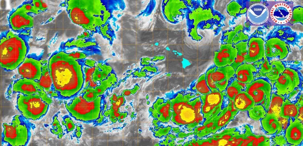
Satellite mapping overlay of all cyclones around the Hawaiian Islands. Image credit: US National Weather Service Honolulu & Central Pacific Hurricane Center. Click on image to view in greater detail.
Central Pacific Hurricane Season Outlook 2016.
Central Pacific Hurricane Season Outlook 2016.
Central Pacific Hurricane Season Outlook 2016.
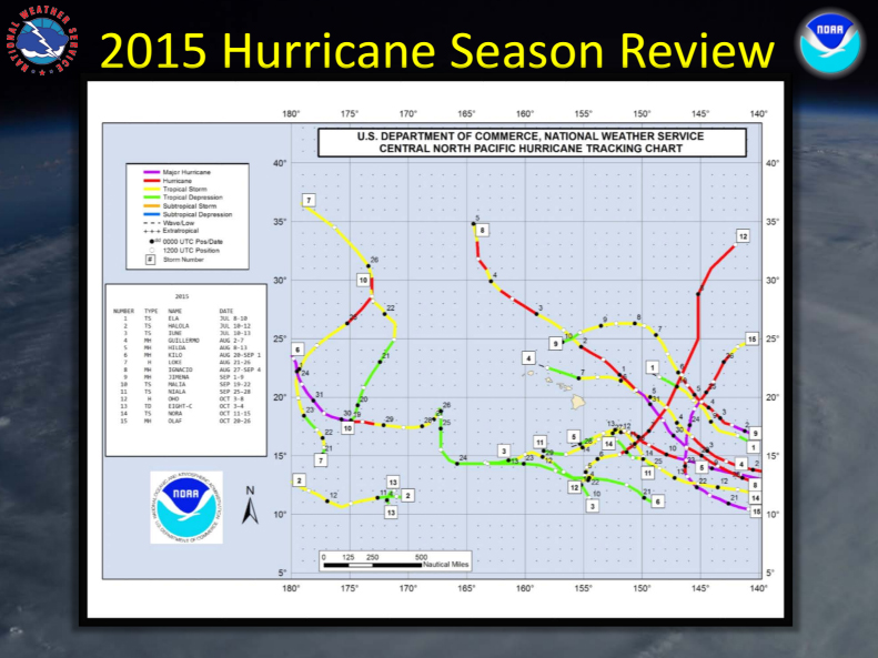
2015 hurricane season review. Central Pacific Hurricane Season Outlook 2016.
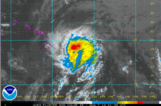
Mid-day imagery as Iselle begins impacting Hawaiʻi Island – 08.07.14. File image courtesy CPHC/NOAA/NWS.
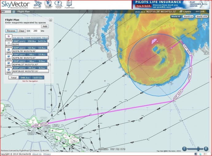
This image depicts the Coast Guard’s search area for sailing vessel Walkabout Aug. 10 2014. The Coast Guard is coordinating the rescue of 42-foot sailboat Walkabout caught in Hurricane Julio 414 miles northeast of Oahu. Walkabout is disabled and taking on water with three people aboard. (File image 2014 U.S. Coast Guard courtesy photo)
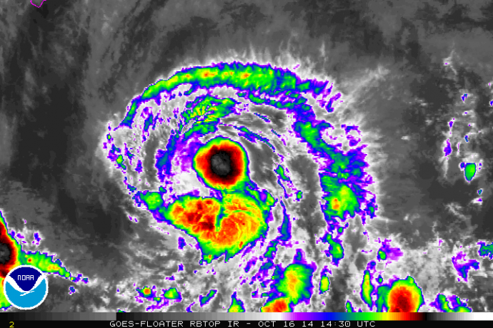
Satellite imagery for Tropical Storm Ana on Oct. 16, 2014. File image courtesy NOAA/NWS/Central Pacific Hurricane Center.
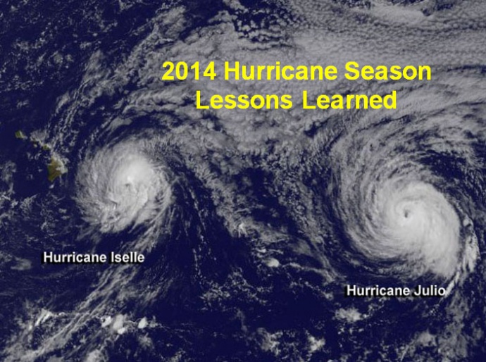
2014 Hurricane Season lessons learned. File image credit: NOAA/NWS.
Sponsored Content