Holiday Weekend Maui County Surf Report
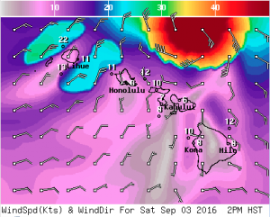
Image: NWS
Alerts (as of 1:00 a.m.)
A Hurricane Warning is posted for all offshore waters in the Hawaiian Islands.
A High Surf Warning is posted for east facing shores of Maui and Molokai.
A Small Craft Advisory is posted for waters around Maui County.
**Click directly on the images below to make them larger. Charts include: Maui County projected winds, tides, swell direction & period and expected wave heights.**
Maui Surf Forecast
North: Wave heights are expected to be head high to well overhead or more today. Poor and blown out conditions expected.
West: Surf is pretty flat today. Spots should stay below waist high.
South: Surf is waist high or less today although spots catching Lester wrap will see much larger surf.
Very large and damaging surf, with peak waves of 15 to 25 feet with locally higher sets are occurring along east facing shores today and expected to diminish late tonight through Sunday. These waves, in combination with a possible storm surge of 1 to 2 feet, may cause significant wave run-up or damage to coastal properties and infrastructure, including roadways. Powerful longshore and rip currents will be present at most beaches. Large breaking waves and strong currents may impact harbor entrances and channels causing challenging marine navigation.
Seas associated with Hurricane Lester at the exposed nearshore buoys have remained steady in the 10 to 15 ft range through the early morning hours. The Waimea buoy has recently climbed to a couple of feet above guidance over the past few hours and will need to be monitored. Expect this trend to persist as Lester passes just north of the islands today through early Sunday. A combination of winds and seas will continue to support dangerous marine conditions through tonight as Lester passes to the north. Winds and seas will quickly trend down Sunday through Monday and a more typical trade wind pattern is expected to return through the upcoming week.
Warning-level surf along all exposed eastern facing shores from the Big Island to Kauai will continue through tonight before quickly trending down Sunday. Surf along north facing shores will near advisory-levels and will need to be monitored through this time. Coastal impacts from the surf will include beach erosion, potential for overwash onto roadways along the typically vulnerable sections of the coasts and life-threatening currents.
Two long-period southerly swells will fill in through the early to mid-week period next week. The second swell may near advisory levels along the southern shores by Wednesday.
Keep in mind, surf heights are measured on the face of the wave from trough to crest. Heights vary from beach to beach, and at the same beach, from break to break.
**Click here for your detailed Maui County weather report.**
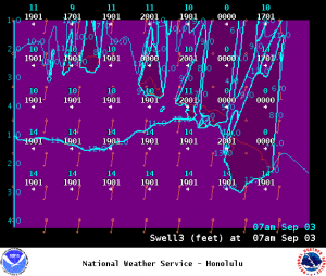
Image: NWS
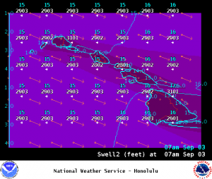
Image: NWS
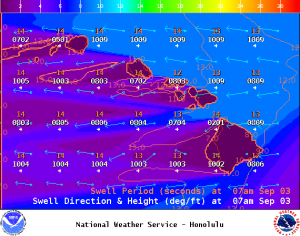
Image: NWS
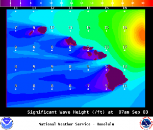
Image: NWS
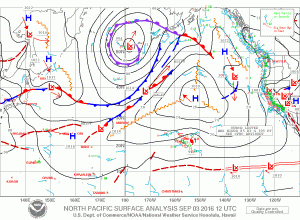
Image: NWS
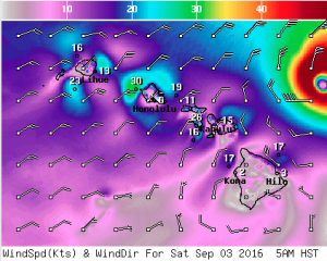
Image: NWS
Sponsored Content