

Explosive Collapse at Kīlauea Releases Energy Equivalent to 5.5 Quake
The Hawaiian Volcano Observatory reports that an explosive collapse event at Kīlauea summit occurred at 6:41 a.m. on Tuesday, July 24, 2018.
There was no tsunami generated from the seismic event that released energy equivalent to a 5.5 earthquake, according to the Pacific Tsunami Warning Center.
An overflight of the ocean entry area on Monday showed lava flowing approximately a quarter mile from Isaac Hale and Pohoiki Boat Ramp, and slowly closing in on the popular recreation spot.
The USGS reports that since May 3, 2018, Kīlauea Volcano’s lower East Rift Zone eruption has destroyed more than 700 structures, covered more than 32 sq km (12.4 sq mi) of land with black lava, and added more than 700 acres of new land to the island.

Collapse of Kīlauea’s caldera floor has exposed South Sulphur Bank, prominent in the mid-19th century but covered as lava flows filled the caldera. The flat top of the white deposit shows how high the caldera fill reached. As the caldera floor dropped in mid-June 2018, South Sulphur Bank was again exposed. The height of the bank, now more than 65 m (213 ft), increases about 2.5 m (9 ft) with each collapse event at Kīlauea’s summit. On the caldera floor, white patches lie along spatter ramparts formed in 1971 and 1974. PC: USGS 7.22.18
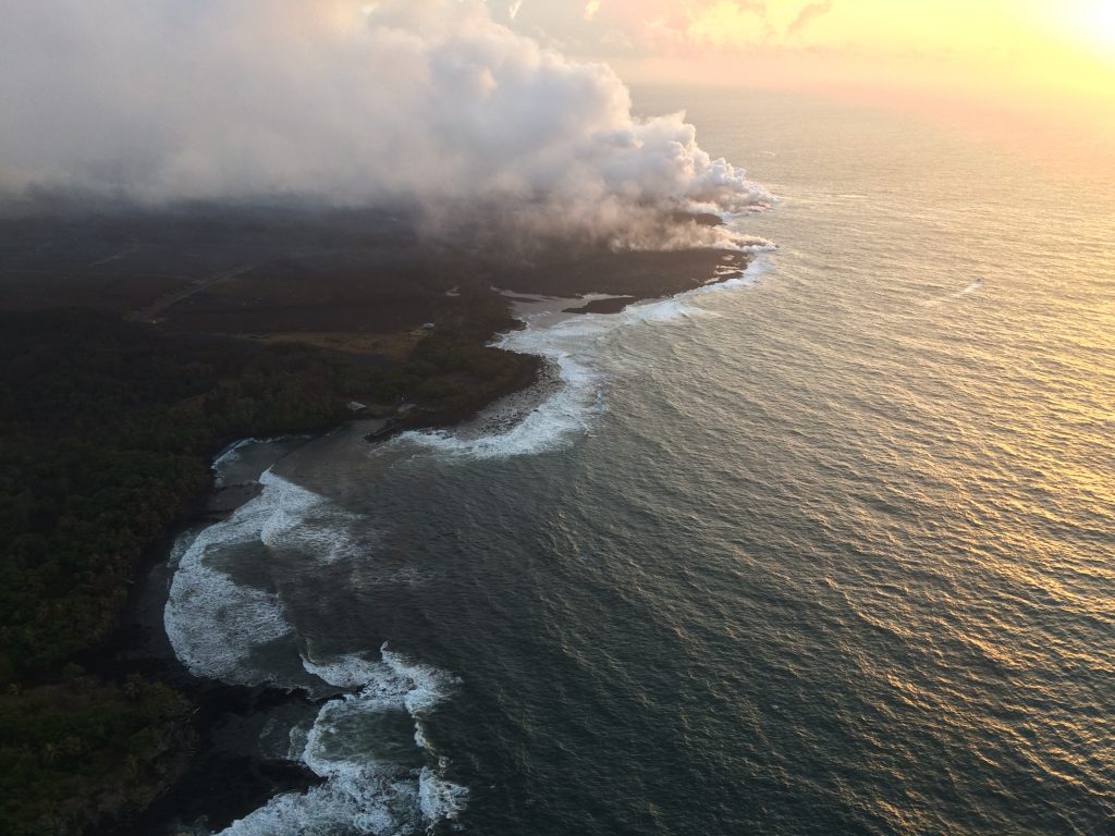
Lava continued to enter the sea near Ahalanui during HVO’s early morning helicopter overflight of Kīlauea’s lower East Rift Zone (view to northeast) on Monday morning. The southern margin of the flow was still about 500 m (0.3 mi) from the boat ramp at Isaac Hale Park on Monday. The jetty along the launch ramp is visible near the center of the photo. (PC: USGS/7.23.18)

The fissure 8 channel continues to carry lava toward the coast on the west side of Kapoho Crater (vegetated cone, far left). Northwest of this cone, overflows (lower left) of the channel occurred overnight, but lava was confined to the existing flow field and did not threaten any homes or structures. PC: USGS July 23, 2018

Fissure 8 on Kīlauea’s lower East Rift Zone continues to erupt, feeding a channel that carries lava to the coast. This aerial image captured during HVO’s early morning overflight, shows the erupting vent (center) and near-vent part of the channel. PC: USGS July 22, 2018

The main ocean entry, as observed early Sunday morning (7.22.18), was located a few hundred meters (yards) northeast of the southern flow margin, which remains about 500 m (0.3 mi) from the boat ramp at the Isaac Hale Park. PC: USGS July 22, 2018.
Sponsored Content


