January 4, 2021, 9:19 AM HST


Early this morning, the west vents in Halema‘uma‘u spattered from two places at the top of a small cone plastered on the northwest wall. This process can be seen in Kīlauea Volcano’s summit F1 thermal webcam view of the lava lake. USGS photo by H. Dietterich. PC: Sunday, Jan. 3, 2021.


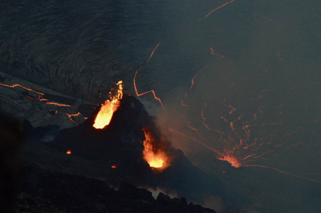
At Halema‘uma‘u, the west vents (visible in the foreground of this photo as two glowing holes on a cone-shaped feature) erupt occaisional spatter. Lava is also emerging in a small dome fountain above the lake crust in front of the west vents, probably from a submerged portion of the vent (visible in the background of this photo as a bright spot with lava crust boundaries emanating from it like a spider web). These processes can be observed in Kīlauea Volcano’s summit F1 thermal webcam view of the lava lake. USGS photo by H. Dietterich. PC: Sunday, Jan. 3, 2021.


The KW webcam captured this image of Kīlauea’s ongoing summit eruption, which continued overnight. The KW webcam looks in an east direction; north is to the left in the photo, south to the right, west to the bottom, and east to the top. This photo, taken at 6:30 a.m. HST on January 1, 2021, shows that the west vent (bottom of photo) remains active. You can view live KW webcam images here. USGS photo. PC: Jan. 1, 2021.


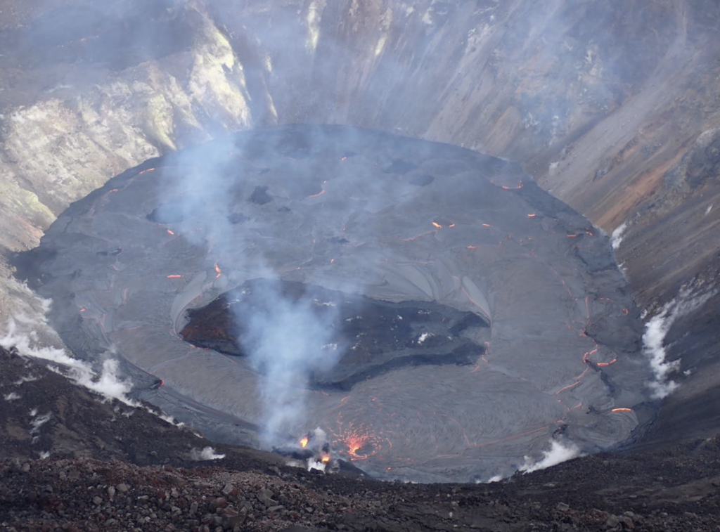
Over the past week, the lava lake in Halema‘uma‘u has developed a subtle levee around its perimeter that allows the lake to be slightly perched above its base, like a mesa. The levees grow from repeated small overflows, and the rafting and piling of pieces of surface crust that fuse together into a barrier that impounds the fluid lake. This is called a “perched” lava lake, and this geometry has been common for lava lakes at Kīlauea’s summit and rift zones. For example, see this photo of a perched lava pond within Pu‘u ‘Ō‘ō crater in 2011. USGS photo by M. Patrick on Jan. 1, 2021.


The western fissure in Halemaʻumaʻu wall remains active. Glowing vents and a prominent spatter cone are visible in this photo, which shows some spattering at the vent. This view looks steeply down from Kīlauea’s west caldera rim, and the lava lake surface is visible in the background. USGS photo by B. Carr on 12/31/2020.


This map of Halema‘uma‘u at the summit of Kīlauea shows 20 m (66 ft) contour lines (dark gray) that mark locations of equal elevation above sea level (asl). The map shows that the lava lake (approximate area marked in red) has filled 184 m (603 ft) of Halema‘uma‘u since the eruption began at approximately 9:30 p.m. HST on December 20, 2020. USGS map.
Lava activity at the Kīlauea Volcano on Hawaiʻi Island remains confined to the Halemaʻumaʻu crater.
The Hawaiian Volcano Observatory reports that the lake lava lake is now 623 feet deep and 82 acres in size. Lava continues to erupt from vents on the northwest side of the crater, resulting in a continued elevated level of SO2 emission rates.
The HVO reports that summit tiltmeters recorded weak deflationary tilt over the past three days. Seismicity remained elevated but stable, with steady elevated tremor and a few minor earthquakes, according to HVO scientists.
ARTICLE CONTINUES BELOW AD The agency issued an update today saying the upper portion of the East Rift Zone (between the summit and Puʻu ʻŌʻō) contracted while the summit deflated at the onset of this eruption. “There is no seismic or deformation data to indicate that additional magma is currently moving into either of Kīlauea’s rift zones,” according to the report.
“The lake is now perched about a meter above its narrow edges as measured yesterday morning (Jan. 3); overflows onto the narrow edge slowly elevated a low wall around the lake similar to an above-ground swimming pool,” the HVO reports.
Near-real time webcam views of the lava lake can be found here: https://volcanoes.usgs.gov/volcanoes/kilauea/multimedia_webcams.html.


