Public Comment Period Underway on DHHL’s Honokōwai Master Plan

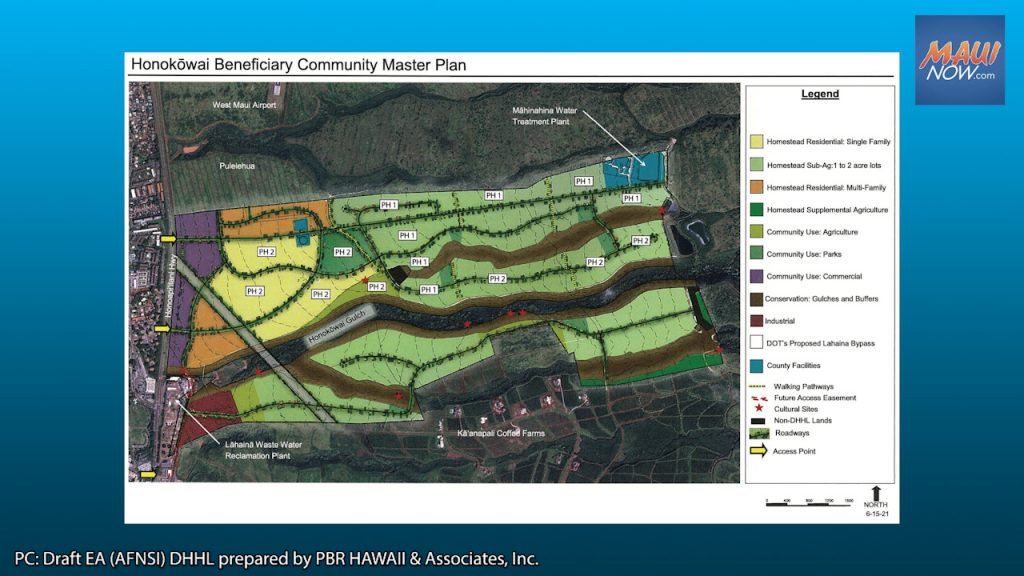
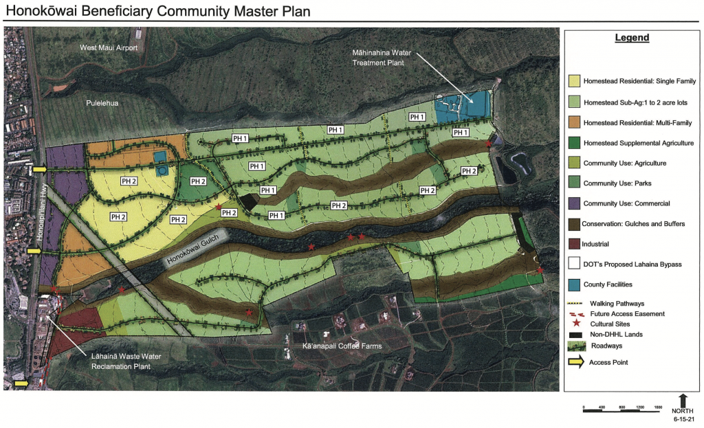
The state Department of Hawaiian Home Lands engaged its beneficiaries in a master planning process to determine appropriate land uses for DHHL’s approximately 850 acres of lands at Honokōwai including new agricultural homesteads, multi-family homes, and individual or community farming.
The land uses in the Master Plan Area are anticipated to involve agricultural homesteads (subsistence and supplemental agriculture); residential homesteads (single-family and multifamily); community uses including agriculture, park, and commercial areas; conservation areas; industrial uses; roadways; and lands set aside to accommodate the Hawai‘i Department of Transportation’s Lahaina Bypass and County of Maui infrastructure.
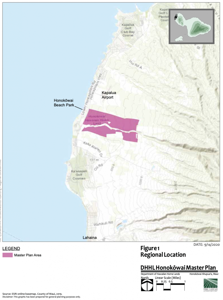
The Master Plan Area is located approximately five miles north of Lahaina, mauka of the Honoapi‘ilani Highway, generally between Kaka‘alaneo Drive and Kapalua Airport. The Proposed Action involves eight TMK parcels, all owned by DHHL, for a total program land area of approximately 777 acres.
The purpose of the Proposed Action is to evaluate the most appropriate uses for DHHL’s lands in Honokōwai, by developing a master plan through the Beneficiary Consultation process and technical studies, and to ensure conformance with the DHHL Maui Island Plan (2004), to provide direct and indirect benefits to DHHL beneficiaries and programs in the form of improved lands, homesteading opportunities, agriculture and/or community supporting uses, and revenue generation opportunities.
DHHL’s primary intent is to repurpose lands previously in pineapple cultivation but currently fallow to subsistence agricultural, residential, community, commercial, and industrial use, and to support those uses with adequate infrastructure.
According to the Draft EA, like many DHHL lands across the state, the Master Plan Area has rich agricultural history, and it is anticipated that through proper stewardship and management, the Master Plan Area can be restored to its former productivity, and a resource for native Hawaiians.
Timetable and Preliminary Cost
The estimated total infrastructure construction cost is estimated at approximately $50 to $59 million dollars. Federal or State funds may be used. Engineering design and permitting is anticipated to be completed in 2023. Infrastructure construction is anticipated to be completed around 2027, with vacant lots available shortly thereafter.
Residential components of the Proposed Action are anticipated to be undertaken in two development phases. Phase 1 will consist of the subsistence agricultural homesteads (1-2 acre lots) to the north of Honokōwai gulch, or up to 57 subsistence agricultural homesteads. Phase 2 will consist of up to 394 homesteads including single-family and subsistence agricultural homesteads, agricultural space, and neighborhood parks. Future phases will realize the remaining components of the Honokōwai Master Plan.
Public review
A statutory 30-day public review and comment period starts, with comments due by Aug. 9, 2021. Comments can be sent to the proposing/determining agency with a copy to the consultant. The Proposing/Determining Agency is the State of Hawaiʻi, Department of Hawaiian Home Lands. Contact is: Julie-Ann Cachola, 808-620-9500, julie-ann.cachola@hawaii.gov P.O. Box 1879, Honolulu, HI 96805. The Consultant is PBR HAWAII & Associates, Inc., 1001 Bishop Street, Suite 650, Honolulu, HI 96813 Selena Pang, 808-521-5631, spang@pbrhawaii.com.
The full DEA-AFNSI document is available for review here.


