

Kona low to force a “plume of deep tropical moisture” over the islands
Warnings/Watches/Advisories:
Hawaiʻi Island Flash Flood Warning until 10: p.m.
Update: 6:39 p.m., 12:47 p.m., 9:23 a.m., Friday, Feb. 17, 2023
The National Weather Service has issued a Flash Flood Warning for Hawaiʻi Island until 10 p.m. on Friday, Feb. 17, 2023.
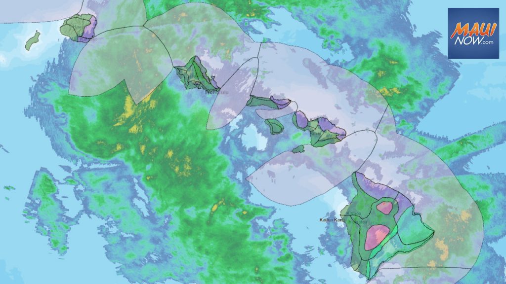
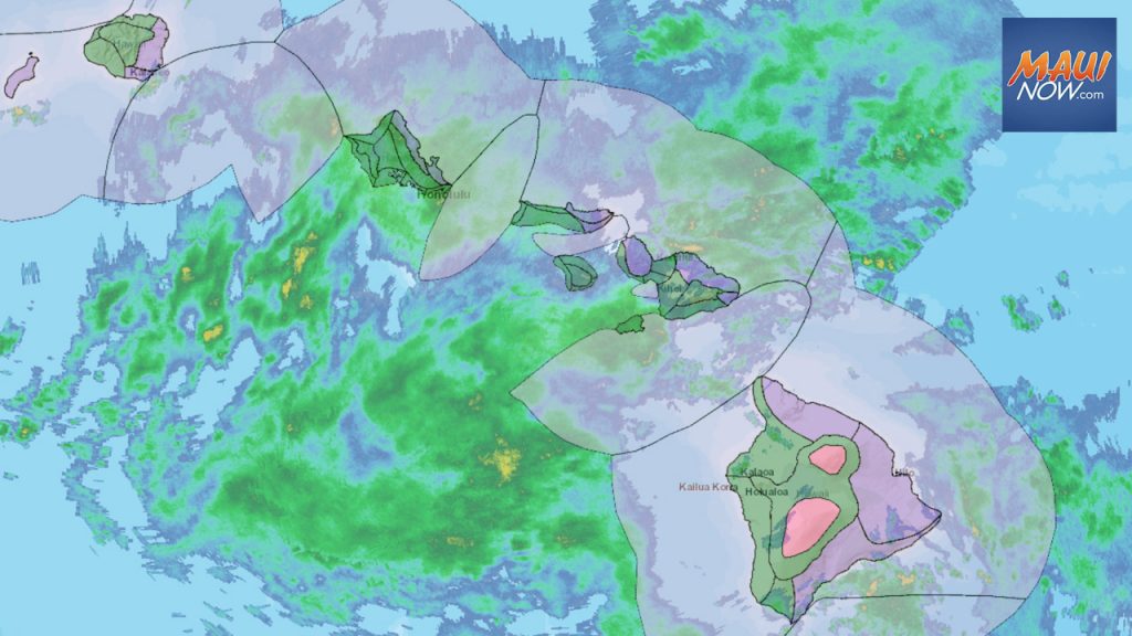
At 6:39 p.m., radar showed persistent heavy showers forming over the southeast slopes of Mauna Loa, with rainfall rates between 1 and 2 inches per hour. In the Kaʻū District, road closures include Highway 11 at Kawa Flats, Wood Valley Road, and Kaalaiki Road.
Maui Flood Advisory Canceled:
Update: 3:55 p.m., 1:23 p.m., Friday, Feb. 17, 2023
The Flood Advisory for Maui has been canceled as of 3:55 p.m. Weather radar shows that the heavy rain has diminished. A Flood Watch remains in effect until 6 p.m. Saturday for Kahoʻolawe, Kauaʻi, Lānaʻi, Maui, Molokaʻi, Niʻihau, Oʻahu and the Big Island of Hawaiʻi.
As a precaution, the public is advised to stay away from streams, drainage ditches and low-lying areas prone to flooding. Rainfall and runoff will also cause hazardous driving conditions due to ponding, reduced visibility and poor braking action.
Greatest potential for flooding on Big Island and Maui
10 a.m., Friday, Feb. 17, 2023
The National Weather Service issued an updated weather synopsis at 10 a.m., saying, “A broad swath of deep moisture within a east to southeast flow will maintain a threat of flooding over portions of the state through Saturday, mainly along windward and southeast slopes with the greatest potential on the Big Island and Maui. While somewhat wet conditions will linger into Sunday, the threat of widespread rainfall will diminish as building easterly trade winds may push the deepest moisture to the west. Deeper moisture may move over the islands again mid week.”
Greater flash flood potential over windward and SE slopes of Maui and Big Island
Update: 4:42 a.m., Friday, Feb. 17, 2023
“Light to moderate rain may be locally heavy at times over Kauaʻi and Oʻahu while periods of heavy rain will result in much greater flash flood potential over windward and southeast-facing slopes of the Big Island and Maui,” according to an update issued by the National Weather Service on Friday morning.
The agency reports that light to occasionally moderate rain dampened most areas overnight. As of 4 a.m., rain was increasing in coverage and intensity south of Kauaʻi and Oʻahu, with a potential to move ashore later this morning.
“Showers will decrease in coverage over western areas by tonight, but will continue over favored portions of Maui and the Big Island well into next week,” according to the NWS.
The agency issued a forecast discussion on Friday morning saying most of the overnight period featured steady light to moderate rain with a few embedded convective areas. Twelve-hour rainfall totals as of 2 a.m. were generally about 1.5 inches or less in areas impacted by rain.
The NWS says rain will be “essentially constant” through at least Saturday for windward and southeast Big Island and Windward Maui. “The footprint of the heaviest rain through the near term has been refined to focus more over interior and upslope zones,” according to the NWS.
Kona low to force a “plume of deep tropical moisture” over the islands
Posted: 7:16 p.m., Thursday, Feb. 16, 2023
A kona low west of Kauai will force “a large swath” of very moist, tropical air over the state the next several days, according to the National Weather Service. The NWS says the greatest threat will focus over east and southeast portions of the Big Island for the next few days.
The NWS reports that the kona low, located to our west, will force a plume of deep tropical moisture over the islands for the next few days.
“Heavy rainfall and a few thunderstorms will be possible. High rainfall rates for an extended period of time are expected to result in flash flooding, particularly in areas which are already saturated from recent rainfall,” according to the NWS.
Forecasters say this moisture will fuel what is expected to be a prolonged period of significant rainfall and flooding concerns lasting into the weekend. Heavy showers and slight chances of thunderstorms will affect both windward and leeward areas of all islands throughout this period.
The NWS issued a forecast discussion saying a large area of deep tropical moisture is being pulled northward on the eastern periphery of the kona low. “This area of moisture has overspread the Big Island already and will be slowly working its way E to W up the chain as the kona low pulls toward the west. At the same time, a developing surface trough near the islands and a mid-to-upper atmospheric low SW of the islands will maintain an environment very favorable for heavy rainfall in our local area through the next few days.”
A Flood Watch remains in effect through Saturday afternoon.
Northerly winds near Kauaʻi will continue to gradually weaken this evening, then winds will shift to the south tonight statewide, according to the latest forecast.
Sponsored Content


