

Volcano Watch: April is Tsunami Awareness Month in Hawaiʻi
by US Geological Survey Hawaiian Volcano Observatory scientists and affiliates
Governor Green recently proclaimed that April is again Tsunami Awareness Month for the State of Hawaiʻi. This is not to be confused with World Tsunami Awareness Day, which is November 5.

For decades, officials from the Pacific Tsunami Warning Center and International Tsunami Information Center, along with the Pacific Tsunami Museum, and other government officials have used April 1 as the beginning of a month-long campaign to spread the word on how to recognize and mitigate hazards from tsunamis.
Tsunamis are a series of waves generated when a large volume of ocean water is displaced.
Why April 1st? The date marks the deadliest tsunami to hit our shores. In 1946, the ocean water was displaced by a M8.6 earthquake near the Aleutian Islands in Alaska. The tsunami run-up, or maximum rise of the incoming water on-shore, reached 55 ft (17 m) in Hilo and 158 people perished across the state. Locally, near the earthquake epicenter in Alaska, the run-up was 138 ft (42 m) on Unimak Island.
Our islands are situated in the middle of the Pacific Ocean—a giant body of water surrounded by a long chain of volcanoes (also known as the Ring of Fire) along the edge of five continents. These volcanoes exist because the Pacific plate is subducting under other tectonic plates. These subduction zones, where tectonic plates converge or come together, are where very large (megathrust) earthquakes typically happen. A more recent example of such an event is the M9.1 Tōhoku earthquake that occurred near Japan in 2011; it caused an 18 ft (5 m) run-up in Hawaiʻi a few hours after the earthquake.
Tsunamis that hit Hawaiʻi don’t always come from distant earthquakes. Although not as frequent, tsunamis can also be generated by underwater volcanic eruptions. A very recent example of this is the Hunga-Tonga Hunga-Haʻapai eruption in 2022. The volcanic plume in January 2022 rocketed 36 mi (58 km) up, above sea level, and was the largest volcanic blast ever recorded by modern instruments. This event caused 60 ft (20 m) run-up on local nearby islands, but only a small, but measurable, tsunami on Hawaiian shores.
Fortunately for Hawaiʻi, we are far away from subduction zones and explosive volcanoes—though Kama‘ehuakanaloa (formerly Lō‘ihi Seamount) and other Hawaiian volcanoes sometimes produce small explosive eruptions. We have a few hours to react if a distant megathrust earthquake or catastrophic volcanic eruption causes a tsunami that crosses the Pacific.
Unfortunately, Hawaiʻi can generate tsunamis locally. Such was the case on Nov. 29, 1975, when a M7.7 earthquake was generated under Kalapana due to the south flank of Kīlauea abruptly sliding farther southeast towards the ocean. The strong local earthquake caused millions of dollars in property damage, and the subsequent tsunami took two lives at Halapē (a coastal camping location on the south flank of Kīlauea) and caused additional property damage with a maximum run-up of 47 ft (14 m).
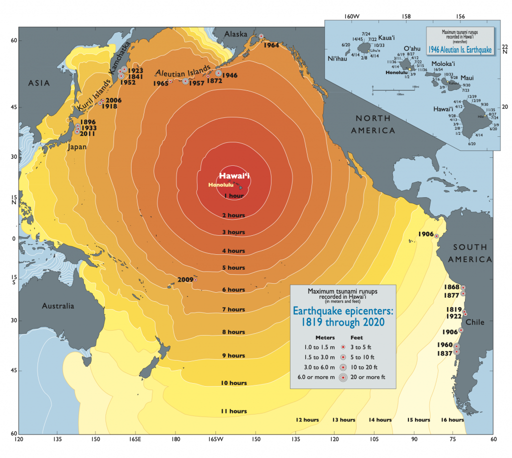
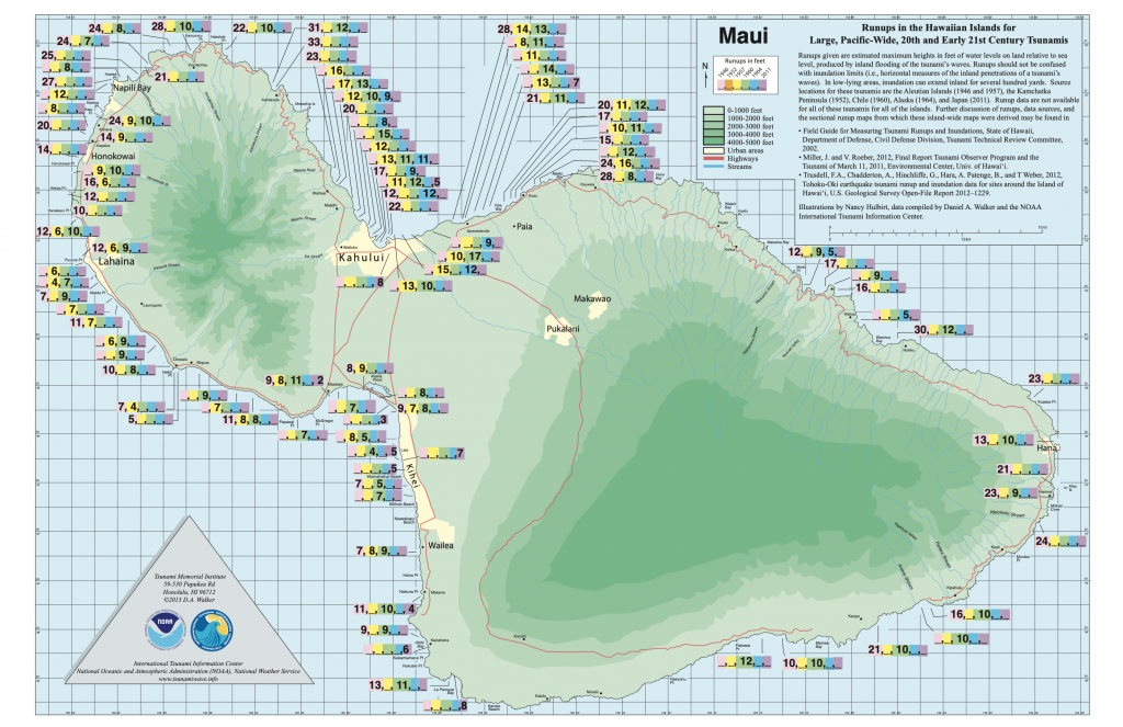
Tsunamis in Hawai‘i (Walker, ITIC, 2013, 2020)
Locally generated tsunamis are why we must always be prepared. A local tsunami strikes fast and with little time for us to react—devastating waves can travel across the Hawaiian island chain in minutes, and not just in the month of April. If there is a strong earthquake and you are at a location along the coast, “Don’t Fool Around. Get to High Ground!” This is a much better hazard mitigation policy than “Bumbai You Learn!”
To learn more about tsunami preparedness, visit the International Tsunami Information Center website or head over in-person for free tsunami and hazard preparedness workshop at the Pacific Tsunami Museum in Hilo on Saturday, April 22, from 1 to 4 p.m.
Volcano Activity Updates
Kīlauea is not erupting. Its USGS Volcano Alert level is ADVISORY.
Webcams show no signs of active lava in Halemaʻumaʻu crater, at the summit of Kīlauea in Hawai‘i Volcanoes National Park. Summit tiltmeters showed one deflation-inflation event over the past week. Seismicity is low. The summit sulfur dioxide (SO2) emission rate was most recently measured on April 5, when it totaled 110 tonnes per day.
Mauna Loa is not erupting. Its USGS Volcano Alert Level is at NORMAL.
Webcams show no signs of activity on Mauna Loa. Seismicity remains low. Summit ground deformation rates show inflation above background levels, but this is not uncommon following eruptions. SO2 emission rates are at background levels.
There were five earthquakes with 3 or more felt reports in the Hawaiian Islands during the past week: a M3.9 event 4 km (2 mi) SW of Pāhala at 34 km (21 mi) depth on April 4 at 6:33 a.m. HST, a M3.8 event 0.5 km (0.3 mi) S of Honalo at 11 km (7 mi) depth on April 2 at 8:18 a.m. HST, a M3.0 event 25 km (16 mi) ENE of Hōnaunau-Nāpōʻopoʻo at 8 km (5 mi) depth on April 2 at 6:52 a.m. HST, a M2.0 event 5 km (3 mi) SW of Volcano at 0 km (0 mi) depth on April 1 at 11:12 p.m. HST, and a M3.4 event 13 km (8 mi) SSE of Volcano at 6 km (4 mi) depth on April 1 at 7:30 a.m. HST.
HVO continues to closely monitor Kīlauea and Mauna Loa.
Visit HVO’s website for past Volcano Watch articles, Kīlauea and Mauna Loa updates, volcano photos, maps, recent earthquake info, and more. Email questions to askHVO@usgs.gov.
Sponsored Content


