Category 4 Hurricane Kiko expected to approach Hawaiʻi in early to middle part of next week
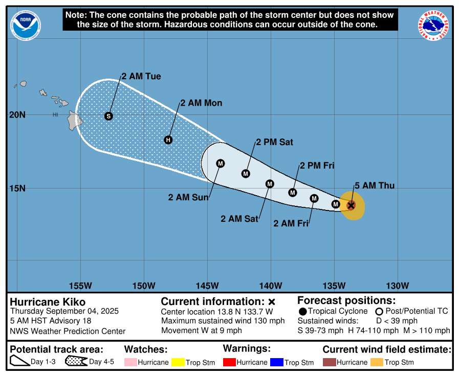
Kiko is located 1,470 miles ESE of Hilo, or 1,675 miles ESE of Honolulu, Hawaiʻi. The system is currently in the East Pacific basin, well ESE of the Hawaiian Islands. It is expected to cross into the central Pacific basin Friday night.
Forecasters with the National Weather Service and National Hurricane Center say Kiko is a little weaker, but could re-intensify as it continues westward, well to the ESE of the Hawaiian Islands.
The NWS National Hurricane Center’s Weather Prediction Center reports that Kiko is forecast to approach the Hawaiian Islands during the early to the middle portion of next week. The risk of direct impacts from wind and rainfall is increasing; However, it is too soon to determine the exact location or magnitude of these impacts, and interests should continue to monitor the progress of this storm.
At 5 a.m. on Thursday, Sept. 4, Hurricane Kiko was located near latitude 13.8 North, longitude 133.7 West. Kiko is moving toward the west near 9 mph and this motion is expected to continue through tonight. On Friday, Kiko is expected to turn west-northwestward and maintain this motion for the following few days.
Maximum sustained winds are near 130 mph with higher gusts. Kiko is a category 4 hurricane on the Saffir-Simpson Hurricane Wind Scale. Fluctuations in intensity are expected in the next two to three days.
Hurricane-force winds extend outward up to 30 miles from the center and tropical-storm-force winds extend outward up to 80 miles. The estimated minimum central pressure is 951 mb (28.09 inches).
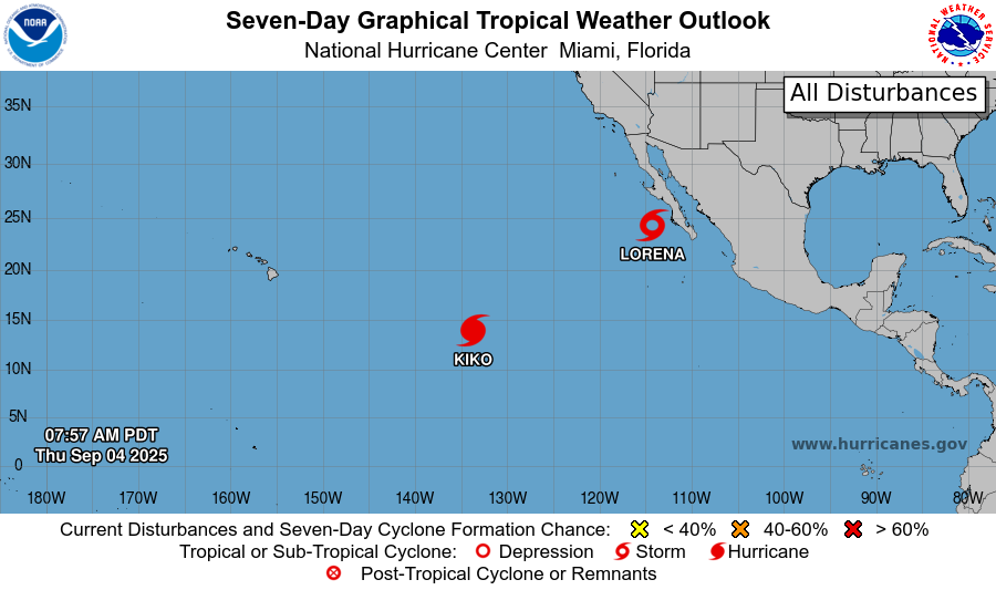
The National Hurricane Center is also issuing advisories on Hurricane Lorena, located in the East Pacific basin just off the west coast of Baja California Sur.
A Tropical Storm Warning is currently in effect for the West Coast of Baja California Sur from Puerto Cortes to Punta Eugenia.
Sponsored Content