Tropical Storm Fausto continues on path north of Hawaiian Islands through late Wednesday
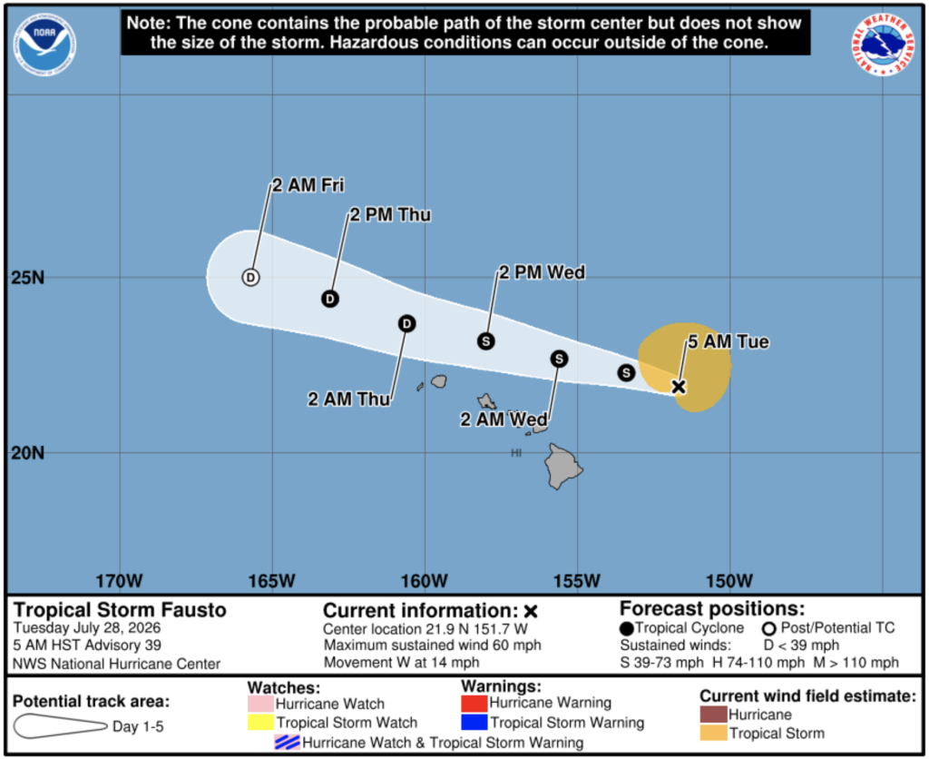
Fausto weakened Monday night from a hurricane to a tropical storm as it continues on a path forecast to take it north of the Hawaiian islands through late Wednesday.
Although the current forecast indicates that the strongest winds and heaviest rainfall will remain north of the islands, the Central Pacific Hurricane Center advises interests across Hawaiʻi to continue to monitor the progress of the storm.
Surf generated by Fausto will continue to build westward across Hawaiʻi along exposed east-facing shores through today. Large surf and strong currents will lead to dangerous conditions along exposed shores over the next few days, according to the National Weather Service.
Maximum sustained winds are now near 60 mph with higher gusts. Tropical-storm-force winds extend outward up to 140 miles, mainly to the northeast of the center of the system, according to the CPHC.
Sponsored Content