

Trade Swell Expected Through Weekend
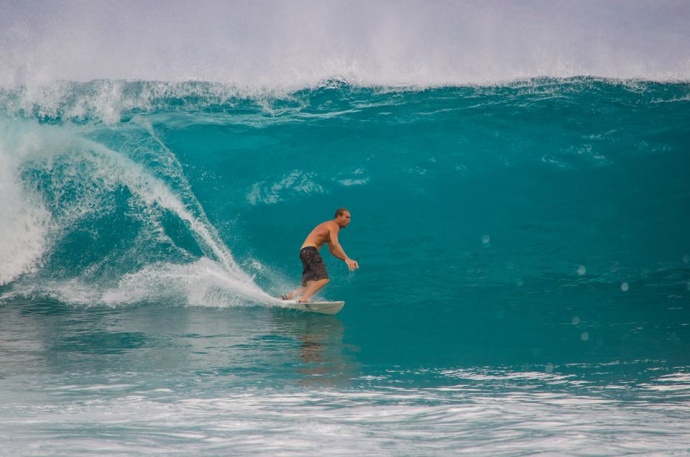
Image: Asa Ellison
By Meteorologist Malika Dudley / Email: malika@mauinow.com
Alerts
A Small Craft Advisory is in effect for the Pailolo and ʻAlenuihāhā channels as well as Māʻalaea Bay through 6:00 a.m. Sunday. East winds up to 25 knots are expected with rough seas up to 10 feet.
**Click directly on the images below to make them larger. Charts include: Maui County projected winds, tides, swell direction & period and expected wave heights.**
 Maui Surf Forecast
North: Wave heights of about knee/waist high are expected today. Easterly breaks (Hana) are expected to be bigger, especially on the sets.
West: Wave heights waist high are expected in the morning with a slow easing trend through the day. The best breaks exposed to the south could be chest/shoulder high early in the day on the sets. Many spots will be blocked by other islands and only about ankle/knee high.
South: Wave heights waist high are expected in the morning with a slow easing trend through the day. The best breaks exposed to the south could be chest/shoulder high early in the day on the sets.
 Our current south-southwest swell is expected to continue to slowly fade through the week. Small rideable pulses out of the south are expected but nothing super notable. August 3-5th we expect a new knee/thigh high swell with a better angled swell expected the 5-8th with waves possibly up to waist high or more.
Trade swell will push into northeasterly exposures. Otherwise, the north Pacific is looking very quiet.
Keep in mind, surf heights are measured on the face of the wave from trough to crest. Heights vary from beach to beach, and at the same beach, from break to break.
**Click here for your detailed Maui County weather report.**
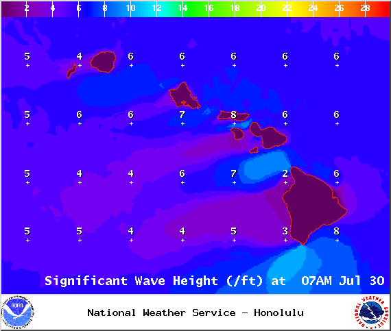
Image: NOAA / NWS

Image: NOAA / NWS
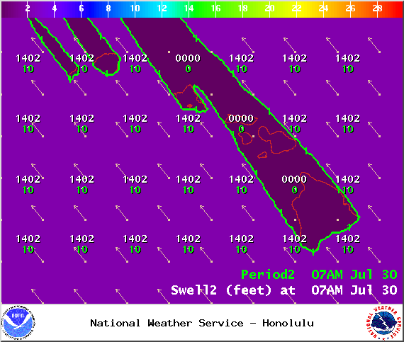
Image: NOAA / NWS

Image: NOAA / NWS

Image: NOAA / NWS
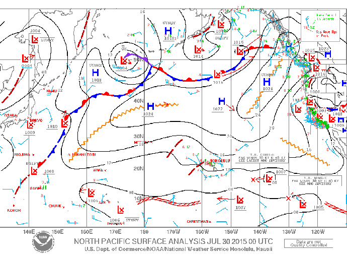
Image: NOAA / NWS
Sponsored Content


